Download
1 / 9
230 likes | 940 Views
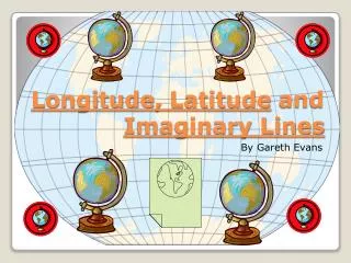
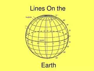
The Imaginary Lines Around the Earth. Latitude, Longitude, Time Zones, Tropics and Climate Zones . K. Shadle. What are all of those lines? . There are many imaginary lines that circle the earth, but what are they are why are they there? Latitude Longitude Time Zones Climate Zones

E N D
The Imaginary Lines Around the Earth Latitude, Longitude, Time Zones, Tropics and Climate Zones.K. Shadle
What are all of those lines? • There are many imaginary lines that circle the earth, but what are they are why are they there? • Latitude • Longitude • Time Zones • Climate Zones • The Tropics • The Arctic and Antarctic Circles
Latitude • Lines of LATITUDE run around the earth parallel to the equator. • The equator is 0 degrees • Lines of latitude are measure from 0-90 degrees North and 0-90 degrees South • The equator is the LONGEST line of latitude
Longitude • Lines of LONGITUDE run from the North Pole to the South Pole • Also called meridians. • They are measured in degrees 0-180 East and 0-180 degrees West. • 0 degrees is found in Greenwich, England. This line is also called the Prime Meridian
Time Zones • Longitude is used to help determine Time Zones. The line that runs through the Bering Strait is the International Dateline. • There are 24 time zones because there are 24 hours in a day.
Example • Buenos Aires is west of London, and they are separated by 4 time zones. • This means that when it is noon in Buenos Aires it is 4 pm in London. • When it is noon in London it is 8 am in Buenos Aires. • http://www.funsocialstudies.learninghaven.com/articles/timezones.htm