Download
1 / 32
320 likes | 355 Views
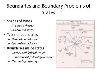
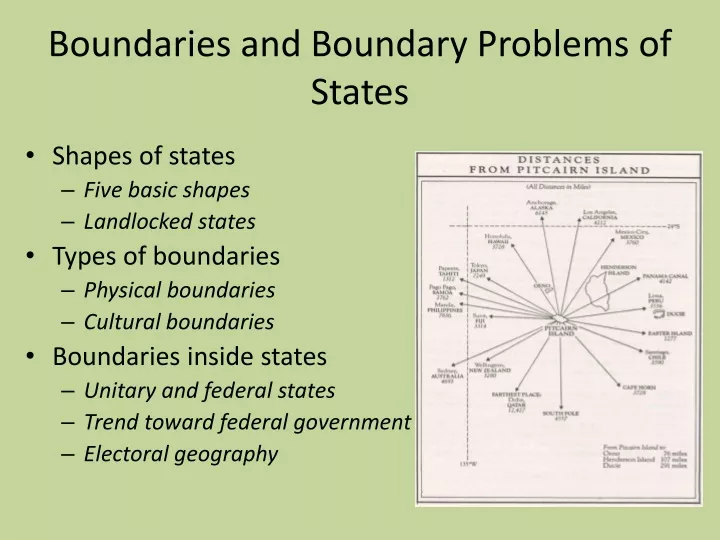
Boundaries and Boundary Problems of States. Shapes of states Five basic shapes Landlocked states Types of boundaries Physical boundaries Cultural boundaries Boundaries inside states Unitary and federal states Trend toward federal government Electoral geography.

E N D
Boundaries and Boundary Problems of States • Shapes of states • Five basic shapes • Landlocked states • Types of boundaries • Physical boundaries • Cultural boundaries • Boundaries inside states • Unitary and federal states • Trend toward federal government • Electoral geography
What is territorial morphology? • Relationship between shape, size, site & situation to a state’s political situation • Shape affects issues facing the people of a country both internally & internationally
What kind of issues would each type have? • C= considered politically ideal • F=hard for unity • E=transportation problems, capital can lose influence if on one end • Pr=piece may want to break away, easier for invasion • Pe=relationship with state inside boundary http://people.hofstra.edu/Jean-paul_Rodrigue/GESA/topic1/territorialmorphology.html
African States Fig. 8-6: Southern, central, and eastern Africa include states that are compact, elongated, prorupted, fragmented, and perforated.
Compact States: Efficient • In a compact state, the distance from the center to any boundary does not vary significantly. • Compactness is a beneficial characteristic for most smaller states, because good communications can be more easily established to all regions.
Prorupted States: Access or Disruption • An otherwise compact state with a large projecting extension is a prorupted state. • Proruptions are created for two principal reasons. • First, a proruption can provide a state with access to a resource, such as water. • Proruptions can also separate two states that otherwise would share a boundary.
Elongated States: Potential Isolation • There are a handful of elongated states, or states with a long and narrow shape. • The best example is Chile. • A less extreme example of an elongated state is Italy. • Elongated states may suffer from poor internal communications.
Fragmented States: Problematic • A fragmented state includes several discontinuous pieces of territory. • There are two kinds of fragmented states: those with areas separated by water, and those separated by an intervening state. • A difficult type of fragmentation occurs if the two pieces of territory are separated by another state. • Picture the difficulty of communicating between Alaska and the lower 48 states if Canada were not a friendly neighbor. • For most of the twentieth century, Panama was an example of a fragmented state divided in two parts by the Canal, built in 1914 by the United States.
India: The Tin Bigha Corridor Fig. 8-7: The Tin Bigha corridor fragmented two sections of the country of Bangladesh. When it was leased to Bangladesh, a section of India was fragmented.
Perforated States: South Africa • A state that completely surrounds another one is a perforated state. • The one good example of a perforated state is South Africa, which completely surrounds the state of Lesotho.
Landlocked States • Lesotho is unique in being completely surrounded by only one state, but it shares an important feature with several other states in southern Africa, as well as in other regions: It is landlocked. • The prevalence of landlocked states in Africa is a remnant of the colonial era, when Britain and France controlled extensive regions. • Direct access to an ocean is critical to states because it facilitates international trade. • To send and receive goods by sea, a landlocked state must arrange to use another country’s seaport.
Frontiers in the Arabian Peninsula Fig. 8-8: Several states in the Arabian Peninsula are separated by frontiers rather than precise boundaries.
Boundaries are of two types: physical and cultural • Neither type of boundary is better or more “natural,” and many boundaries are a combination of both types. • Important physical features on Earth’s surface can make good boundaries because they are easily seen, both on a map and on the ground. • Three types of physical elements serve as boundaries between states: • mountains, • deserts, • and water.
Mountain Boundaries • Mountains can be effective boundaries if they are difficult to cross (and) because they are rather permanent and usually are sparsely inhabited. • Mountains do not always provide for the amicable separation of neighbors. • Argentina and Chile agreed to be divided by the crest of the Andes Mountains but could not decide on the precise location of the crest.
Desert Boundaries • Like mountains, deserts are hard to cross and sparsely inhabited. • Desert boundaries are common in Africa and Asia.
Water Boundaries • Rivers, lakes, and oceans are the physical features most commonly used as boundaries. • Water boundaries are especially common in East Africa. • Boundaries are typically in the middle of the water, although the boundary between Malawi and Tanzania follows the north shore of Lake Malawi (Lake Nyasa). • Again, the boundaries result from nineteenth-century colonial practices: Malawi was a British colony, whereas Tanzania was German. • Water boundaries can offer good protection against attack from another state, because an invading state must secure a landing spot. • The state being invaded can concentrate its defense at the landing point.
Coastal Waters • The use of water as boundaries between states can cause difficulties, though. • One problem is that the precise position of the water may change over time. • Rivers, in particular, can slowly change their course. • Ocean boundaries also cause problems because states generally claim that the boundary lies not at the coastline but out at sea. • The reasons are for defense and for control of valuable fishing industries.
Cultural Boundaries • The boundaries between some states coincide with differences in ethnicity. • Other cultural boundaries are drawn according to geometry; they simply are straight lines drawn on a map.
Geometric Boundaries • Part of the northern U.S. boundary with Canada is a 2,100-kilometer (1,300- mile) straight line (more precisely, an arc) along 49° north latitude, . . . established in 1846 by a treaty between the United States and Great Britain, which still controlled Canada. • The United States and Canada share an additional 1,100-kilometer (700-mile) geometric boundary between Alaska and the Yukon Territory along the north-south arc of 14° west longitude.
Aozou Strip: A Geometric Boundary Fig. 8-9: The straight boundary between Libya and Chad was drawn by European powers, and the strip is the subject of controversy between the two countries.
Ethnic Groups in Southwest Asia Fig. 8-14: Ethnic boundaries do not match country boundaries, especially in Iraq, Iran, Afghanistan, and Pakistan.
Language Boundaries • Language is an important cultural characteristic for drawing boundaries, especially in Europe. • By global standards, European languages have substantial literary traditions and formal rules of grammar and spelling. • The French language was a major element in the development of France as a unified state in the seventeenth century. • In the nineteenth century, Italy and Germany also emerged as states that unified the speakers of particular languages. • The movement to identify nationalities on the basis of language spread throughout Europe in the twentieth century.
Division of Cyprus Fig. 8-10: Cyprus has been divided into Green and Turkish portions since 1974.
Boundaries inside States • Within countries, local government boundaries are sometimes drawn to separate different nationalities or ethnicities. • They are also drawn sometimes to provide advantage to a political party.
Unitary and Federal States • In the face of increasing demands by ethnicities for more self-determination, states have restructured their governments to transfer some authority from the national government to local government units. • The governments of states are organized according to one of two approaches: the unitary system or the federal system. • The unitary state places most power in the hands of central government officials, whereas the federal state allocates strong power to units of local government within the country.
Unitary and Federal States Continued • Unitary states are especially common in Europe. • In reality, multinational states often have adopted unitary systems, so that the values of one nationality can be imposed on others. • In a federal state, such as the United States, local governments possess more authority to adopt their own laws. • Multinational states may adopt a federal system of government to empower different nationalities, especially if they live in separate regions of the country. • The federal system is also more suitable for very large states because the national capital may be too remote to provide effective control over isolated regions.
France: Curbing a Unitary Government • A good example of a nation-state, France has a long tradition of unitary government in which a very strong national government dominates local government decisions. • Their basic local government unit is the département. • A second tier of local government in France is the commune. • The French government has granted additional legal powers to the departments and communes in recent years. • In addition, 22 regional councils that previously held minimal authority have been converted into full-fledged local government units.
Poland: A New Federal Government • Poland switched from a unitary to a federal system after control of the national government was wrested from the Communists. • Under the Communists’ unitary system, local governments held no legal authority. • Poland’s 1989 constitution called for a peaceful revolution: creation of 2,400 new municipalities, to be headed by directly elected officials. • To these municipalities, the national government turned over ownership of housing, water supplies, transportation systems, and other publicly owned structures. • Businesses owned by the national government were either turned over to the municipalities or converted into private enterprises.
Electoral Geography • The boundaries separating legislative districts within the United States and other countries are redrawn periodically to ensure that each district has approximately the same population. • Boundaries must be redrawn because migration inevitably results in some districts gaining population, whereas others are losing. • The job of redrawing boundaries in most European countries is entrusted to independent commissions. • In most U.S. states the job of redrawing boundaries is entrusted to the state legislature. • The process of redrawing legislative boundaries for the purpose of benefiting the party in power is called gerrymandering.
Types of Gerrymandering • Gerrymandering takes three forms. • “Wasted vote” spreads opposition supporters across many districts but in the minority. • “Excess vote” concentrates opposition supporters into a few districts. • “Stacked vote” links distant areas of like-minded voters through oddly shaped boundaries.
Gerrymandering: Florida and Georgia • Recent gerrymandering in the United States has been primarily “stacked vote.” • “Stacked vote” gerrymandering has been especially attractive to create districts inclined to elect ethnic minorities. • Through gerrymandering, only about one-tenth of Congressional seats are competitive, making a shift of more than a few seats increasingly improbable from one election to another in the United States. Fig. 8-11: State legislature boundaries were drawn to maximize the number of legislators for Republicans in Florida and Georgia.