Download
1 / 31
320 likes | 431 Views
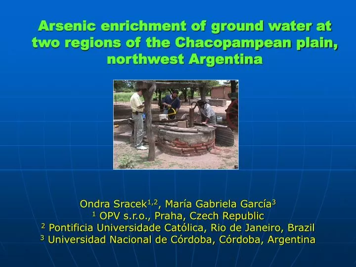
Arsenic enrichment of ground water at two regions of the Chacopampean plain, northwest Argentin a. Ondra Sracek 1,2 , Mar í a Gabriela G arc í a 3 1 OPV s.r.o., Praha, Czech Republic 2 Pontificia Universidade Cat ó lica, Rio de Janeiro, Brazil

E N D
Arsenic enrichment of ground water at two regions of the Chacopampean plain, northwest Argentina Ondra Sracek1,2, María Gabriela García3 1 OPV s.r.o., Praha, Czech Republic 2 Pontificia Universidade Católica, Rio de Janeiro, Brazil 3 Universidad Nacional de Córdoba, Córdoba, Argentina
ARSENIC IN ARGENTINA ●In Argentina, > 1 million of people are exposed to risk linked to natural arsenic ●They depend on drinking water with over 0.05 mg/L arsenic (limit WHO 0.01 mg/L, Argentina limit 0.05 mg/L) ●Most affected: parts of the Chaco-Pampean plains (+ Andes; minor extent) ●Arsenic is related to sedimentary aeolian and fluviatile sediments ●These sediments contain up to 25 wt % of volcanic ash
Santiago del Estero: Río Dulce Alluvial Cone Arsenic history Semiarid region (precipitation 532 mm/year) with distinct rainy (summer) a dry (winter) periods Principal plant is cotton cultivated on fields irrigated by ground water Shallow groundwater is used by rural population living in dispersed settlements Conditions in shallow aquifers are generally oxidizing In 1984 first shallow groundwater monitoring (many sites with > 0.4 mg As/L) First symptoms of chronic endemic regional hydroarsenicism in 1983
Geology and Hydrogeology General profile of Río Dulce alluvial cone ● thickness of sediments from 150 to 0 m ● alternating layers od gravel, sand, silt and clays Humayampa fault
RESULTS Volcanic ash Unsaturated zone Saturated zone as a distinct layer (max. thickness 1.35 m, mean 0.54 m; in 52% of area) also dispersed in the sediment (up to 25 wt %) 50 cm
RESULTS Volcanic ash Unsaturated zone Saturated zone as a distinct layer (max. thick. 1.35 m, mean about 0.50 m; in 52% of area also dispersed in the sediment (25 %) VOLCANIC ASH 20-21 ppm Vanadium 2-20 ppm Uranium 3-6 ppm Arsenic 0.2-3 ppm Molybdenium 50 cm
RESULTS Electron microprobe Highly weathered volcanic glass Altered biotite with precipitated barite Other results: - partially altered titano-magnetite, biotite and ilmenite - ferrihydrite in isolated spots rather than in coatings - gypsum with less hydrated margins present in many samples
Piper diagram A clear evolution trend from Ca-HCO3 ground water type towards Na-HCO3 ground water type with high concentrations of SO4 and Cl
Correlation: Depth to groundwater table (thickness unsaturated zone) Groundwater arsenic ● No relation between the depth to water table, which also determines the groundwater recharge time
Correlation: Groundwater flow velocities (residence time) Groundwater arsenic ● moderate correlation between high As and low hydraulic gradient zones (= highest groundwater residence times)
Correlation: Groundwater arsenic Volcanic ash layer ● no correlation between high As zones and presence of volcanic ash layer and its position regarding water table (above-below) volcanic ash layer is not the (only) source of groundwater As presence of other ash lentils or As from dispersed ash
Correlation: Groundwater arsenic pH value ● clear correlation between As hot spots and areas with high pH
Correlation: Groundwater arsenic Electrical conductivity ● high As zones are related to zones of high electrical conductivity (predominantly zones with high Na+ - HCO3- ground water type) ● these zones also correspond to zones of high pH
Summary Zones with high arsenic concentrations in groundwater are related to zones: ● of high residence time ● of high pH ● high EC, Na-HCO3 ground water type not related to zones: ● where volcanic ash layer is present ●where volcanic ash layer is below or above the water table
CORRELATION DIAGRAMS high arsenic concentrations and by positive correlation of As with ● pH, HCO3 , EC negative correlation of As with ● Ca, Mg characterized by high ● pH, ●Na ● EC (Na-HCO3–waters) seems to be related to zones of cation exchange (Ca, Mg for Na)
CORRELATION OF As WITH MINOR AND TRACE ELEMENTS gw-arsenic has a good correlation found in high concentrations in volcanic ash 21 ppm V 20 ppm U 6 ppm As 3 ppm Mo volcanic ash is assumed to be primary source of As in the shallow groundwater V, Mo, U, and F
SUMMARY OF RESULTS FROM SANTIAGO DEL ESTERO • 1. Areas with high and low groundwater arsenic concentrations could be delimited • 2. Areas of high groundwater As concentrations are related to areas ●with slow groundwater flow (long residence times) • ●high electrical conductivity and Na-HCO3 type of GW • ●high pH • – probably caused by cation exchange and dissolution of silicates • 3. Probable primary source of groundwater As seems to be volcanic ash • ●present as a distinct layer • ●and dispersed in the sediment. • This is indicated by • - high concentrations of As, V, U, and Mo in volcanic ash and • the positive correlation of As with V, U, and Mo in groundwater
Tucumán Location of study area Sali River
Río Salí Hidrogeological basin POPULATION Concentrated in small settlements Most of population is located along the Salí River Water supply is by deep and shallow groundwater CLIMATE Subtropical with distinct dry season (winter) Mean precipitation 600 (east) to 1000 (west) mm ACTIVITY Cultivation of sugar cane and soybeans on irrigated fields Suggar mills and citric industries near Salí River
Geology and hydrogeology W-E section of the Hydrogeological basin showing the main Aquifer units and lithology
Hydrogeochemistry Large differences in chemical composition between unconfined and confined aquifers Shallow unconfined aquifer: loessoid sediments Na-HCO3 type of ground water pH: 7.1-8.7 EC: 250 - >3,000 mS cm-1 Dissolved Oxygen: 0.2 – 8.1 mg L-1 Elements exceeding standard requirements (WHO): As (up to > 700 μg/l), V, F, Fe, Mn,NO3-
Sources of As in loess Potential primary source Secondary source grains of glass coatings of ferric oxyhydroxides Microprobe images
Deep confined and semiconfined aquifers General Hydrogeochemistry Hydrochemical zones Semiconfined aquifer Confinedaquifer pH: 7.0-8.4 EC: 619 - 2182 mS cm-1 Dissolved Oxygen: 0.5 – 7.8 mg L-1 Elements exceeding standard requirements (WHO): As (up to 70 mg L-1), Fe and Mn (occasionally)
Hydrogeology Potentiometric surface of the deep confined aquifer
Spatial variation of As in confined and semiconfined aquifers
Hydrogeochemical profiles in the semiconfined aquifer close to the Rio Salí Increased HCO3- concentration in the transition zone, caused by the degradation of DOC
Hydrogeochemical profiles in the semiconfined aquifer High organic load in the river, temporary reducing conditions during dry period increased concentrations of As, Fe and Mn in the transition zone
Summary of results from Tucuman • Primary source of dissolved As in the shallow groundwater seems to be the dissolution of volcanic glass spreads in the loess matrix • Secondary source seems to be associated with desorption from Fe oxy-hydroxide coats and/or reductive dissolution • High As concentrations in the unconfined aquifer are generally associated with high pH values • In the semiconfined aquifer, increasing As concentrations in the transition zone are associated with increasing load of organic matter in the Sal River and the occurrence of reductive conditions in surface waters • In deep confined water (more than 40 m deep) As concentrations are generally lower than 50 mg L-1
Comparison of both regions • In spite of different climatic conditions and scales of investigation there seems to be similarity between both regions • Arsenic concentrations are high in shallow aquifer comprised of loessoid sediments, they are linked to high pH, Na-HCO3 type of ground water • Primary source of arsenic seems to be highly weathered volcanic glass in sediments, coatings of Fe(III) minerals on silicate grains are discontinuous because supply of iron was limited due to acidic character of original rocks • Competition with other oxyanion forming species like V, B, Mo, and PO4 may further limit adsorption • Deep aquifers (data only from Tucuman) have much lower dissolved arsenic concentrations • Ground water arsenic concentrations may be locally elevated close to surface water bodies affected by discharged organic contamination;
Acknowledgements We thank Jochen Bundschuh, who provided many slides for the Santiago del Estero section.