Download
1 / 39
390 likes | 470 Views
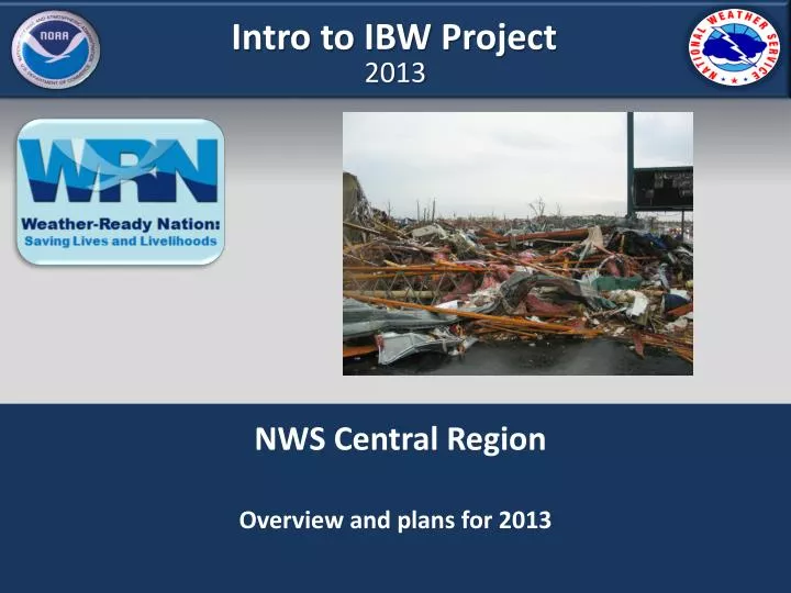
Intro to IBW Project. 2013. NWS Central Region Overview and plans for 2013. IBW Project 2013. Rationale. What ? IBW is a simple, but important change to the existing warning system.

E N D
Intro to IBW Project 2013 NWS Central Region Overview and plans for 2013
IBW Project 2013 Rationale • What ? • IBW is a simple, but important change to the existing warning system. • Part of a gradual evolutionary process to improve usefulness and effectiveness of our severe convective warnings (Yes – with a thumbs up); • It should NOT be misrepresented as an evolutionary leap turning the warning system upside down (No – with a finger wag). • At its core; IBW consists of one change (in 2 parts): • addition of a “considerable damage threat” warning tier for significant tornadoes (~EF2 or greater) • addition of concise wording on impacts and risk commensurate with those threats.
IBW Project 2013 Rationale • Why ? Because the numbers say we should. • 13% of all tornadoes in CR are EF2-5 262 fatalities (97% of all fatalities) • 87% of all tornadoes in CR are EF0-1 7 fatalities (3% of all fatalities) • All tornadoes are NOT the same ! By treating all tornadoes as one-size-fits-all, the existing system - by default - emphasizes warnings for weak tornadoes at the expense of warnings for life threatening tornadoes. • This is a flaw in the current warning paradigm – and one that leaves the public more exposed to dangers of high-end tornadoes than they should be. • Rationale 1: “Societal Needs” demand tornado warnings that emphasize high impact events – i.e. those most likely to do serious harm. If we are serious about reducing tornado deaths – this is where we should start.
IBW Project 2013 Rationale • Why ? Because public and partners say we should. • Key findings from NWS Service Assessments (not just 2011): • Most identify local siren systems as first source of warning; but, perceptions exist that “sirens go off all the time and nothing happens”. • Most seek confirmation from additional sources before seeking shelter. • Extraordinary risk signals prompt people to take action; but, there is currently no mechanism to elevate the threat in NWS tornado warnings. • Existing dissemination systems not fully compatible with storm-based warning polygons; causes confusion when there are multiple polygons. Polygonology! • Rationale 2: Clear and credible risk communication is necessary for people to take immediate protective action.
IBW Project 2013 Rationale • Why ? Because Tornadoes are the only hazard whereby NWS does not include an expected magnitude as part of the warning message. • What if we issued a flood warning for the Red River in Fargo, but refused to say how high the river stage would get ? • What if we told ATC at O’Hare there would be fog, but refused to give them a predicted visibility ? • What if we issued a Hurricane Warning for Mobile Bay but refused a prediction of wind speeds (CAT 1-5) or surge heights ? • Rationale 3: Tornadoes are like any other hazard and require expressions of magnitude to elicit the most appropriate actions.
IBW Project 2013 Rationale • Concerns… • IBW will result in a diluted public response for base (non-tagged) Tornado Warnings, would it not ? • Unknown but unlikely; it will take years of study to find out. But… • IBW now places emphasis on those tornadoes likely to do serious harm; correcting, in part, a critical gap in the existing tornado warning paradigm. If there is a trade-off, it is the correct one. • If public response for base Tornado Warnings is diluted – it is extremely unlikely to be less than response levels for SVRs. • As it turns out, mortality rates from EF0-1 tornadoes are roughly equivalent to that from severe thunderstorm winds.
IBW Project 2013 Rationale • Concerns… • We don’t have the skill or tools to discern large tornadoes from small or no tornadoes, do we ? • The 88D is designed for this task; It is not designed for detection of small tornadoes that can and often occur below the spatial and temporal resolution of the radar. • POD for EF0-1 tornadoes = 69% in CR • POD for EF2-5 tornadoes = 84% in CR • POD for EF3-5 tornadoes = 94% in CR • While the ability to detect larger tornadoes with lead time has long been known, we are more interested in evaluating skill measures i.e. Hit Rate (1-FAR). • In CR, Hit Rate since 2008 for all Tornado Warnings is 28%.
IBW Project 2013 Rationale • Concerns… • We don’t have the skill or tools to discern large tornadoes from small or no tornadoes, do we ? • Prior to 2012 very few studies (if any) have examined skill in discerning large tornadoes from small/no tornadoes; not easy to do this a lab setting as many warning inputs (e.g. spotter reports) are difficult to simulate. • One of the primary benefits of the IBW project is ability to evaluate capacity for discerning hazard magnitude in TORs; and provide a baseline for future comparison. • FY12 results in demo area produced promising inferences, but small sample size precludes definitive conclusions. Need a larger sample size.
IBW Project 2013 Rationale Concerns… We don’t have the skill or tools to discern large tornadoes from small or no tornadoes, do we ? Hit Rate (all CR tornadoes 2008-2012) = 28% Hit Rate (all tornadoes IBW 2012 demo) = 49% (CSI=0.51) 82 IBW defined Tornado Warnings issued (through December 2012). EF0 61 IBW Tornado Events EF5
IBW Project 2013 Rationale Concerns… We don’t have the skill or tools to discern large tornadoes from small or no tornadoes, do we ? Categorical Hit Rate (EF0-1 tornadoes IBW 2012 demo) = 49% (CCSI =0.39) Categorical Hit rate (EF2-5 tornadoes IBW 2012 demo) = 47% (CCSI = 0.39) 15 Tornado Warnings issued with “considerable” or higher tag and 7 verified with EF2+ events (47%). EF0 51 IBW Tornado Events 10 IBW Tornado Events EF1 EF2 EF5
IBW Project 2013 Rationale Concerns… We don’t have the skill or tools to discern large tornadoes from small or no tornadoes, do we ? Categorical Hit Rate (EF0-3 broadened category) = 54% (CCSI=0.45) Categorical Hit Rate (EF1-5 broadened category) = 73% (CCSI=0.58) Of 15 tornado warnings with “considerable” or higher tags, 11 resulted in EF1 or greater intensity tornadoes. (73%). EF1 EF5 EF0 EF3
IBW Project 2013 Rationale Note the overlap at the top of EF0-1 and bottom of EF2-5; similar to results from 2012 IBW Positive relationship between MxVrot and EF-Scale From Smith et al. 2012
Risk Paradigm Probability of Occurrence Time of Occurrence Magnitude/Intensity Location of Occurrence • Risk = fHazard Character ; Vulnerability • IBW does allow opportunity to assess discernment between no event, low impact, and high impact events through descriptions of potential tornado intensity. • IBW method of conveying predicted Tornado hazard magnitude/intensity is the use of Damage/Threat Indicator Tags at the bottom of TOR/SVS texts. • These are CAP (Common Alert Protocol) compliant and follow a model using Wind/Hail Threat Indicator Tags in SVR/SVS texts established in 2008. • End users needs to know their vulnerabilities and know their protective options.
Risk Management Evaluation Outcome 1 Risk Characterization Outcome 2 Risk Communications Outcome 3 Risk Management • Outcome 1 – Risk Characterization: Developing and encapsulating the knowledge about the severe weather hazard, its potential impact, and its risk to life and property. • Outcome 2 – Risk Communications • Outcome 3 – Risk Management
Risk Management Evaluation Outcome 1 Risk Characterization Outcome 2 Risk Communications Outcome 3 Risk Management • Outcome 1 – Risk Characterization • Outcome 2 – Risk Communications: Packaging and delivering storm warnings (communicating) to convey the understanding of risk. • Outcome 3 – Risk Management
Risk Management Evaluation Outcome 1 Risk Characterization Outcome 2 Risk Communications Outcome 3 Risk Management • Outcome 1 – Risk Characterization • Outcome 2 – Risk Communications • Outcome 3 – Risk Management: What knowledge of risk influences decisions yielding desired actions (societal response).
IBW Project 2013 Preliminary analysis • Six key areas of information that Core Partners focus on in a warning situation: • Threat and magnitude • Timing • Location • Duration • History • Confidence • WxEm developed independent validation and verification (matrix) against these areas • Final report quantifying our success against these key areas is available at
IBW Project 2013 • Catastrophic Damage Threat Indicator (Tornado Emergency) • Restrictions on its use to address past misuse of the product. • TOR emergencies should only be considered when there is substantial visual evidence that a violent tornado is occurring and will imminently impact (or nearly impact) a population center of any size. • This should be exceedingly rare and should never be issued on radar evidence alone. These are reserved for extraordinary events. • Most times, a “considerable” damage threat tag will suffice. There really is no “wrong” choice concerning considerable vs. catastrophic tags for observed, violent (EF4-5) tornadoes.
IBW Project 2013 • Tornado Possible Tag in SVRs • Previously mandated in SVRs when Tornado Watch in effect • Now can be used at forecaster discretion regardless of whether watch is in effect. • Intended to be used when weak brief spin-ups are somewhat possible, but not likely - based on evaluation of environment (i.e. not to the level of a tornado warning). • Ex. warm season QLCS events whereby 0-6km shear vector is oriented near perpendicular to orientation of squall line.
IBW Project 2013 • “Polygonology” • Re-emphasize awareness of county boundaries • Understanding storm motion and propagation (keep storm in polygon) • Importance of editing the default polygon • Building confidence in using tags • Understanding definition and when to use • Guidelines for TOR vs. SVR (2 out of 3) • Storm environments • QLCS Mesovortex conceptual model • Data/tools available for warning process
IBW Project 2013 • In summary, we are providing enhancements by: • Improving communication of critical information • Making it easier to quickly parse out the most valuable information • Enabling users to prioritize the key warnings • Providing different levels of risk within the same product • Enabling the NWS to express a confidence level of potential impacts and risks
2023Z EF3 2003Z EF4 1958Z EF3 2039Z EF1 2028Z EF4 1950Z EF1 2014Z EF4 (Henryville) 2007Z EF3-4
1937Z Vrot = 29 kts Tornado Warning Issued 1940Z
1942Z Vrot= 44 kts “considerable” damage threat tag possible
1947Z Vrot = 41 kts
1951Z Vrot = 53 kts “considerable” damage threat tag definitely here.
1956Z Vrot= 71 kts
2001Z Vrot=80 kts
2005Z Vrot= 75 kts
2010Z Vrot= let’s just say this looks bad “Tornado Emergency” was Issued at 1910z as Tornado approached Henryville
2014Z Vrot= 70 kts
2019Z Vrot= 78 kts
2024Z Vrot = 71 kts
2029z Vrot = 54 kts
2033z Vrot = 46 kts
IBW Project 2013 Contributors: Dr. Greg Mann NWS DTX Mike Hudson NWS CRH Stacy Kraatz CMU WxEM • Questions?