Download
1 / 63
630 likes | 816 Views
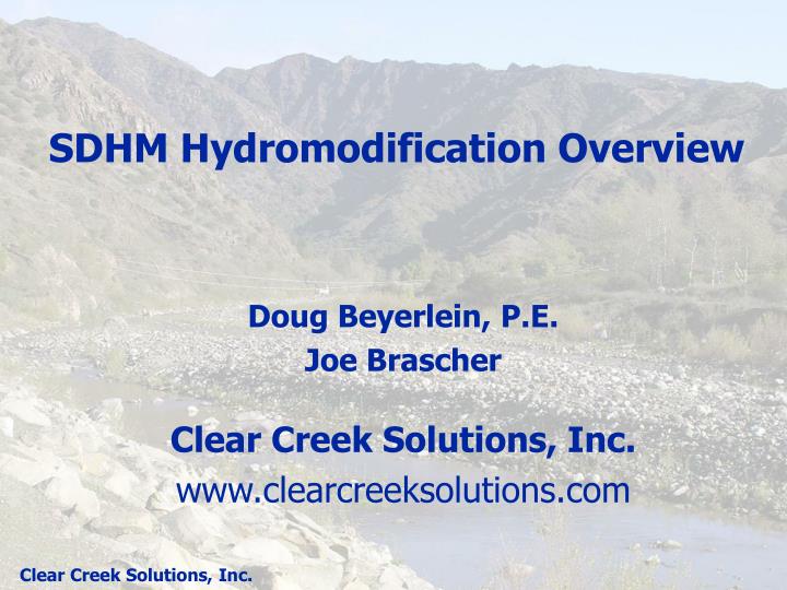
SDHM Hydromodification Overview. Doug Beyerlein, P.E. Joe Brascher Clear Creek Solutions, Inc. www.clearcreeksolutions.com. Why HMP Modeling?. Impacts of land use changes : Increase in impervious surface Decrease in amount of vegetation Grading and compaction of soils

E N D
SDHM Hydromodification Overview Doug Beyerlein, P.E. Joe Brascher Clear Creek Solutions, Inc. www.clearcreeksolutions.com
Why HMP Modeling? Impacts of land use changes: Increase in impervious surface Decrease in amount of vegetation Grading and compaction of soils Construction of drainage facilities
Why HMP Modeling? Effects of land use change on stormwater runoff: Less infiltration and evapotranspiration More surface runoff (increased volume) Runoff leaves the site faster (increased peak flows) Runoff occurs more often (increased duration) Runoff conveyed directly to creek (increased connectivity)
What is HMP Modeling? HMP modeling is quantifying the hydrologic impacts caused by land use changes in terms of: (1) frequency (2) duration
Frequency Frequency is the probability of a certain size event occurring: 2-year (50% probability) 5-year (20%) 10-year (10%) 25-year (4%) 50-year (2%) 100-year (1%)
Frequency Traditionally we have used single-event design storms to size facilities based on frequency. Design storm assumption: 25-year rainfall causes 25-year flood.
Single-event design storm methodology doesn’t work for HMP design because: • Single-event flow frequency standards are based on inappropriate assumptions. • Single-event modeling cannot compute flow durations (percent of time flows exceed a specific value).
Duration Flow Duration Analysis: Percent of time the flow exceeds a specific flow value.
Durations • Flow duration standard: based on erosive flows. • Western Washington: 50% of 2-yr to 50-yr
Durations • Flow duration standard: based on erosive flows. • Santa Clara, San Mateo, Alameda: 10% of 2-yr to 10-yr
Durations • Flow duration standard: based on erosive flows. • San Diego County: 20% of 5-yr to 10-yr
HMP Modeling Options Based on continuous simulation hydrology: HSPF (SDHM) HEC-HMS SWMM
HSPF: HYDROLOGIC SIMULATION PROGRAM - FORTRAN • Continuous simulation model • Natural and developed watersheds and water systems • Land surface and subsurface hydrology and quality processes • Stream/lake hydraulics and water quality processes • Time series data management and storage • Time series data statistical analysis and operations • Core watershed model in EPA BASINS and Army Corps WMS • Development and maintenance activities sponsored by U.S. EPA and U.S. Geological Survey
HSPF: History • 1966 – Stanford Watershed Model by Linsley and Crawford • 1972 – HSP by Hydrocomp • 1973 – ARM (Agricultural Runoff Management) Model for EPA by Hydrocomp • 1974 – NPS (Non-Point Source) Model for EPA by Hydrocomp • 1979 – HSPF (combining HSP, ARM, and NPS) for EPA by Hydrocomp
HSPF: Glossary (Greek to English) • UCI: User Control Input (file type) • WDM: Watershed Data Management (file type) • PERLND: Pervious land area • IMPLND: Impervious land area • RCHRES: Conveyance/routing reach • FTABLE: Stage-storage-discharge table • SURO: Surface runoff • IFWO: Interflow (shallow, subsurface runoff) • AGWO: Active groundwater/base flow
HSPF: File Types • UCI file: User Control Input (text file) • Land area (soil, vegetation, slope, impervious) values • Conveyance parameter values • Display of annual peak flows • Duration analysis • WDM file: Watershed Data Management (binary file) • Precipitation time series • Potential evapotranspiration time series • Simulated runoff time series
HSPF Made Easy: SDHM • San Diego Hydrology Model (SDHM). • SDHM is HSPF in an easy to use package.
HSPF Made Easy: SDHM • HSPF UCI and WDM files are automatically created by SDHM and are transparent to the user, but are available for review.
SDHM • Available free to local municipal agency staff from www.clearcreeksolutions.com. • Available to consultants for a fee.
SDHM • Based on the same software platform as BAHM and WWHM3. • Customized for San Diego County.
WDM Data: Precipitation Requirements: • continuous record (no data gaps or missing data) • 30-50 years of data • hourly or smaller time interval Example: San Diego Airport National Weather Service data Note: Need to scale precipitation data to project site. Take ratio of station mean annual precip and project site mean annual precip.
WDM Data: Potential Evapotranspiration Requirements: • continuous record (no data gaps or missing data) • 30-50 years of data • daily or smaller time interval Example: local pan evaporation data If using pan evap data need to include pan evap coefficient to convert to PET data.
WDM Data: Irrigation? Requirements: • continuous record (no data gaps or missing data) • 30-50 years of data • daily or smaller time interval Example: Representative of urban landscape watering patterns.
Simulation Period • 30-50 years • dependent on start and end dates of precip and PET time series • should start in a dry period (water year: Oct 1 – Sep 30)
PERLNDs (Pervious Land Areas) Designation of PERLND types is based on • soil type (A, B, C, D) • vegetation type • forest/trees • scrub/shrub • natural grasslands • bare earth/dirt • urban landscape vegetation (irrigated) • land slope • flat (0-5% slope) • moderate (5-10% slope) • steep (10-20% slope) • very steep (>20% slope)
PERLNDs (Pervious Land Areas) Simulate the water movement and storage in the different components/pathways in the hydrologic cycle.
IMPLNDs (Impervious Land Areas) Designation of IMPLND types is based on • land slope • flat (0-5% slope) • moderate (5-10% slope) • steep (10-20% slope) • very steep (>20% slope)
Three types of runoff • SURO (surface runoff) • IFWO (interflow) • AGWO (groundwater/base flow) • Stormwater runoff is usually defined as the sum of SURO+IFWO (surface runoff + interflow).
RCHRES (Conveyance reach system) Precipitation on Reach Surface Evaporation Outflow through exit 1 Volume of Water in a Reach Exit 2 Inflow (upstream sources, direct drainage) Exit (N = up to 4) Exit can represent infiltration through bottom of reach
RCHRES (Conveyance reach system) • RCHRES can represent any type of conveyance/storage system: • open channel • stormwater pond • stormwater vault • pipe system • bioretention cell • planter box • porous pavement
RCHRES (Conveyance reach system) • All conveyance/storage systems are described using an FTABLE. • An FTABLE is a table with: • Stage (feet) • Surface area (acres) • Storage volume (acre-feet) • Discharge (cfs)
RCHRES (Conveyance reach system) Open channel:
RCHRES (Conveyance reach system) Stormwater pond:
RCHRES (Conveyance reach system) Stormwater pond discharge: Riser and notch discharge based on weir equation. Orifice discharge based on orifice equation.
RCHRES (Conveyance reach system) Riser notch options: Rectangular V-Notch Sutro
RCHRES (Conveyance reach system) Stormwater vault:
RCHRES (Conveyance reach system) Pipe system:
RCHRES (Conveyance reach system) Bioretention cell: Need HSPF Special Actions to check on the ability to discharge from the surface storage to Layer 1.
RCHRES (Conveyance reach system) Planter box: Need HSPF Special Actions to check on the ability to discharge from the surface storage to the soil layer.
RCHRES (Conveyance reach system) Porous pavement: Storage in the pavement layer and gravel subgrade. Infiltration to the underlying native soil is optional.
Downstream Point of Compliance • Point of Compliance (POC) is at the downstream exit from the project site.
Two Model Scenarios Compute stormwater runoff for both existing and post-development conditions. Existing Post-development
Flow Frequency • To compute frequency the maximum hourly annual existing flow values are needed.
Flow Frequency Computational Methods • Weibull Plotting Position P = (m-a)/(N-a-b+1) where P = probability m = rank N = number of years a = constant b = constant Return period, Tr (years) = 1/P
Duration Analysis Flow Duration Analysis: Percent of time the flow exceeds a specific flow value.
Duration Analysis Comparison Flow Duration Table for flows from 20% of the 5-year to 100% of the 10-year frequency value.
Duration Analysis Comparison Flow Duration Curves for flows from 20% of the 5-year to 100% of the 10-year frequency value.
Other Analysis: Drawdown For vector management: Want to know the water level drawdown/retention depth (or stage) for 1-5 days plus maximum stage and drawdown time. Use stage time series.
SDHM Steps for sizing hydromod facilities: • Locate project site on county map. • Input existing land conditions. • Input future developed land conditions. • Create hydromod mitigation facility. • Create Point of Compliance. • Automatically size hydromod mitigation facility. • Run HSPF. • Compute flow durations. • Compute drawdown (optional).
SDHM 1. Locate project site on county map: Place red dot on county map