Download
1 / 70
730 likes | 1.03k Views
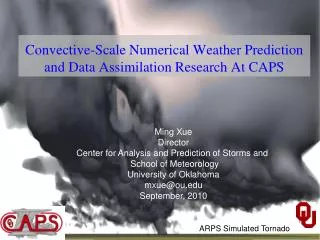
The Advanced Regional Prediction System (ARPS). Center for Analysis and Prediction of Storms University of Oklahoma. The Advanced Regional Prediction System (ARPS). ARPS is an end-to-end, fully automated, multi-scale, nonhydrostatic atmospheric prediction system.

E N D
The Advanced Regional Prediction System (ARPS) Center for Analysis andPrediction of Storms University of Oklahoma
The Advanced Regional Prediction System (ARPS) ARPS is an • end-to-end, • fully automated, • multi-scale, • nonhydrostatic atmospheric prediction system
ARPS: The Foundation • Developed from scratch starting in 1992 • Advanced physics and numerical techniques • Designed for all classes of computers, especially MPP (has been run on 1024 node Cray T3E, Origin 2000, workstations, PCs, Cray C/J/T-90) • Professionally engineered; consistent design structure; extensive documentation including external user’s guide
ARPS: The Foundation • Designed to be used operationally; self-contained and globally-relocatable • Email-based user support system • Online documentation (PDF, HTML, text) and FAQ • Tested in real time for many years, and since 1996 has been used on a regular basis experimentally by numerous groups including American Airlines and the National Weather Service • Used for a variety of research applications
Uniqueness of ARPS • A system with its own native ingest, analysis, and data retrieval packages • Only system that can assimilate WSR-88D Level II (base) and III Doppler radar data from multiple radars in real time • A system designed from beginning for all classes of computers • A system that has been run operationally for several years, using full physics and high-resolution observations, at grid spacings down to 3 km • A system designed for commercial and operational use from the very beginning; professional software design/documentation
Example Research Applications • Density Current Theories and Simulations
Simulation of 3D Density Currents/Gust Fronts Growing Vortices from both Horizontal Shear and Lobe-cleft Instabilities A ‘haboob’ acrossing Melbourne, Australia, 2 Feb. 1983
Example Research Applications • Simulations of Squall lines
Example Research Applications • Tornadic Supercell Storm Simulations Column contains high vorticity
Example Research Applications • Orographic flows and Severe Downslope Wind Storms High surface wind on the lee slope Air flow trajectory over mountain
ARPS Data Analysis System (ADAS) • Manages the real time ingest, QC, objective analysis of observations • Doppler radar data (NIDS, base Level II from n systems, VAD) • MDCRS commercial aircraft wind and temperature reports • Wind profilers • RAOBS (conventional, CLASS, dropsondes) • Mobile and fixed mesonets • SAO and METAR observations • GOES satellite • NCEP gridded model output • Based on Bratseth successive correction method • Converges to OI • User specifies number of passes and data used
ARPS Data Analysis System (ADAS) • User specifies background error covariances and structure functions • Handles large variety of data formats (GRIB, NetCDF, ARPS binary, GEMPAK) • Performed on flexible native ARPS grid • Linked closely with ARPS data assimilation system (via, e.g., nudging, intermittent assimilation) • 3-D cloud analysis and diabatic initialization package using GOES and NEXRAD data • Currently run daily, in real time, over serval regions of the US
ADAS Cloud Analysis Scheme GOES Visible Image at 1745 UTC on 07 May 1995
ADAS Cloud Analysis Scheme Vertical E/W Cross-Section: METAR + GOES IR + WSR-88D
ADAS Cloud Analysis Scheme PW and Vertically Integrated Condensate Valid 13 UTC on 12 April 1999 GOES Visible Image Valid 13 UTC on 12 April 1999
Sample ARPSView Products Cloud Type and LWC at FL 050 Cloud Type and LWC at FL 320 Cloud Type and LWC N/S X-Section
Sample ARPSView Products Surface Visibility Clear-Air Turbulence Icing Potential
Sample ARPSView Products Sounding and Hodograph Meteogram
Sample ARPSView Products Hourly Station Model Plots for 10 Regions in US
Single-Doppler Velocity Retrieval (SDVR) • observe ... • One (radial) wind component • reflectivity • need ... • 3 wind components • temperature • humidity • pressure • water substance (6-10 fields) • SDVR solves the inverse problem • control theory (adjoint), simpler methods • computationally very intensive
Shapiro 2-Scalar SDVR Methodology Dual-Doppler SDVR-Retrieved
Real Time Test Bed for Acquiring WSR-88D Base Data (Project CRAFT) Approval Pending DDC ICT INX TLX KFSM AMA Radars Online LBB FWS
ARPS Model • General features • Fully self-contained meso- and storm-scale prediction model • Can be run at any resolution • CAPS has run at 10 m to 60 km • Fortran 99 from ARPS 5.0 • Extensive in-code documentation • External user’s guide (available online) • Email-based user support system + online FAQ • Code available online (http://www.caps.ou.edu/ARPS) • Entire ARPS system is in the public domain - no restrictions • Designed for all architectures • MPI for shared and distributed memory parallel computers • UNIX workstations • Linux and Windows PCs and their clusters
ARPS Model • Dynamics and Numerics • Non-hydrostatic • Fully compressible • Generalized terrain-following vertical coordinate • Arakawa C-grid • User-defined vertical stretching • Polar stereographic, Lambert conformal, Mercator projections • 1-D, 2-D, 3-D geometry • Split-explicit solution with vertically implicit option • 2nd and 4th order quadratically conservative centered differences • Zalesak multi-dimensional monotonic FCT advection • Multi-dimensional positive definite centered difference (MPDCD) • Initialization • Horizontally homogeneous (analytic, sounding) • 3-D inhomogeneous
ARPS Model • Dynamics and Numerics (continued) • Boundary conditions • Lateral: Options for any combination of periodic, rigid, zero-gradient, wave-radiating, externally-forced, user-specified • Upper: Options for rigid, zero-gradient, periodic, Klemp-Durran wave radiating, Rayleigh sponge • Other Features • Divergence damping • Options for some or all Coriolis terms • Skamarock adaptive mesh refinement • 2nd and 4th order spatial computational mixing • Physics • SGS Turbulence • Smagorinsky-Lilly, 1.5-order TKE, Germano dynamic closure
ARPS Model • Physics • Moist Processes • Kuo or Kain-Fritsch cumulus parameterization • Kessler, Lin-Tao, Schultz NEM grid-scale microphysics (all highly optimized) • Surface and PBL • Convective PBL scheme based on TKE formulation • Stability-dependent bulk aerodynamic drag for surface heat, momentum, and moisture fluxes • 2-layer diffusive soil model with surface energy budget (multiple soil types in 1 grid cell; API initialization) • Full long- and short-wave radiation (NASA code) including cloud interactions, cloud shadowing, and terrain gradient effects • 1 km resolution (over US) USDA sfc characteristics data base and pre-processing software; 30 second global terrain database; 3 second for US plus pre-processing software
Model Grid Verification of Land-surface, PBL and Radiation models
ARPS Model • Operation • Compilation controlled by a single Unix script/makefile • Platform dependencies handled automatically • Optimization options • Parallel execution via MPI and a system-independent translator for DSM and compute clusters • Multiple I/O formats: binary, HDF, NetCDF, GrADS, GRIB, AVS, Vis5D, ASCII, packed binary • Data reader and unpacking programs provided • EXT2ARPS reads GRIB and GEMPAK data for initializing using NCEP Eta and RUC models • Full restart capability • Entire ARPS forecast system fully automated via ARPSControl scripts and cron tabs
ARPS Model • Code Validation • Code validated against analytical solutions (mountain waves, Beltrami flows) and other models • Validation suite shipped with the code • Sample data sets available
Real Time Testing • Daily operation of experimental forecast models is critical for • involving operational forecasters in R&D • evaluating model performance under all conditions • testing new forecast strategies (e.g., rapid model updates, forecasts on demand, re-locatable domains) • developing measures of skill and reliability based on a long-term data base of model output • learning how to integrate new forecast information into operational decision making • Over 25 groups around the US are running models in real time in collaboration with NWS Offices or NCEP Centers; few are assimilating observations
CAPS Spring 1999 Operational Test • ARPS Model • Assimilation of NEXRAD basedata + profilers,MDCRS, OK Mesonet,METARS, GOES • 3 km grid spacing • Full model physics • Run on 256-node massively parallel SGI Origin at NCSA • Real time output on web to NWSFOs, SPC, AWC • Hundreds of products produced each hour
January 21-22, 1999 Arkansas Tornado Outbreak • 56 tornadoes in the state of Arkansas • around 00UTC, January 22, 1999 • A historical number of tornadoes in January