Download
1 / 30
310 likes | 343 Views
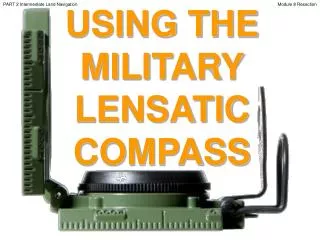
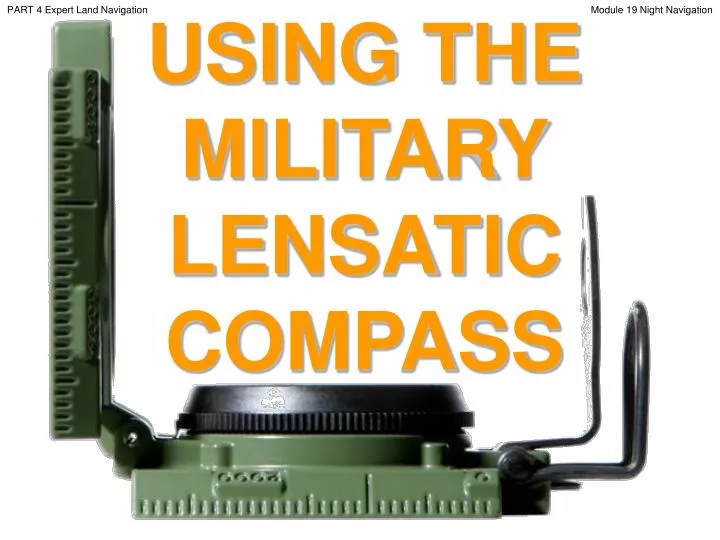
PART 4 Expert Land Navigation. USING THE MILITARY LENSATIC COMPASS. Module 19 Night Navigation. PART 4 Expert Land Navigation. Module 19 Night Navigation. WARNING.

E N D
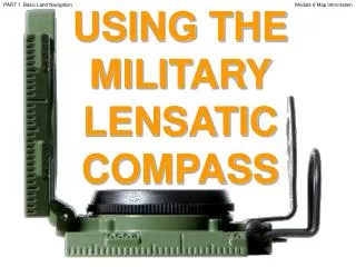
PART 4 Expert Land Navigation USING THE MILITARY LENSATIC COMPASS Module 19 Night Navigation
PART 4 Expert Land Navigation Module 19 Night Navigation WARNING This presentation is intended as a quick summary, and not a comprehensive resource. If you want to learn Land Navigation in detail, either buy a book; or get someone, who has the knowledge and skills, to teach you in person.
PART 4 Expert Land Navigation Module 19 Night Navigation NOTE To get the ideas across presented on these slides, many figures, pictures, and calculations may not be to scale and may be exaggerated for clarity.
PART 4 Expert Land Navigation Module 19 Night Navigation Note: Prior to being issued any training *equipment, you will be required to sign a “statement of liability” agreeing to pay for anything you damage or lose. All items will be inspected and inventoried prior to your signature and at the end of the training day too. If you do not intend to sign this statement, then you may be denied training. *You may use your own equipment.
PART 4 Expert Land Navigation Module 19 Night Navigation Any Questions?
PART 4 Expert Land Navigation Module 19 Night Navigation LAND NAVIGATIONPRESENTATIONPART 4Module 19Night Navigation
PART 4 Expert Land Navigation Module 19 Night Navigation . . . and now on with the . . . PRESENTATION
PART 4 Expert Land Navigation Module 19 Night Navigation LAND NAVIGATION WITH MAP ANDLENSATIC COMPASS
PART 4 Expert Land Navigation Module 19 Night Navigation LAND NAVIGATION • Why Learn Land Navigation? • Tracking present location • Determining Distance • Sense of direction • How to read a topographic map • Terrain and map association • Spatial skills • Planning safe, practical routes • And more Navigational skills • The best way to learnLAND NAVIGATION is to get "dirt time", that is, get out there with a map and compass! • Navigation is not about finding yourself after you are lost (although that’s what happens sometimes); it’s about keeping track of your position as you move away from a known point. As you move you have to remain cognizant of the terrain you are leaving, of the terrain you are passing, and of the terrain that is ahead. • Navigation in the wilderness means knowing your starting point, your destination, and your route to get there. • These skills will allow you to venture farther off the beaten path than you ever thought before. Training and practicing land navigation on foot provides the following everyday navigation (how not to get lost) benefits; (Where am I?) (How far is it and am I there yet ?) (Where do I want to go and where am I actually going ?) (Do I understand the map ?) (What hill or river am I looking at ?) (Can I mentally visualize the landscape in 3D ?) (Take a long safe route or a short risky route ?)
PART 4 Expert Land Navigation Module 19 Night Navigation • THIS PRESENTATION IS DIVIDED INTO FOUR PARTS • ________________________________________________________________________________________________________________________________________________________ • PART 1 Basic Land Navigation • The Lensatic Compass module 1 • The Topographic Map modules 2, 3, 4, • The Land and Map Association modules 5, 6 • PART 2 Intermediate Land Navigation • Making Sense of Direction module 7 • Tracking Present Location modules 8, 9, 10, 11 • Determining Travel Distance modules 12, 13, 14 • PART 3 Advance Land Navigation • Navigation Methods to Stay On Course module 15 • Additional Skills of Land Navigation module 16 • Planning to Navigate module 17 • PART 4 Expert Land Navigation • Navigation in different types of Terrain module 18 • Night Navigation module 19 • Sustainment module 20
PART 4 Expert Land Navigation Module 19 Night Navigation THESE ARE THE TRAINING MODULES Module 1 Lensatic Compass – parts and features, and how to sight the compass by two different methods. Module 2 Topo Map Margin – what map margin data represents, map care, and how to properly fold a map. Module 3 Topo Map Scale – map sizes and how it affects amount of detail that will be shown. Module 4 Topo Map Symbols – you must understand them; to read and speak map language to others. Module 5 Terrain Relief – shows elevation, indicates terrain features and heights of natural features. Module 6 Map Information – what a protractor is for and how a map provides four kinds of information. Module 7 Sense of Direction – lateral drift, current bearing, obstacles, back azimuth, deliberate offset. Module 8 Resection – locate position with map only. Modified resection is with a map or compass. Module 9 Intersection & Triangulation – two methods to locate position by compass. Module 10 Map Speaks Compass Language - there is no need to orient the map to find your position. Module 11 Plotting Position Coordinates – exact positioning, used to communicate to others with a map. Module 12 Route Measure – mapping straight-line distance, curvature distance, and slope distance. Module 13 Pace Count – using ranger pacing beads and estimating hiking speed. Module 14 Travel Distance Estimation – estimating by 100 meter rule, rule-of-thumb, and by time. Module 15 Plan to Navigate – in a group or alone, equipment, safety, responsibilities, route selection. Module 16 Stay on Course – advance reference points and advance baselines. Module 17 Additional Land Navigation Skills – estimate daylight, conserve energy, blisters, weather insight. Module 18 Navigating Different Terrain – special environments, featureless terrain, visibility, dense foilage. Module 19 Night Navigation – night adaptation, protecting night vision, navigate with lensatic compass. Module 20 Sustainment – maintaining skills, training others, setting up a land navigation course.
PART 4 Expert Land Navigation Module 19 Night Navigation Any Questions?
PART 4 Expert Land Navigation Module 19 Night Navigation PART 4EXPERT LAND NAVIGATION MODULE 19 • Night Navigation • Description • Skills
PART 4 Expert Land Navigation Module 19 Night Navigation NIGHT NAVIGATIONDESCRIPTION Darkness presents its own characteristics for Land Navigation because of limited or no visibility. However, the techniques and principles are the same as that used for day navigation. The success in nighttime Land Navigation depends on rehearsals during the planning phase before the movement, such as detailed analysis of the map to determine the type of terrain in which the navigation is going to take place and the predetermination of azimuths and distances. • Navigating at night is challenging and requires a high level of knowledge, confidence, and lots of practice • performing these skills, before heading out to the wilderness at night. • Dark Adaptation • Protecting Night Vision • Scanning the terrain • Traveling at night • Night navigation with Lensatic Compass
PART 4 Expert Land Navigation Module 19 Night Navigation NIGHT NAVIGATIONDark Adaptation • The first thing is to get your eyes ready for night vision navigation. • Before heading into the dark, allow your eyes to adjust to the dark. Five minutes in the dark without looking at bright lights is the minimum necessary, 30 minutes is better. • Dark adaptation is affected by exposure to bright lights such as matches, flashlights, flares, and vehicle headlights. Full recovery from this exposure may take up to 45 minutes. • Exposure to bright sunlight during the day can impair your night vision. Wear sunglasses in bright sunlight to prevent this. For sunglasses to be effective, all visible light must be attenuated, not just portions of the visible spectrum. To protect night vision, provide the best comfort, allow for scanning close to the sun, and provide normal color vision, dark sunglasses with a neutral gray tint are recommended. • staying either in a dark area for about 30 minutes, or in a red-lighted area for about 20 minutes followed by about 10 minutes in a dark area. The red-lighted method may save time by allowing you to check equipment, or do some other job before moving into darkness. • If in a white lighted area, wear red goggles for 30 minutes, before heading out in the night. Wearing red goggles is effective because red light does not affect the eyes.
PART 4 Expert Land Navigation Module 19 Night Navigation Any Questions?
PART 4 Expert Land Navigation Module 19 Night Navigation NIGHT NAVIGATIONProtecting Night Vision • Second thing is maintain night vision during the night. Any bright light can temporarily ruin one's night vision. • Dark adaptation is affected by exposure to bright lights such as matches, flashlights, flares, and vehicle headlights. Full recovery from this exposure may take up to 45 minutes. • Using a flashlight with a red lens filter will not damage your night vision. • The fashionable eye patch worn by the pirates weren't always due to the loss of an eye. In fact many pirates did it so that the one eye was good at seeing in the dark. • If it becomes necessary to look into a lighted area or to use a flashlight, cover one eye so as to retain some night vision in the eye. • Use a red light stick to read your map or other activity during the night. • Night vision goggles (NVG) impede dark adaptation. However, if a soldier adapts to the dark before donning the goggles, he gains full dark adaptation in about two minutes after removing them.
PART 4 Expert Land Navigation Module 19 Night Navigation NIGHT NAVIGATIONScanning the Terrain • Night vision scanning enables you to overcome many of the physiological limitations of your eyes and • reduce the visual illusions that so often confusesthe eyes (mind). • Practice seeing things without looking directly at them. • The technique involves scanning from right to left or from left to right using a very slow, scanning movement. • At night you must avoid looking directly at a faintly visible object when trying to confirm its presence.Use the corners of your eyes. • Off-Center Vision. This technique requires looking 10 degrees above, below, or to either side of an object rather than directly at it. This allows the peripheral vision to remain in contact with an object. • Bleach-Out Effect. Even when off-center viewing is practiced, the image of an object viewed longer than two to three seconds tends to bleach out and become one solid tone. As a result, the object is no longer visible. To overcome this condition, you must be aware of this phenomenon and avoid looking at an object longer than two to three seconds. By shifting your eyes from one off-center point to another, you can continue to pick up the object in your peripheral field of vision. • Practice what you know about seeing at night until it becomes second nature for you to use your eyes to their best advantage. • You can use Night Vision Binoculars as an • additional aid in scanning the landscape at night.
PART 4 Expert Land Navigation Module 19 Night Navigation NIGHT NAVIGATIONTraveling at Night • As you know there are many more hazards at night, where your visiblility is limited. • The basic technique used for night Land Navigation is dead reckoning. • If you are using Night Vision Goggles (NVG) or Night Vision Binoculars, you can use other day Land Navigation techniques. • When moving around in the dark, it is safer to move slowly and slide your feet, using your toes to sense obstacles in front of you. • Travel at a steady pace and avoid running in the dark. • You tend to travel slower and shorter steps, adjust your pace count. • Check your progress and position on the map every 30 minutes. • Lifting knees higher than normal when walking will reduce the chance of stumbling over rocks, roots, and low branches. • Stay off paths that wild predators use for preying on other animals. • Navigation using the stars is recommended in some areas; however, a thorough knowledge of constellations and location of stars is needed.
PART 4 Expert Land Navigation Module 19 Night Navigation Any Questions?
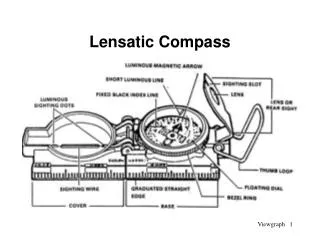
PART 4 Expert Land Navigation Module 19 Night Navigation NIGHT NAVIGATIONLensatic Compass for Night Travel Night Use of the Compass. For night use, special features of the compass include the luminous markings, the bezel ring, and two luminous sighting dots. Turning the bezel ring counterclockwise causes an increase in azimuth, while turning it clockwise causes a decrease. The bezel ring has a stop and spring which allows turns at 3º intervals per click and holds it at any desired position.
PART 4 Expert Land Navigation Module 19 Night Navigation 327 11 NIGHT NAVIGATIONLensatic Compass for Night Travel
PART 4 Expert Land Navigation Module 19 Night Navigation NIGHT NAVIGATIONLensatic Compass for Night Travel • STEP 1 • Plot your course on the map. Say your travel is a 327º azimuth. • Align the North Arrow and Luminous Bezel Line with the Black Index Line.
PART 4 Expert Land Navigation Module 19 Night Navigation . . NIGHT NAVIGATIONLensatic Compass for Night Travel • STEP 2 • 360º - 327º = 33º sum • 33 3 = 11 • RotateLuminous Bezel Line 11 clicks right. NOTE 1 If sum is not exactly divisible by 3, then round up or down to the nearest whole number. * Round up – hit right of target * Round down –hit left of target NOTE 2 Check the bezel ring around the face of the compass; it should make a distinct click as it is rotated. If it does not click, you will have to use the alternate method for night azimuth settings. ALTERNATE METHOD 360º - 327º = 33º sum Set Luminous Bezel Line to 33º
PART 4 Expert Land Navigation Module 19 Night Navigation CENTER-HOLD METHOD NIGHT NAVIGATIONLensatic Compass for Night Travel • STEP 3 • NOTE • Use the Luminous Sighting Dots as a visual queue on aligning your body with the compass during night navigation. • Using the Center-Hold method, rotate your body till the North Arrow and Luminous Bezel Line are aligned. • The 327º azimuth will be aligned under the Black Index Line
PART 4 Expert Land Navigation Module 19 Night Navigation NIGHT NAVIGATIONLensatic Compass for Night Travel • STEP 4 • NOTE • Use the Luminous Sighting Dots as a visual queue on • aligning your body with the compass during night navigation. • Using the Center-Hold method, keep the North Arrow aligned with the Luminous Bezel Line. • Proceed forward in the direction of the Luminous sighting Dots. DIRECTION OF TRAVEL
PART 4 Expert Land Navigation Module 19 Night Navigation Any Questions?
PART 4 Expert Land Navigation Module 19 Night Navigation Note: Prior to being issued any training *equipment, you will be required to sign a “statement of liability” agreeing to pay for anything you damage or lose. All items will be inspected and inventoried prior to your signature and at the end of the training day too. If you do not intend to sign this statement, then you may be denied training. *You may use your own equipment.
PART 4 Expert Land Navigation Module 19 Night Navigation TESTING Now it is time for the following . . . • Written exam • Hands-on / Outdoors exam
PART 4 Expert Land Navigation Module 19 Night Navigation THE END OFLAND NAVIGATIONPRESENTATIONPART 4Module 19Night Navigation