Download
1 / 23
320 likes | 815 Views
Hungary, 2012. Introduction to Cartography. Nazrulo Toirbekov Assistant lecturer TSPU, labnazar@gmail.com. A ‘warming up’ exercise. How do you tell people directions to somewhere? - Have you ever used the terms ‘north’, ‘south’, ‘east’ or ‘west’ to describe directions?

E N D
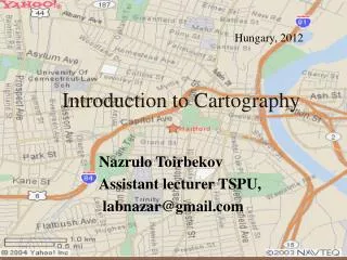
Hungary, 2012 Introduction to Cartography Nazrulo Toirbekov Assistant lecturer TSPU, labnazar@gmail.com
A ‘warming up’ exercise • How do you tell people directions to somewhere? • -Have you ever used the terms ‘north’, ‘south’, ‘east’ or ‘west’ to describe directions? • -Do you use reference locations? For example, It is two blocks from the E-5? Or, It will be right in front of you when you get off the bus. It is right on the bank of Duna or .... • -Describe to someone how you would get to University of West Hungary from the Airport or from train station • Have you ever drawn a map to illustrate to someone how to get somewhere? • Everyone is an amateur cartographer • However, this class will help you to start learning in details .
Objectives • Students will be able to express their knowledge about maps • Students will understand the importance of maps • Students will apply the use of new vocabulary in order to read a map • Students will analyze their own personal surroundings
Key words • Cartography • Map • Personal surroundings • Directions • Geographic information • Scale
Outlines • Introduction • History of cartography • Maps & their classification • Mapping tools (equipments) • Cartography today and tomorrow • Conclusion
Introduction • Maps are important for daily lives. • It is never too late to learn how to use a map so that you can always find your way.
Definitions • Cartography (from Greek khartēs, "map"; and graphein, "write"), or mapmaking, has been an integral part of the human story for a long time, possibly up to 8,000 years. • Cartography is the science and study of making maps • Source -http://en.wikipedia.org/wiki/History_of_cartography
Why cartography is important? • To communicate geographic information in a graphic form as a digital image or a paper map (analog) • To position the surroundings, location and ect. • Graphics better than description —’A picture tells a thousand words’. • «Map is the second language of geography»-N.Baranski
History of cartography 100 A.D. – geometry 1200 – Dark Ages 1300 – Renaissance 1680 – Enlightenment 1800s – Place => Space 1950+ -- Systems Approach • Evaluation of Cartographical Experience Worksheet • In your best words, describe what a map means to you. • Name different types of maps you may come across. • What is a key used for? A legend? A compass? • Why are maps important? • Who designs maps? How do you think this is done? 1.Source: www.maphistory.info/ 2.History of cartography volume 1&2
Types and classification of maps Classed by Scale Small scale Medium scale Large scale Classed by Function General reference maps Thematic/special purpose maps Charts Classed by Subject Matter Cadastral maps Plans Soil, vegetation, precipitation, etc
Map making process Mapping involves information transformations: • Data collection • Selection • Classification • Simplification (упрощение) • Exaggeration (преувеличение) • Symbolization • Use of map The cartographer's task - explore the ramifications of each mapping possibility and choose the most appropriate for the intended task. Who is your audience?
Basic characteristics of all maps: • Location • Attribution (приписывание) • Reduction of reality • Scale • Geometrical transformation/projection • Abstractions of reality
Mapping tools Mapping in the western world has undergone six major technological revolution: • Manual • Magnetic (compass -12th century) • Mechanical (Mechanical Printing Press-16th century) • Optical (telescope 17th century) • Photochemical (Photography-19th century) • Electronics (computers, GPS, GIS, 1950-present)
Cartography now • Digital databases are replacing the printed map as a means of storage of geographic information • Intergrated with spatial technologies (i.e.,Geographic Information Systems, Remote Sensing, Global Positioning Systems) and intergral part of Geographic Information Science (the science of the definition, use,analysis/interpretation of geographic information)
Cartography tomorrow • Maps will not dissapear but will be transformed • Maps will still be present in the medium of communication • Increasing intergration of spatial technologies • Cartographic principles will aid as a guide for these developing spatial technologies
Summary • Cartography is both an art and a science • It is a very robust sub-discipline of Geography which is rich and dynamic • The cartographic introduction we learned in this class will be directly useful in such classes as GIS and Remote Sensing • These principles will be important in other classes as you may have to understand maps or construct them for assignments or projects
Evaluation Evaluation of Cartographical Experience Worksheet • In your best words, describe what a map means to you. • Name different types of maps you may come across. • What is a compass used for? A legend? • Why are maps important? • Who designs maps? How do you think this is done?
Reference History of Cartography volume 1 & 2. Cartography in prehistoric, ancient, and medieval Europe and the Mediterranean-Edited by J. B. Harley and David Woodward Web. Links: en.wikipedia.org/.../History_of_cartography www.maphistory.info/ academic.emporia.edu/.../h_map.htm
Homework • Our next class would be: Map Projections and Map Scale Please review some books and sources on that.