Download
1 / 44
440 likes | 549 Views
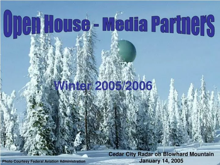
Open House - Media Partners. Winter 2005/2006. Cedar City Radar on Blowhard Mountain January 14, 2005. Photo Courtesy Federal Aviation Administration. In An Hour or Less…. Situational Awareness Everything You Have Always Wanted to Know About Polygons, But Were Afraid to Ask VTEC

E N D
Open House - Media Partners Winter 2005/2006 Cedar City Radar on Blowhard Mountain January 14, 2005 Photo Courtesy Federal Aviation Administration
In An Hour or Less… • Situational Awareness • Everything You Have Always Wanted to Know About Polygons, But Were Afraid to Ask • VTEC • The Winter That Was – Larry Dunn • Winter Weather Criteria/Policies • Hydrology Program Update – Brian McInerney • Winter Heating Costs Relief - Pamela Atkinson • Enhanced Communications
And Then…Most Importantly… • What is on your mind?
SAMs Capabilities Include… • Monitoring of local/national stations (dish network) for emerging weather related stories • Monitoring of NWS product flow to stations • Staff/Media briefings • Monitoring of security cameras
Everything You Have Always Wanted to Know About Polygons, But Were Afraid to Ask
The Polygon Defined • A graphically displayed figure defined by a set of 4 or more latitude and longitude points • The Polygon represents the area of maximum threat…the area that is truly most at risk from impending severe weather
Polygon Advantages • More accurately display warning (threat) area • Reduction in falsely alarmed area (area with little or no threat) • Distribution possible via cell phones, PDAs, etc. • Increase confirmation part of the warning process
The Need For Polygons • A study by Mileti and Sorenson (1990) suggested: • People do not take cover solely based on NWS warnings • NWS warnings start the “confirmation process”, by which people: • Look outside to determine if they are in imminent danger • Turn to local media to confirm they are in imminent danger (particularly at night)
The Need For Polygons…Continued • Graphical warning displays aid in the confirmation process by narrowing the warning to the highest threat area. • Media can use graphical products to refine the threat area • Emergency officials can plan use of resources better by utilizing more specific graphical warnings • Numerous applications for Private sector warning alerts (e.g. First Alert)
Polygon and AssociatedCounty Warnings • Latitude/Longitude points included in all TORs, SVRs, FFWs, SVSs, and SMWs • One Polygon or three counties…compare the areal coverage!
Polygon Advantage Polygon Eliminates Area False Alarmed
Polygon Warning Scenarios Eastward moving supercell is producing large hail and severe winds, and may soon produce a tornado at the location of the hook signature. What is the best polygon procedure? A.TOR for Sumner Co. B.TOR for tornado threat C. Initial SVR for entire area, SVR to the north storm, TOR for the for the hail. tornado threat area. = SVR = TOR
Current Applications • Polygons on Network Stations • Becoming common practice in Central and Southern Plains • WeatherData and Baron Weather Solutions both offer Polygon display packages • RIDGE Radar Display • http://www.srh.noaa.gov/ridge/
Polygon Future • Emphasis on graphically generated warnings, in addition to text • Warnings focused on specific area(s) threatened, independent of geopolitical boundaries • Polygon display software enhancements will continue • Graphical displays via weather radios, cell phones, PDAs, etc. will become more common
Demographic Information Available To Customers via Software Enhancements
WHY VTEC? • Easier-to-decode, uniform way to receive watch, warning, advisory information • Tracking of products • Improved dissemination • Standardizes our products for both internal and external use
VTEC Products • VTEC Products • Short Fused • Severe Thunderstorm Warnings (SVR) • Severe Weather Statements (SVS) • Tornado Warnings (TOR) • Flash Flood Warnings (FFW) • Long Fused • Winter weather watches, warnings, and advisories (WSW) • Non-precipitation watches, warnings, and advisories (NPW) • Fire Weather Watches and Red Flag Warnings Storm (RFW) • Flood/Flash Flood Watches (FFA) • Watch County Notification (WCN)
The Winter That Was Cedar Mountain Snow Depth January, 2005 Photo Courtesy Randy Julander
Winter Weather Terms/CriteriaHeavy Snow Warning/Lake Effect Warning
Winter Weather Terms/CriteriaBlizzard Warning/Ice Storm Warning Blizzard Warning - Heavy snow and/or blowing snow (visibility less than 1/4 of a mile) and sustained winds or frequent wind gusts of 35 mph or more are expected for a period of three hours or more. Ice Storm Warning - Significant and damaging ice accumulations (usually one quarter inch or more) are expected. Wind Chill Warning – Wind chills of -30º F or colder, with winds >10 mph for 3 hours or more. WFO SLC Winter Weather Criteria is on-line at http://www.wrh.noaa.gov/slc/wxsafety/WinterWX.htm
Hazardous Weather Outlook versus Special Weather Statement • HWO will be issued on an event driven basis…primarily when potential exists for a headline event. • Special Weather Statement will be reserved for significant (out of the ordinary) events.
Watch Issuance • Issued for Second, third, and occasionally fourth forecast periods • Lake effect snow exception • Snow amounts in the zones and the grids should at a minimum touch the lower end of warning criteria if a watch is in effect • Exception is for a storm expected to begin in the 3rd or 4th period, where criteria will not be met until the 4th period or beyond
Warning/Advisory Issuance • Typically Issued for first and second forecast periods • Exception for Lake Effect snow • Exception for large synoptic scale storms • Will use high end of forecast snowfall range to issue advisories and warnings • If snow is expected to begin earlier, but be below criteria for a period of time, prior to becoming heavier, we will make this clear in the WSW “light snow will begin this afternoon and become heavier this evening…”
Ending Warning/Advisory • Warnings/advisories ended when criteria has been met and additional snow accumulation is expected to fall 2 categories below the warning/advisory • Warning in effect and criteria met - if additional accumulation will be sub-advisory, cancel the warning or allow it to expire • Advisory in effect and criteria met – if no additional accumulation expected, cancel the advisory or allow it to expire • Warning in effect and criteria met – if advisory level accumulation or more expected, keep the warning going • Advisory in effect and criteria has been met – if any additional accumulation, keep the advisory going • We will be cautious about downgrading or canceling
Breaks in the Storm • If break in the storm is expected to be less than 4 to 6 hours, we will leave the event in effect • Expected break in the storm will be discussed in the WSW and AFD
Early Season Storms • For the first event of the season, warnings may be issued for snow amounts not meeting warning criteria • Policy applies to first event in mountain zones • Policy applies to first event in valley locations in urban corridor (UTZ001, UTZ002, UTZ003, UTZ004, if in October or earlier
Utah Flood CategoriesSevier River Drainage Example • Convective flash flooding:Convective Flash flooding is generally not much of a problem in the Sevier River Drainage. The drainage is mostly agricultural with tilled soils and a majority of the terrain is somewhat flat. Infiltration occurs at a high rate, and vegetation is abundant in the area. • Long duration rain driven events:Long duration rain driven events occur in the fall, winter, and spring months. These events may occur, but flooding is not very common for the same reasons mentioned above. • Spring snowmelt river flooding:Spring snowmelt river flooding occurs anytime from March through June. Most times, higher river flows are accompanied by heavy rainfall, either convective or stratiform, or a rapid warming on large snowpacks. Typically, above average snowpack is melting at a rate over an inch per day or greater, and the airmass is capable of producing rainfall amounts near one inch or greater. An additional scenario occurs when large snowpacks melt rapidly due to a rapid increase in temperature.
New Flood Forecast Points Virgin River near Virgin Virgin River near Bloomington Santa Clara near St. George Santa Clara near Gunlock Sevier River near Marysvale Sevier River near Kingston East Fork Sevier River near Kingston Sevier River near Sigurd Rock Creek near Mountain Home Yellowstone River near Altonah Flood
Contact Information Additional Information Contact Brian McInerney Hydrologist National Weather Service 801-971-2033 c brian.mcinerney@noaa.gov
Winter Heating Costs Relief Ice Storm(Possibly Springfield, Illinois, 1924)
Options • Instant Messaging • Web based briefings • Conference calls • Meet-Me Notification Software used internally • Can take similar approach for partners • News Conferences