Download
1 / 44
440 likes | 771 Views
VCE Geography 2010. Lesson 1 Check equipment list ‘Semester 1 Planner’ and Course Outline Reflect on Transition exercises Introduction to Coasts unit (see page 74 of New Perspectives). Year 11 VCE Geography – 2010 Semester 1 Planner. Semester 1.

E N D
Lesson 1 • Check equipment list • ‘Semester 1 Planner’ and Course Outline • Reflect on Transition exercises • Introduction to Coasts unit • (see page 74 of New Perspectives)
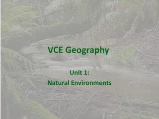
Semester 1 Unit 1 – Natural Environments This unit investigates the geographic characteristics of natural environments and landforms and the natural processes that shape and change the earth’s surface. It investigates how the interactions between natural processes and human activities can also change natural environments. Students must investigate at least two natural environments in each area of study Term 1 – Coasts Term 2 – Volcanic environments Area of study 1 Characteristics of natural environments Area of study 2 Changes in natural environments
Task 1 – Define a coast. Write a definition in your folder What is a coast? ‘A coast is the link between the sea and the land, and there is a strong spatial interaction between these two zones. What happens on land affects the sea and what happens in the sea affects the land’. (Taken from Place and Change by Pask. R et al, 2002) Technically, the term refers to the region that stretches from the shallow water of the continental shelf to the furthest extent of wave and tide influence on the land. Coasts are not static, they are dynamic places. They quickly change shape and location in response to natural processes and human activities. For example, sand and other materials are moved onto and off beaches by currents and waves. During major storms, huge waves can move large amounts of coastal sediment, and can flood vast areas in hours. Task 2 – Familiarise yourself with the coastal zones on Pg. 75 of ‘New Perspectives’ and label the photograph handout. Put completed photo annotation in your folder.
Annotate this photo using the coastal zones diagram on page 75 of NP.
Lesson 2 Task 3 – Discuss as a class, different types of coasts and copy descriptions of coast types into folder. Talk to each other about which coastal regions you have been to and identify which coast type they characterise. Task 4 – Trace the Victorian coastline onto tracing paper, using the satellite image provided. Add a key and label different coast types. Then discuss in a group, how swell/wave direction impacts on the Victorian coastline. Use Pg.77 of ‘New Perspectives’ to help you.
Task 5 – Even though the sea and wind conditions vary daily, the Victorian coastline is usually subjected to waves from the south west. Explain why this is the case. Task 6 – Describe the distribution of different types of coast within Victoria. Give some reasons for these variations.
Lesson 3 - How coasts are formed • Next we will be looking at how waves are formed and ways in which they can shape the land. • Open two text resources to help you – New Perspectives pg 78-79 and Jacaranda essentials Geography 2, page 82 and 83 • You will also need to load the Coasts Interactive PowerPoint and refer to slides 1-7 an 27-28 to assist you in completing this task. • Task 7 - Please write down a definition for each of the following terms and also draw a simple diagram to illustrate the term. You may use the diagrams in the books and on the PowerPoint to assist you. • Swash • Backwash • Destructive wave • Constructive wave • Fetch • Longshore drift • Task 8 - Once you have finished your definition of ‘longshore drift’, attempt Activity 6, 7a,b,c and d, on Page 83 of Jacaranda Geography 2 to test your understanding of the longshore drift process.
Lesson 4 - Coastal features caused by erosion • Today we will be looking at types of coastal erosion and features or landforms that are caused by coastal erosion. • Types of coastal erosion • Abrasion, hydraulic action, attrition, corrosion, sub-aerial erosion • (also could look at mass movement and dune blowouts) • Coastal features/landforms caused by erosion • Headlands and bays • The influence of wave refraction and wave reflection • Wave-cut notch and wave-cut platform • Caves, arches, stacks and stumps.
Types of coastal erosion Abrasion, hydraulic action, attrition, corrosion, sub-aerial erosion (please see New Perspectives page 78 for definitions) Abrasion Corrosion Sub-aerial erosion Hydraulic Action
Headlands and bays Headlands and bays form on coasts where bands of rock of alternating resistance run perpendicular (at right angles) to the coast. Bays form where weak/less resistant rocks (such as sandstone or clay) are eroded, leaving bands of stronger/more resistant rocks (such as chalk, limestone or granite) forming a headland.
Wave refraction: is the bending of waves as they reach shallow water. This causes the curving of wave crests around the headland. Wave energy is concentrated around the headland , causing eroded landforms such as wave-cut notches, stacks, and arches. Wave reflection: The reflecting of wave energy back towards the sea, usually occurring where a wave strikes a solid surface such as a cliff or sea wall. This causes the erosion and transportation of sediment back into the sea.
Shallow water Shallow water Tom Abbott, Biddulph High School and made available through www.sln.org.uk/geography and only for non commercial use in schools
Shallow water Shallow water wave Tom Abbott, Biddulph High School and made available through www.sln.org.uk/geography and only for non commercial use in schools
Shallow water Shallow water wave Tom Abbott, Biddulph High School and made available through www.sln.org.uk/geography and only for non commercial use in schools
Shallow water Shallow water wave Tom Abbott, Biddulph High School and made available through www.sln.org.uk/geography and only for non commercial use in schools
Shallow water Shallow water wave Tom Abbott, Biddulph High School and made available through www.sln.org.uk/geography and only for non commercial use in schools
Shallow water Shallow water wave Tom Abbott, Biddulph High School and made available through www.sln.org.uk/geography and only for non commercial use in schools
Shallow water Shallow water wave Tom Abbott, Biddulph High School and made available through www.sln.org.uk/geography and only for non commercial use in schools
Shallow water Shallow water wave Tom Abbott, Biddulph High School and made available through www.sln.org.uk/geography and only for non commercial use in schools
Shallow water Shallow water wave Tom Abbott, Biddulph High School and made available through www.sln.org.uk/geography and only for non commercial use in schools
Shallow water Shallow water wave Tom Abbott, Biddulph High School and made available through www.sln.org.uk/geography and only for non commercial use in schools
Shallow water Shallow water wave Tom Abbott, Biddulph High School and made available through www.sln.org.uk/geography and only for non commercial use in schools
Shallow water Shallow water wave Tom Abbott, Biddulph High School and made available through www.sln.org.uk/geography and only for non commercial use in schools
Shallow water Shallow water wave Tom Abbott, Biddulph High School and made available through www.sln.org.uk/geography and only for non commercial use in schools
Wave cut platform A wave-cut notch forms after destructive waves hit against the cliff face, causing undercutting between the high and low water marks. Wave cut platform Over time, a wave-cut notch enlarges into a cave. The waves undercut this portion until the roof of the cave cannot hold due to the pressure, and it collapses, resulting in the cliff retreating landward. The base of the cave forms the wave-cut platform as attrition causes the collapsed material to be broken down into smaller pieces and transported by waves as sand sediment.
Cave Caves form when the sea attacks small cracks in a headland and opens them. The cracks then gradually get larger and turn into a small cave. Arch An arch is formed when a sea cave is eroded away on both sides of the headland. Sea stack Continued erosion of an arch causes the arch to collapse, leaving the pillar of hard rock standing away from the coast called a stack. Sea stump Eventually, erosion will cause the stack to collapse, leaving a stump. This stump is usually a small rock island; small enough to be submerged by high tide.
Task – photo annotation • Each photograph provided includes examples of a variety of coastal processes and coastal features formed by erosion. • Cut out each photo and stick it in your folder. • Annotate each photograph, using arrows, terms and explanations . Explain each coastal feature or process you can identify. • Include: headland, bay, wave-cut notch, wave-cut platform, arch, cave, stack, stump, wave refraction, wave reflection, abrasion, sub-aerial erosion and hydraulic action.
Lesson 5 - Coastal features caused by deposition • Today we will be looking at types of coastal features or landforms that are caused by coastal deposition. • Constructive waves are responsible for building up coastlines by transporting sediments to the shore and depositing them. • Coastal deposition features/landforms • Beach • Sand dune • Sand spit • Tombolo
Beach A beach usually consists of loose particles which are often composed of rock, such as sand, gravel, shingle or pebbles. Beaches can sometimes have biological origins, such as shell fragments. Beaches are formed when sand or other loose sediments are transported by wave action. Beach materials come from erosion of rocks offshore, as well as from headland erosion and slumping (collapsing).
Sand dunes • Dunes occur in different forms and sizes, formed by interaction with the wind, when dry sand is blown to the black of the beach(transportation). Most dunes are longer on the windward side where the sand is pushed up the dune and have a shorter slip face in the lee of the wind. • Task • Study the information and diagram on sand dunes on page 89 of Jacaranda Geography 2. • 1. Describe the conditions with which dune vegetation needs to cope. • 2. List some adaptations that help plants to survive in dune environments. • 3. What might be the consequences of removing vegetation from sand dunes?
Sand Spit A sand spit is one of the most common coastal landforms. A sand spit is a linear accumulation of sediment (a build up of sand in a line) that is attached to land at one end. How it is formed Sand is carried parallel to the shore by longshore drift. The transportation of sand may eventually extend across a bay or between headlands especially where water is relatively calm. Spits are typically elongated, narrow features built to several dozen feet by wind and waves. Spits often form when wave energy decreases as a result of wave refraction (see notes to remind yourself what this means) in a bay. When a coastline turns abruptly, wave energy is reduced by a divergence of wave trajectories. This reduction in wave energy causes the deposition of sediment (mainly sand). In other words, sand accumulates as the water loses its ability to transport material.
Spits grow in size as sand is continually deposited in the direction determined by prevailing winds (longshore drift). As spits grow, the sheltered area behind them often develops into a marshland, where plant and animal species can thrive. In a case where a sand spit forms near the mouth of a river (such as in the two diagrams below), the fast currents from the river mouth (estuary) erode the sand accumulating in the river channel, preventing it from depositing sand all the way across the river to the next headland. In cases where a river estuary is not present, wave energy levels will determine the length of the sand spit. Sand will only accumulate where deposition occurs; not erosion.
Examples Two sand spits formed by longshore drift occurring in opposite directions. A - right to left B - left to right Revel Island, Virginia, USA Dawlish Warren, Dorset, England
Sand spit formation This photo shows Dawlish Warren sand spit in England. Task 4. Using your notes on sand spits and your knowledge of coastal processes of erosion, transportation and deposition, describe the processes that are occurring at each point (a,b,c,d) and explain the causes. 5. Identify which coastal management strategies are being used at E & F, and explain how they work. 6. State which of the following is occurring at each point: erosion, transportation or deposition 7. State what the wave energy level is likely to be at each point. D C B E F A
8. Draw an annotated diagram in your folder of the photo, include answers to tasks 2,3 & 4. • 9. The Dawlish coastal management agency wishes to widen the estuary to allow larger vessels to enter the river. Design a coastal management plan to solve this issue. • You will need to: • Draw 3 diagrams • Diagram 1 – current situation • Diagram 2 – coastal features altered • Diagram 3 – final coastal layout • Annotate each diagram with • explanations of coastal processes • occurring and management • strategies to control these • processes. D C B E F A
Tombolo A tombolo is a deposition landform such as a spit or bar which forms a narrow piece of land between an island or offshore rock and a mainland shore, or between two islands or offshore rocks. They usually form because the island causes wave refraction, depositing sand and shingle moved by longshore drift in each direction around the island where the waves meet. Task 10. Describe the difference between a spit and a tombolo.
Lesson 6 – Coastal management • In future lessons, we will explore human impacts in the coastal environment; positive and negative. Firstly, let’s use our knowledge of coastal erosion, transportation and deposition to explore the techniques used to protect this vulnerable and dynamic environment. • Today we will be looking at ways to protect the coastline through human intervention. • Coastal protection techniques • Hard construction Soft construction • Groynes • Revetments • Riprap • Gabions • Breakwaters • Beach nourishment • Sand dune stabilisation
Groynes Groynes are wooden, concrete or rock barriers (walls) perpendicular to the sea. Beach material builds up on the up drift side, where littoral drift (longshore drift) is predominantly in one direction, creating a wider and a more plentiful beach. The groyne structure enhances the protection of the coast because the retained sand material filters and absorbs the wave energy. There is a loss of beach material on the down drift side, requiring that another groyne to be built there. This is why groynes are often laid in groups, not on their own. • Positives • Groynes are extremely common, cost-effective coastal defence measures, requiring little maintenance. • Negatives • Groynes do not protect the beach against storm waves and if placed too close together will create currents, which will carry sand material offshore. • Groynes are increasingly viewed as detrimental to the aesthetics of the coastline, and face strong opposition in many coastal communities.
Revetments Revetments consist of wooden slanted or upright blockades, built parallel to the sea on the coast, usually towards the back of the beach to protect the cliff or settlement beyond. The most basic revetments consist of timber slants with a possible rock infill Riprap Riprap is made from a variety of rock types, commonly granite, limestone or occasionally concrete rubble from building and paving demolition. Riprap works by absorbing and deflecting the impact of a wave before the wave reaches the defended structure. The size and mass of the riprap material absorbs the impact energy of waves, while the gaps between the riprap traps and slows the flow of water, lessening its ability to erode soil or structures.
Gabions Gabions consist of boulders and rocks contained in a wired mesh cages and usually placed in front of areas vulnerable to heavy to moderate erosion: sometimes at cliffs edges . They may also be placed to jag out at a right angle to the beach like a large groyne. When the seawater breaks on the gabion, the water drains through leaving sediments, also the rocks and boulders absorb a moderate amount of the wave energy
Offshore breakwater An offshore breakwater is constructed using large concrete blocks and natural boulders. These materials are sunk offshore to alter wave direction and to filter the energy of waves and tides. The waves break further offshore and therefore reduce their erosive power. This often leads to wider beaches, which absorb the reduced wave energy, protecting cliff and settlements behind. Aerial photo Breakwaters can also be attached to the land. This is very common adjacent to a marina. In the case below left, two breakwaters protect the coast and provide shelter for the local marina. Port Taranaki, NZ. Plymouth Breakwater, UK.
Beach nourishment Beach nourishment or replenishment is one of the most popular soft engineering techniques of coastal defence management schemes. This involves importing alien sand off the beach and piling it on top of the existing sand. The imported sand must be of a similar quality to the existing beach material so it can integrate with the natural processes occurring there, without causing any adverse effects. Beach nourishment can be used alongside the groyne schemes. Sand dune stabilisation Vegetation can be used to encourage dune growth by trapping and stabilising blown sand. A common form of planting in the foredunes is Ammophila. These grasses include Marram Grass, Bent Grass, and Beach Grass.Their extensive systems of creeping underground stems allow them to thrive under conditions of shifting sands and high winds.