Download
1 / 23
550 likes | 1.28k Views
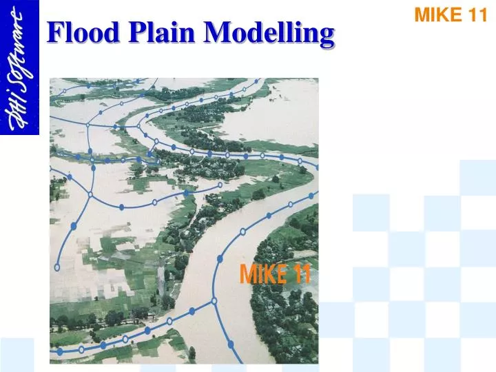
Flood Plain Modelling. Flood Plain Modelling. Flood Plain Model Options : 1 - D : - Lump River and Flood Plain as Single branch ( Limitation: Same Water Levels in River and Flood Plain)

E N D
Flood Plain Modelling • Flood Plain Model Options: • 1 - D : - Lump River and Flood Plain as Single branch (Limitation: Same Water Levels in River and Flood Plain) • Quasi 2-D: - River and Flood Plain separate Flow Paths - Requires accurate and detailed Data - Relevant for: Flood Mapping, Flood Plain Inundation and Drainage Modelling Flood Damage assessments
START N Flood plain model not needed Does the river spill? Y N Do the spill areas convey significant flow discharges ? Are levees present ? Y N Y Flood Cell with link channel Additional Flooded Area Are spill flows conveyed parallel to the river ? N Flood plain attached to cross section Y 1-D N Are levees present ? Y Is the flood plain flow frequent interrupted by roads and other flow obstructions? Y N Q 2-D Interlinked Flood Cells Routing Channels
Flood Plain Modelling RIVER MODEL 1D RIVER CROSS-SECTIONS
Flood Plain Modelling SCHEMATIZATION (1 DIMENSION) LOOPED RIVER NETWORK TRIBUTARIES
Flood Plain Modelling SCHEMATIZATION OF FLOODPLAINS (QUASI 2D) PARALLEL RIVERS FLOODED AREAS LINK CHANNELS
Channel Center-Lines SCHEMATIZATION (1 DIMENSION)
Non-Channel Flow Axes SCHEMATIZATION OF FLOODPLAINS (QUASI 2D)
Flood Plain Schematisation Flood Plain Description, definitions: FP1: Ignored FP2: Add. Storage River Flood plain? River Flood plain FP3: Part of Cross section FP4: Separated from River River Flood plain River Flood plain Linkchannel
Flood Plain Schematisation ? ? FP1 : FP2 : FP3 : FP4 : • •
MIKE 11 Descriptions: FP2 and FP3 FP2 Add. Storage area in processed data Raw data view Processed data table FP3 Relative Resistance in raw data
MIKE 11 Descriptions: FP4 River channel and floodplains modelled separately. Link channels define flow exchange properties Channel 1 Channel 2 Channel 3 Link1 Link2 Link Channels (Network Tabular View)
River-Floodplain Flow Exchange Floodplain Connection to River Branch U/S Bed Level D/S Chainage Link Structure Manning's Coefficient River U/S Chainage D/S Bed Level Connection to Floodplain Cell or Branch Longitudinal Parameters of a Link Structure
High ground River Khal Flood Plain Inundation Flood Plain Inundation, definitions: No Flooding:FL1 : Local Rainfall FloodingFL2 : Flooding via KhalsFL3 : Flooding via Levees No Flooding FL1 FL2 FL3
Flood Plain Drainage Flood Plain Drainage, definitions: Flood Plain Inundation, definitions: DR1 : Drainage via ChannelDR2 : Drainage via Levees River FloodPlain Channels DR1 FloodPlain River Levee DR2
Storage calculated from cross section width dx /2 dx /2 1 2 b b 2 1 b 3 A =b (dx /2+dx /2) s 2 1 2 dx dx 1 2
Total Surface Storage Total surface storage =Storage width . dx + Add. Storage Area