Download
1 / 35
350 likes | 460 Views
GPS: From Plate Tectonics to GPS Seismology - blurring the boundaries, sharpening our vision “Current GPS Research, new discoveries, limitations …” Charles Meertens UNAVCO. Measuring earth motions with GPS – the ultimate ultra broadband sensor

E N D
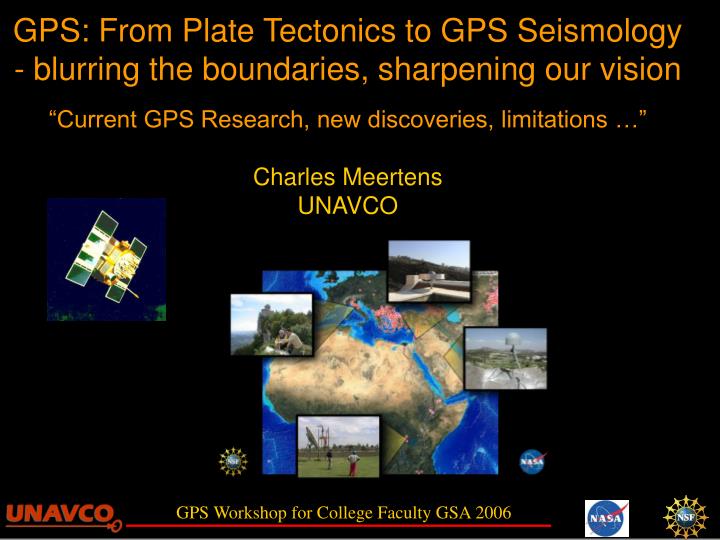
GPS: From Plate Tectonics to GPS Seismology - blurring the boundaries, sharpening our vision“Current GPS Research, new discoveries, limitations …”Charles MeertensUNAVCO
Measuring earth motions with GPS – the ultimate ultra broadband sensor Steady-state Plate motions and Plate Boundary deformation (years to decades) Transient deformation – Episodic Tremor and Slip (days to months) GPS Seismology – Co-, Post-seismic deformation (seconds to minutes) GPS and Earthquake Hazards in the News (or why measure continuously and model in real time) Outline
Continental DriftGeologic evidence the plants and animals, the ice, the rocks match, Alfred Wegner proposed Continental Drift in 1912 because…. and the climates and poles do not. the shapes match, http://volcano.und.edu/vwdocs/vwlessons/atg.html http://kids.earth.nasa.gov/archive/pangaea/evidence.html
Seafloor Spreading and Plate Tectonics added evidence from magnetic stripes, age of the sea floor, bathymetry, earthquakes led to the theory of seafloor spreading and plate tectonics in the 1960’s (Hess, Dietz, Vine, Matthews, Wilson, Cox, Atwater, …) http://volcano.und.edu/vwdocs/vwlessons/atg.html http://www.unavco.org - Education and Outreach Maps
Conventional thinking and teaching gives the impression that plate boundaries are sharp (left) and motions are linear in time. Geologic and geophysical studies led to the recognition of broad plate boundary zones…the boundaries are not sharp. USGS and http://www.unavco.org/pubs_reports/brochures/1998_UNAVCO/1998_UNAVCO.html
Space Geodesy Wegener's Dream "This [direct measurement of continental drift] must be left to the geodesists. I have no doubt that in the not too distant future we will be successful in making a precise measurement of the drift of North America relative to Europe."-- Alfred Wegener, 1929 In the 1970’s and 80’s space geodetic techniques such as VLBI verified plate tectonics and showed that current plate motions are very close to those estimated from geologic and earthquake evidence (NUVEL). Subsequently GPS techniques have refined tectonic models, mapped out microplates and quantified plate boundary deformation and have shown that motions in the plate boundary are anything but linear or constant in time.
Additional reading Kious and Tilling (USGS) provide one of the few educational resources to capture the idea of plate boundary zones and the power of GPS geodesy http://pubs.usgs.gov/gip/dynamic/dynamic.html
Using GPS to measure Steady-state Plate motions and Plate Boundary deformation From the work of Corne Kreemer, University of Nevada Reno and Bill Holt, SUNY Stony Brook
GPS Permanent GPS Station: This example shows fairly linear motions over many years Rate 3 +/- 0.1 mm/year Basin and Range, Yellowstone U. of Utah, Caltech, Harvard SAO
Global Plate Motions and Boundary Zones ObservedGPS Velocities Plus Earthquake Slip directions Plate Tectonic Model with Deformable Boundaries Model Velocities and Plate Boundary Strain GSRMModel of Kreemer and Holt 5170 geodetic velocities from 86 different studies
Transient deformation – Episodic Tremor and Slip From the work of Herb Dragert, Geological Survey of Canada
Global Plate Motions and Boundary Zones Plate Boundary Observatory ~1000 GPS (with Nucleus) ~100 Strainmeters ObservedGPS Velocities Plus Earthquake Slip directions Plate Tectonic Model with Deformable Boundaries Model Velocities and Plate Boundary Strain GSRMModel of Kreemer and Holt 5170 geodetic velocities from 86 different studies
These motions have been used to estimate the location and extent of long-term coupling across the subducting plate interface Daily and Long-term (Interseismic) Deformation Motions Along the Northern Cascadia Margin Changes in daily positions calculated from continuous GPS data reveal long-term trends that indicate crustal movement. Time series of daily positions of UCLU and CHWK wrt DRAO (Penticton) for 1999-2001
Correlation of Tremor & Slip in the Victoria Area Updated from Rogers & Dragert, Science, 2003 • Blue dots show GPS east component at Victoria • Bottom graph shows total # of hrs with tremor activity in a 10-day window • The shaded bars show predicted time windows for ETS
Correlation of Tremor & Slip in the Victoria Area Updated from Rogers & Dragert, Science, 2003 • Blue dots show GPS east component at Victoria • Bottom graph shows total # of hrs with tremor activity in a 10-day window • The shaded bars show predicted time windows for ETS
Conceptual Model of ETS on the Cascadia Subduction Zone Both offshore and at greater depths (>50km), the two plates converge steadily at ~ 4 cm/yr, the geological average rate. Across the shallower interface, the plates are locked for centuries, rupturing only at times of great thrust earthquakes. View from East At depths of 25 to 45 km, plates resist motion temporarily for ~14 months and then slip a few centimetres over periods of 1 to 2 weeks, accompanied by distinct seismic tremors. View from South
Conceptual Model for Plate Motions & Stress Accumulation Across the Cascadia Subducting Plate Interface
Can Slip Events Trigger Megathrust Earthquakes? Slip Dragert et al., EPS, 2004 Loading of the up-dip locked zone is miniscule (<0.1 bar), but if stress is close to critical, a discrete slip event could trigger a megathrust earthquake.
Tremor & Slip on Vancouver Island and Cumulative Probabilities of Megathrust Earthquakes Mazzotti & Adams, BSSA, 2004 Conditional probability per week at 300 yrs within a 580 yr megathrust cycle During slip, this probability increases by a factor of ~50.
GPS Seismograms (1 to 10 hz GPS) Time period seconds to minutes From the work of Andria Bilich, Kevin Choi, and Prof. Kristine Larson, University of Colorado, Boulder Who gratefully acknowledge…. IGS, JPL, UNAVCO, NGS, CORS, SOPAC, CDDIS, SCIGN, NRCan, GSI/GEONET, AeroMap Surveying Funding from the NSF geophysics program (EAR-0003943, EAR-0337206), NSF Graduate Research Fellowship (AB), and NASA Graduate Student Fellowship (KC)
Long, complex rupture Magnitude 7.9, shallow strike-slip SE directivity Large Love waves Denali Earthquake3 November 2002 USGS fact sheet
Denali Seismograms • 25 GPS stations • 1 sample/second • Different azimuths and distances
Clipped Seismometers+ 1-Hz GPS Many broadbands in western North America clipped… … and high-rate GPS fills in the gaps
Seismometer Broadband and strong motion instruments Direct measurement in inertial reference frame Measure acceleration or velocity integrate for displacement Can saturate or ‘clip’ = distorted amplitude/phase Very sensitive even to remote earthquakes High-rate GPS Receiver measures distance between receiver and multiple satellites Estimate position/displacement in terrestrial reference frame No integration required No upper limit to amplitude Sensitive only to larger or near vicinity earthquakes Seismometer vs. High-rate GPS Measurements
No other instruments available Clipped seismometers Constrain integration Differentiating static offset vs. postseismic vs. radiated energy Additional source of data for rupture modeling When are GPS seismograms useful?
San Simeon 23 December 2003 Mw6.5 • Ji et. al, 2004 • Combined: • Strong motion • Teleseismic • GPS • Static • Coseismic • First time high-rate GPS used to constrain seismic source model
Tokachi-Oki2003 September 25 Seismic Network GPS Network
Time-Dependent Rupture modeling of Tokachi-Oki event using high-rate GPS • Miyazaki et al., 2004 • Used only high-rate GPS to model rupture • Currently working on joint seismic+high-rate GPS inversions
GPS and Earthquakes in the News…Towards Real-time Tsunami Amplitude PredictionSobolev and others, EOS 12 September 2006“The GPS Shield” High-rate GPS Synthetic Time series
GPS and Earthquakes in the News… Preseismic Lithosphere-Atmosphere-Ionosphere CouplingKamogawa, EOS 10 October 2006 GPS TEC Map
Thank-you! Unidata and UNAVCO/GEON IDV Collaboration Image source credits: Mantle Tomography - Shapiro and Ritzwoller; Megnin and Romanowicz Geodynamics Model - McNamara and Zhong Global Strain Rate Map and Plate motions -Kreemer and Holt