Download
1 / 10
100 likes | 311 Views
Development of an Extratropical Surge and Tide Operational Forecast System (ESTOFS) for the Atlantic and Gulf Coasts. Jesse Feyen, Yuji Funakoshi, and Frank Aikman III (NOS/OCS/CSDL) Hendrik Tolman , Arun Chawla , and Ilya Rivin (NWS/NCEP/EMC) Arthur Taylor (NWS/MDL). ESTOFS Overview.

E N D
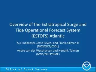
Development of an Extratropical Surge and Tide Operational Forecast System (ESTOFS)for the Atlantic and Gulf Coasts Jesse Feyen, Yuji Funakoshi, and Frank Aikman III (NOS/OCS/CSDL) HendrikTolman, ArunChawla, and IlyaRivin (NWS/NCEP/EMC) Arthur Taylor (NWS/MDL)
ESTOFS Overview • Purpose • Basin-wide storm surge model for coupling with coastal wave models (SWAN or WWIII) • Add tide in surge predictions • Lacking in operational Extratropical Storm Surge (ETSS) model runs • Can use tidal grids to add to forecaster-generated surge grids to generate combined field • Provide multi-model ensemble for extratropical surge forecast guidance
ESTOFS Model Overview • Atlantic and Gulf coasts • Coastal resolution ≈ 3 km • Tides from global tide model • Atmospheric forcing from GFS • Winds and sea level pressure • ADCIRC finite element model • Community-based • Unstructured grid • 2D barotropic solves for water level and depth-averaged currents (no temp, salinity)
Operational Set-up • Running 4 times per day to match GFS/WWIII cycle • Total 8 days simulation per cycle • 12-hr nowcast followed by 180-hr forecast • Delivers three water level outputs • Combined Water Level (CWL): surge + tides • Harmonic Tidal Prediction (HTP): astronomical tides • Subtidal Water Level (SWL): SWL = CWL – HTP • ETSS website will include ESTOFS SWL at its points • Gridded output both on native grid (NetCDF) and 5 km NDFD CONUS grid (GRIB2) • NetCDF via http://nomad1.ncep.noaa.gov/pub/raid2/estofs
Providing Gridded Water Level ESTOFS Atlantic grid (NetCDF) NDFD CONUS grid (GRIB2)
Providing Gridded Water Level EC2001 grid (NetCDF) NDFD CONUS grid (GRIB2)
Providing Gridded Water Level EC2001 grid (NetCDF) NDFD CONUS grid (GRIB2)
Status of ESTOFS transition • Running semi-operationally on cirrus via cron job • Uses scripts and code from CO-OPS’ Coastal Ocean Modeling Framework (COMF) to streamline transition • Using 1 node (64 logical CPUs), cycle takes 60 mins • GFS forcing (20 min), run (25 min), process (10 min) • Skill assessment complete • 1 year hindcast (2009) • semi-operational forecast • Meeting with NCO to schedule transition