Download
1 / 29
320 likes | 584 Views
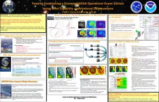
NOAA operational ocean modeling. A joint NWS – NOS – IOOS enterprise. Ming Ji NOAA/NCEP/OPC Frank Aikman III NOAA/NOS/CSDL Hendrik L. Tolman NOAA/NCEP/EMC. Background. 2004 Science Advisory Board and NOAA response A three-level system

E N D
NOAA operational ocean modeling A joint NWS – NOS – IOOS enterprise Ming Ji NOAA/NCEP/OPC Frank Aikman III NOAA/NOS/CSDL Hendrik L. Tolman NOAA/NCEP/EMC
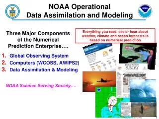
Background • 2004 Science Advisory Board and NOAA response • A three-level system • Global and basin scale operational Backbone Capability at NCEP (partnership with Navy) • On NOAA operational super computers • Coastal Operational Ocean Backbone Capability at NOS, integrated with NCEP effort • Transitioning to NOAA operational super computers • Operational localmodeling at IOOS Regional Associations • RA Operational modeling to adhere to NOAA standards
History • Louis Uccellini and Ming Ji at previous MARACOOS meeting (Fall 2012)
Strategic Approach in Ocean Modeling • Strategic alignment with Navy on Global Ocean model development • Strategic alignment with NOS on coastal model development • Strategic partnership with the IOOS community • Linking backbone to local modeling for applications/services • Standardization, realtime coastal/marine/biological data flow • Community modeling and O2R • Engage private sector through IOOS RAs for a broad range of local service delivery
From the whiteboard … • There are already many models in place, but particularly the interaction with the IOOS RAs still needs to be worked out in many details.
NCEP • Real Time Ocean Forecast System (RTOFS) • Based on community HYCOM model. • Strong collaboration with Navy. • Adopting existing 1/12° model from NRL (NOPP). • GFS forcing (including diurnal cycle). • Timeline: • Operational 10/25/2011 with NRL/NAVOCEANO (NCODA) initialization (daily feed from NAVO). • FY2014-15: full initialization at NCEP. • Developing agreement with NRL on NCODA.
RTOFS • Presently five major efforts: • Eddy resolving ocean modeling. • Eddy resolving ocean initialization. • Coupled modeling for hurricanes. • Coupled modeling for weather – CFS / NEMS. • Episodic tracers (with shelf life) • All RTOFS models presently based on HYCOM • RTOFS represents line of products. RTOFS-Atlantic Operational 2005 Operational 10/25/2011 RTOFS-Global Live testing RTOFS-HWRF Under development RTOFS-NEMS Operational 07/24/2012 RTOFS-ET-Pac
NCEP • Future RTOFS (2015-2018) Summary • Global model at 1/12 degree resolution • Regional models for Arctic, North Atlantic, East Pacific and possibly West Pacific at 3km nominal resolution (based on NCEP user requirements) • Intend to go to ensemble based systems by 2018 depending on computer resources (particularly for ice) • Full coupling (Atmos-Ocean-Wave-Ice) particularly in ice zones
IOOS • Partnership withIOOS at NWS & NOS • Data standardization and management through IOOS: • RTOFS models available in NetCDF on NOMADS • This was a major change driven by IOOS requirements • Critical Partner for real time coastal/marine/biological data flow • Providing requirements for RTOFS • E.g., resolution, accuracy, … • NOS collaboration with the IOOS modeling community • Develop, agree & adhere to community standards • Includes frameworks, data flow, products • Effectively leveraging Testbeds (e.g. IOOS COMT)
Summary • The 3-level framework from SAB review • Strategic partnerships are essential elements • Navy, NOS, IOOS community • NOAA-IOOS RAs paradigm toward service delivery
Issues/challenges for discussion • R2O-O2R: Connecting Backbone to local models • Define operations • How to run models (CONOPS) • How to exchange data and information • E.g., Standards • Coordinate operations and service delivery • E.g., the Weather Enterprise
NOS • Operational Forecast Systems (OFS) for the Coastal and Estuarine Environment in NOAA’s National Ocean Service (NOS) OUTLINE The state of NOS’s Operational Forecast Systems • Requirements and geographic coverage • CBOFS, NGOFS and ESTOFS examples • OFS products & dissemination • The Coastal Ocean Modeling Framework (COMF) • Objective:More efficient R&D, O&M • Challenges and Applications • Collaboration with the IOOS Ocean Modeling Community • Coupled Model Systems
SST Salinity NOS • NOS Marine Modeling Requirements • Develop a national network of operational hydrodynamic models providing nowcasts and short-term • (0 – 48 hr.) forecasts for: • Support of safe & efficient navigation • Water levels for under-keel clearance • Currents for right-of-way, maneuverability • Emergency response • HAZMAT • Search & Rescue • Homeland Security • Environmentally sound management of the coastal zone • Ecosystem applications • Marine geospatial applications
Chesapeake Bay Operational Forecast System (CBOFS) CBOFS (3-D) Operational 04/11 Currents Temp Salt CBOFS (2-D) Operational 08/01
Northern Gulf of Mexico Operational Forecast System (NGOFS) NGOFS is the first NOS OFS to extend the model domain to US shelf waters to fill gaps between global/basin models and coastal/estuarine models. NGOFS covers 6 NOS PORTS
Atlantic Extratropical Surge and Tide Operational Forecast System (ESTOFS) http://www.opc.ncep.noaa.gov/ estofs/estofs_surge_info.shtml • Computes surge with tides for forecasting and for coupling to WAVEWATCH III® • Applies ADCIRC model • 254,565 nodes • Coastal resolution ≈ 3 km • Depth-averaged barotropic • 6-hr nowcast followed by 180-hr forecast • Pacific model in development http://slosh.nws.noaa.gov/etsurge_ESTOFS/
NOS Coastal Operational Forecast System Products Graphics on CO-OPS Web Site • Time Series Plots (24 hour nowcast and 48 forecast) of water levels, currents, temperature, salinity, and surface winds at selected locations • Contour and vector map plots and animation of water levels, currents, temperature, salinity, and surface winds Model data sets on NOAA’s WOC and CO-OPS Thredds Server • Station/point netCDF files (6-minute output): • Time series at selected stations • Gridded model output netCDF files (hourly output) Model visualization via nowCOAST GIS-Based Web Mapping Portal (WMS) Users value usefulness, accessibility, reliability • Outputs used by USCG, NOS/OR&R, ASA, etc. in real-time • Web products used daily by coastal managers, maritime navigation and emergency response communities. • Reliability and timely delivery of products are most important.
Individual Model systems NOS Coastal Ocean Modeling Framework(COMF) OPERATIONAL MODELS (NOAA’s HPC) REAL-TIME DATA INGEST QA/QC (COMF) • Data Tank on WCOSS: • Atmospheric Forcing • Coastal Boundary Conditions • Riverine Fresh Water Inputs Products and archives Linux Server in CO-OPS FORECAST MODEL GUIDANCE (water level, water temp, currents, & salinity) PRODUCTS (web pages and digital pt. & gridded data) FOR USERS tidesandcurrents.noaa.gov QA/QC (CORMS) 24 x 7
NOAA/NOS Coastal Modeling Challenges Continued Collaboration with the IOOS Ocean Modeling Community • Develop, agree & adhere to community standards • (e.g. frameworks; data flow; products) • Testbeds • (e.g. the IOOS COMT) Coupled Model Systems • Riverine-estuarine-regional/coastal-basin; • Hydrodynamic-wave; hydrodynamic-sediment transport • Physical-biogeochemical coupling (e.g. ecological; water quality; habitat) Forecast uncertainty estimation • Probabilistic approach/Ensemble averaging Coastal data assimilation techniques • HF Radar; coastal altimetry; IOOS data; etc.