Download
1 / 1
10 likes | 132 Views
Dr. Christopher M. (“Kit”) Hayden. radiative transfer - retrieval algorithm (VAS, GOES-8) - meteorological objective analysis - keyboard adjuster. [ retired ]. Frederick W. Nagle. HIRS data processing - satellite navigation - computational math efficiency - Kalman filtering.

E N D
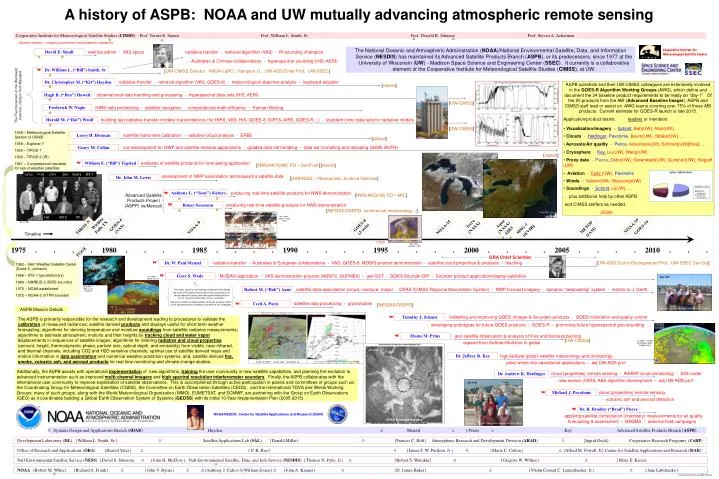
Dr. Christopher M. (“Kit”) Hayden radiative transfer - retrieval algorithm (VAS, GOES-8) - meteorological objective analysis - keyboard adjuster [retired] Frederick W. Nagle HIRS data processing - satellite navigation - computational math efficiency - Kalman filtering Leroy H. Herman satellite instrument calibration - radiative cloud analysis - ERBE [retired] Geary M. Callan s/w development for NWP and satellite retrieval applications - gridded data set handling - data set formatting and decoding (GRIB, BUFR) The views, opinions, and findings contained in this display are those of the author and should not be construed as an official National Oceanic and Atmospheric Administration or U.S. Government position, policy, or decision. satellite data processing - grad studies Cecil A. Paris [NESDIS/OSDPD] Any errors remain my responsibility; while any progress noted, is only possible by the cooperation and effort of my colleagues. Timothy J. Schmit validating and improving GOES (Imager & Sounder) products - GOES calibration and quality control May 2008 - developing prototypes for future GOES products - GOES-R - promoting future hyperspectral geo-sounding Elaine M. Prins geo satellite observation & analysis of fires and biomass burning [UW-CIMSS] - expand from SoAmer/NoAmer to global [left>right: Jeff, Brad, Andy, Mike, Bob, Tim, Gary] Dr. Jeffrey R. Key high-latitude (polar) satellite meteorology and climatology - polar winds into operational applications - adj UW-AOS prof Michael J. Pavolonis cloud (properties) remote sensing - volcanic ash and aerosol detection Cooperative Institute for Meteorological Satellite Studies (CIMSS) Prof. Verner E. Suomi Prof. William L. Smith, Sr Prof. Donald R. Johnson Prof. Steven A. Ackerman (Suomi’s dream – coupling government and academic research) A history of ASPB: NOAA and UW mutually advancing atmospheric remote sensing The National Oceanic and Atmospheric Administration (NOAA)/National Environmental Satellite, Data, and Information Service (NESDIS) has maintained its Advanced Satellite Products Branch (ASPB), or its predecessors, since 1977 at the University of Wisconsin (UW) - Madison Space Science and Engineering Center (SSEC). It currently is a collaborative element of the Cooperative Institute for Meteorological Satellite Studies (CIMSS), at UW. Cooperative Institute for Meteorological Satellite Studies David E. Small new lab admin - VAS specs radiative transfer - retrieval algorithm (VAS) - IR sounding champion - Australian & Chinese collaborations - hyperspectral sounding (HIS, AERI) Dr. William L. (“Bill”) Smith, Sr W [UW-CIMSS Director; NASA-LaRC; Hampton U.; UW-AOS Emer Prof; UW-SSEC] • ASPB scientists and their UW-CIMSS colleagues are extensively involved in the GOES-R Algorithm Working Groups (AWG), which define and document the 34 baseline product requirements to be ready on “day-1”. Of the 25 products from the ABI (Advanced Baseline Imager), ASPB and CIMSS staff lead or assist on AWG teams covering over 75% of those ABI products. Current estimate for GOES-R launch is late 2015. • Application/product teams: leaders or members • Visualization/Imagery - Schmit, Bah(UW), Rink(UW), … • Clouds - Heidinger, Pavolonis, Baum(UW), Straka(UW), … • Aerosols/Air quality - Pierce, Ackerman(UW), Schmidt(UW)[fires], … • Cryosphere - Key,Liu(UW), Wang(UW) • Proxy data - Pierce, Oktin(UW), Greenwald(UW), Gunshor(UW), Sieglaff (UW) • Aviation - Feltz (UW), Pavolonis • Winds - Velden(UW), Wanzong(UW) • Soundings - Schmit, Li(UW), … • … plus additional help by other ASPB • and CIMSS staffers as needed. • (2009) The Five Horsemen of the (Retrieval) Inversion, riding in from Maryland Hugh B. (“Ben”) Howell observational data handling and processing - hyperspectral data sets (HIS, AERI) Hi RES ? Spectra [UW-CIMSS] Harold M. (“Hal”) Woolf building fast radiative transfer models/ transmittances (for HIRS, VAS, HIS, GOES-8, GIFTS, AIRS, GOES-R…) - standard climo data sets for radiative models [UW-CIMSS] 1958 – Meteorological Satellite Section of USWB 1959 – Explorer-7 1960 – TIROS-1 1960 – TIROS-2 (IR) 1961 – Congressional mandate for ops of weather satellites [retired] William E. (“Bill”) Togstad analyses of satellite products for forecasting application W [NWS/MPX(MN) FO – SenFcstr] [retired] Leroy Fred John Ben Geary Bill T development of NWP assimilation techniques for satellite data Dr. John M. Lewis [OAR/NSSL – Researcher, Science historian] Anthony L. (“Tony”) Siebers producing real-time satellite products for NWS demonstration W Advanced Satellite Products Project (ASPP) (w/Menzel) [NWS/AKQ(VA) FO – MIC] Roney Sorenson producing real-time satellite products for NWS demonstration W 10 Apr 2003 - Terra [NESDIS/OSDPD; commercial meteorology…] 13 Oct 2003 - Terra Hal Bill S Kit Mar 1988 – SSM/I & VAS TPW Wichita Falls TX Terra (NASA) Aqua (NASA) circa 1981 GOES-4 (VAS) GOES-8 (3-axis) NOAA-19 TIROS-N NOAA-15 METOP GOES-14 NOAA-9 MSG-1 AIRS SEVIRI (IASI) Timeline {VES} Mar 1995 – GOES-8 LI DPI 1975 . . . . 1980 . . . . 1985 . . . . 1990 . . . . 1995 . . . . 2000 . . . . 2005 . . . . 2010 . . . FGGE ORA Chief Scientist Dr. W. Paul Menzel radiative transfer - Australian & European collaborations - VAS, GOES-8, MODIS product demonstration - satellite cloud properties & analyses - teaching [UW-AOS Suomi Distinguished Prof, UW-SSEC Sen Sci] W 1963 – Nat’l Weather Satellite Center (David S. Johnson) 1966 – ATS-1 (geostationary) 1969 – NIMBUS-3 (SIRS sounder) 1970 – NOAA established 1972 – NOAA-2 (VTPR sounder) Gary S. Wade McIDAS application - VAS demonstration projects (NSSFC, GUFMEX) - geo SST - GOES Sounder DPI - Sounder product application/display/validation W Oct 1980 – GOES-4 VAS May 1979 – SMS-2 and TIROS-N Robert M. (“Bob”) Aune satellite data assimilation (cloud, moisture, mass) - CRAS (CIMSS Regional Assimilation System) - NWP forecast imagery - dynamic “nearcasting” system - mentor to J. Gerth W ASPB Mission Details W The ASPB is primarily responsible for the research and development leading to procedures to validate the calibration of measured radiances; satellite derived products and displays useful for short term weather forecasting; algorithms for deriving temperature and moisture soundings from satellite radiance measurements; algorithms to estimate atmospheric motions and their heights by tracking cloud and water vapor displacements in sequences of satellite images; algorithms for inferring radiative and cloud properties(amount, height, thermodynamic phase, particle size, optical depth, and emissivity) from visible, near-infrared, and thermal channels, including CO2 and H2O sensitive channels; optimal use of satellite derived mass and motion information in data assimilation and numerical weather prediction systems; and, satellite derived fire, smoke, volcanic ash, and aerosol products for real time monitoring and climate change studies. W Jan 2009 – AVHRR cloud optical depth (Google Earth) Oct 2009 NOAA-18 AVHRR - 23 Mar 2009 - Mt Redoubt, AK Additionally, the ASPB assists with operational implementation of new algorithms, training the user community in new satellite capabilities, and planning the evolution to advanced instrumentation such as improved multi-channel imagers and high spectral resolution interferometer sounders. Finally, the ASPB collaborates with the international user community to improve exploitation of satellite observations. This is accomplished through active participation in panels and committees of groups such as: the Coordinating Group for Meteorological Satellites (CGMS), the Committee on Earth Observation Satellites (CEOS), and the International TOVS and Winds Working Groups; many of such groups, along with the World Meteorological Organization (WMO), EUMETSAT, and ECMWF, are partnering with the Group on Earth Observations (GEO) as it coordinates building a Global Earth Observation System of Systems (GEOSS) with its initial 10-Year Implementation Plan (2005-2015). cloud (properties) remote sensing - AVHRR cloud climatology - SOI model Dr. Andrew K. Heidinger - new sensor (VIIRS, ABI) algorithm development - adj UW-AOS prof July 2001 W Dr. R. Bradley (“Brad”) Pierce W NOAA/NESDIS Center for Satellite Applications and Research (StAR) applying satellite composition (chemistry) measurements for air quality CRAS forecast imagery [back>front left>right: forecasting & assessment - RAQMS - airborne field campaigns Jeff, Geary, Paul, Elaine, Bob, Tim, Gary] Systems Design and Applications Branch (SDAB) Hayden Menzel ( Prins) Key Advanced Satellite Products Branch (ASPB) Development Laboratory (DL) {William L. Smith, Sr.} Satellite Applications Lab (SAL) {Donald Miller} {Frances C. Holt} Atmospheric Research and Development Division (ARAD) {Ingrid Guch} Cooperative Research Programs (CoRP) Office of Research and Applications (ORA) {Harold Yates} { P. K. Rao} {James F. W. Purdom, Jr } {Marie C. Colton} {Alfred M. Powell, Jr} Center for Satellite Applications and Research (StAR) Natl Environmental Satellite Service (NESS) {David S. Johnson} {John H. McElroy} Natl Environmental Satellite, Data, and Info Service (NESDIS) {Thomas N. Pyke, Jr} {Robert S. Winokur} {Gregory W. Withee} {Mary E. Kicza} NOAA {Robert M. White} {Richard A. Frank} {John V. Byrne} {Anthony J. Calio} {William Evans} {John A. Knauss} {D. James Baker} {VAdm Conrad C. Lautenbacher, Jr} {Jane Lubchenko} [ NOAAatUW-benefits-gsw20091124.ppt ]