Download
1 / 93
1.21k likes | 1.74k Views
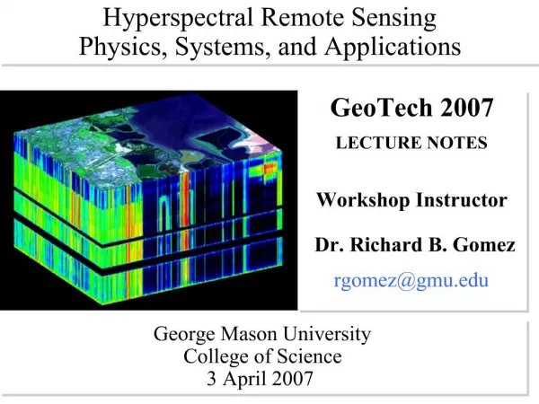
Hyperspectral Remote Sensing. Workshop Instructor: Dr. Ronald G. Resmini rresmini@mitre.org and rresmini@gmu.edu. ASPRS/Potomac Region’s GeoTech 2013. Keck Center, National Academies, Washington, DC 10 December 2013. Dr. Ronald G. Resmini The MITRE Corporation and

E N D
Hyperspectral Remote Sensing Workshop Instructor: Dr. Ronald G. Resmini rresmini@mitre.org and rresmini@gmu.edu ASPRS/Potomac Region’s GeoTech 2013 Keck Center, National Academies, Washington, DC 10 December 2013
Dr. Ronald G. Resmini The MITRE Corporation and George Mason University Please call me Ron v: 703-470-3022 rresmini@mitre.org and rresmini@gmu.edu http://mason.gmu.edu/~rresmini/
What sort of remote sensing system acquired this image? Is it a panchromatic visible? multispectral? hyperspectral? panchromatic infrared? polarimetric? SAR? How can you tell?
Introduction to Hyperspectral Imagery (HSI) Remote Sensing and to ENVI®
Introduction to Hyperspectral Imagery (HSI) Remote Sensing HSI is, fundamentally: SPECTROSCOPY writ large...the phenomenology of spectra; remote material detection, identification, characterization and quantification
HSI Remote Sensing: Frame of Reference... • Remote sensing of the earth • airborne • spaceborne • ground (portables) • But bear in mind other apps: • medical • industrial • many, many others
Applications of HSI RS • Geology • Forestry • Agriculture • Mapping/land use, land cover analysis • Atmospheric analysis • Environmental monitoring • Littoral zone RS • Many, many others
Where/how do we do HSI remote sensing? • What is the nature of what is measured? • What is there to measure? • How is it done? • Are there distinguishing observables? • etc...
Reflected Energy Emitted Energy MWIR SWIR NIR B G R LWIR LWIR Wavelength (nm) (m) 5000 5.0 14000 14.0 700 0.7 1500 1.5 400 0.4 3000 3.0 Electromagnetic EnergyElectromagnetic Spectrum Electromagnetic Spectrum V / NIR / SWIR / MWIR / LWIR Optical Region Shorter Wavelengths High Energy Longer Wavelengths Low Energy X Rays Cosmic Rays Microwaves (Radar) Radio & Television Waves Gamma Rays UV Wavelength(nm) 108 109 101 1010 1011 10-2 10-1 105 106 107 1012 10-5 10-4 10-3 10 400 14000
Check-out the fancy lingo used in the field HSI Sensors Measure Radiance
Reflected vs. Emitted Energy MWIR 104 1000 Earth Reflectance (100%) Earth Emission (100%) 100 Irradiance (W-m-2-um-1) radiant exitance (W-m-2-um-1) 10 Assumes no atmosphere 1 .4 0.1 .7 1 5 7 10 3 Wavelength (µm)
MWIR LWIR NIR SWIR B R G 0.4 mm 0.4 mm 0.4 mm 0.4 mm 0.4 mm 1.5 1.5 1.5 1.5 1.5 3.0 3.0 3.0 3.0 3.0 5.0 5.0 5.0 5.0 5.0 14.0 mm 14.0 mm 14.0 mm 14.0 mm 14.0 mm 0.7 0.7 0.7 0.7 0.7 Panchromatic or single b&w image A normal color-composite image Multispectral: tens of broad bands – tens of images Hyperspectral: hundreds of narrow bands – hundreds of images Sampling Function
So...what sort of remote sensing system acquired this image?
Interaction of energy and objects Emitted Energy MW-LWIR Reflected Energy V-MWIR Incident Energy Absorbed Energy Transmitted Energy Energy Balance Equation:EI () = ER() + EA() + ET()
Levels of Spectral Information Quantification:Determines the abundance of materials. Characterization: Determines variability of identified material (e.g. wet/dry sand, soil particle size effects). Identification:Determines the unique identity of the foregoing generic categories (i.e. material identification). Discrimination:Determines generic categories of the foregoing classes. Classification:Separates materials into spectrally similar groups. Detection:Determines the presence of materials, objects, activities, or events. High Spectral Resolution Hyperspectral (100’s of bands) Multispectral (10’s of bands) Panchromatic Low Spectral Resolution
Image from the NASA Langley Research Center, Atmospheric Sciences Division. http://asd-www.larc.nasa.gov/erbe/ASDerbe.html
Reflectance:Is the ratio of reflected energy to incident energy. Varies with wavelength Function of the molecular properties of the material. Reflectance Signature:A plot of the reflectance of a material as a function of wavelength. Red brick Kaolinite Sandy loam Concrete Grass Reflected Energy All solids and liquids have reflectance signatures that potentially can be used to identify them.
Blackbody – A theoretical material that absorbs and radiates 100% of the energy incident upon it. BB curve is a function of temperature and wavelength. Planck’s Law – gives shape of blackbody curve at a specific temperature. Wien’s Displacement Law– determines wavelength of peak emittance. Peak Emittance 6000K Sun 373K Boiling Water 1500K Hot Coals 3000K Light Bulb Spectral Radiant Emittance 800K 500K 250K 300K Ambient 0.2 0.4 0.7 1 2 3 5 8 10 30 Wavelength (µm) Emissive EnergyBasic Concepts
Units: The Planck or Blackbody Radiation Equation:
Emissivity -is a measure of how efficiently an object radiates energy compared to a blackbody at the same temperature. Varies with wavelength Function of the molecular properties of the material. Emissivity Signature - A plot of emissivity as a function of wavelength. All materials have emissivity signatures that potentially can be used to identify them. Blackbody 1.0 Graybody 0.5 Emissivity Red brickKaolinite Grass Water Black paint Concrete Selective emitter (emissivity signature) 0 Wavelength Emissive Energy
Spectral Signature Libraries • Spectral signatures of thousands of materials (solid, liquid, gas) have been measured in the laboratory and gathered into “libraries”. • Library signatures are used as the basis for identification of materials in HSI data.
Understanding Spectral Data: Signature Variability Factors • Composition • original • change over time • Surface quality • roughness • weathering • Shade & Shadow • Temperature • Brightness • BRDF • Target morphology • shape • orientation • Particle size • Moisture • Spectral mixing
The manner in which a material reflects energy is primarily a function of the optical properties and surface roughness of the feature. Most objects are diffuse reflectors Reflected Energy Angle of Incidence = Angle of Reflectance Energy Scattered in All Directions Smooth Surface Rough Surface (Microscopic) Specular Reflectance Diffuse Reflectance
Emission Absorption No Detection Detected Signature Wavelength Wavelength Wavelength Gas Plume Gas (Cool) Gas (Warm) Same Temperature Background (Cool) Background (Warm) Background Emissive EnergyIdentification of Gases Gases appear in either emission or absorption depending on the temperature contrast between the gas and the background.
Resolutions • Spatial Resolution • Radiometric Resolution • Temporal Resolution
Hyperspectral remote sensing involves measuring energy in the Visible – LWIR portions of the electromagnetic spectrum. Some of the measured energy is reflected from objects while some energy is emitted from objects. Every material has a unique spectral signature. Spectral image data are collected such that signatures can be extracted for material detection,classification, identification, characterization, and quantification. Spectral, spatial, radiometric, andtemporal resolution determine the capabilities of the remote sensing sensor/system. HSI Fundamentals Summary
Properties of the Data Cube • # of samples, lines, bands • Headers, preline, postline, footers, etc. • Data type • Interleaving (BIP, BIL, BSQ) • Byte order • Wavelengths, FWHM • Bad bands list • Band names (very optional) • The logical and physical data cube • The ENVI “.hdr” file • History file (it doesn’t exist) – keep notes!
There’s More to Know... • What you need to know about your data; a check-list: • Date, time, location, ground elevation, platform elevation,heading, GSD, be able to calculate where the sun is;i.e., all RS angles (geometry) • On-going sensor characterization; know what it is; ask for it! • Spatial sampling; spatial resolution • Spectral sampling; SRF; spectral resolution • NESR, NEDr, NEDe, NEDT • Issues: smile, keystone, FPA misregistration, vibration,parallax, scattered light, self-emission, platformmotion/imaging distortions, etc.
A couple of slides on SNR, NESR Reconstituted Reflectance High SNR spectra
Information Content and Extraction • HSI RS is based on the measurement of a physical quantityas a function of wavelength: its spectroscopy • HSI is based on discerning/measuring the interaction oflight (photons, waves) with matter • The sun is the source; or active systems; or very hot objects • Earth RS scenarios involve the atmosphere • There are complex interactions in the atmosphere • There are complex interactions between light and targetsof interest in a scene • There are complex interactions between light, targets ofinterest, and the atmosphere • There’s a lot (lots!) of information in the spectra
DN Calibration Fixes/Corrections Data Ingest Look At/Inspect the Data!! Atmospheric Compensation Algorithms for Information Extraction The General Data Analysis/Exploitation Flow Spectral Library Access Information Fusion Iteration Geometric/Geospatial Product/Report Generation Distribution Archive/Dissemination Planning for Additional Collections
HSI Remote Sensing: Frame of Reference... • A Scientist’s Approach to the Data: • look at the data(!) • observables have a physical,chemical, biological, etc. basis • must understand nature of observables • bumps and wiggles have real,physical (spectroscopic) significance • application of tools comes last!
Some HSI Systems NASA Hyperion: http://edcsns17.cr.usgs.gov/eo1/sensors/hyperion NASA AVIRIS: http://aviris.jpl.nasa.gov/ NASA AIRS: http://www-airs.jpl.nasa.gov/ ProSpecTIR and SEBASS: http://www.spectir.com/airbornesurveys.html Probe-1: http://www.earthsearch.com/index.php?sp=10 AHI: http://www.higp.hawaii.edu/~lucey/hyperspectralpaul.html AISA: http://www.channelsystems.ca/SpectralImaging-AISA.cfm NRL HICO: http://www.nrl.navy.mil/pao/pressRelease.php?Y=2009&R=90-09r
Defining HSI Dimensionality • Hundreds of bands of data in an HSI data cube • An HSI pixel (a spectrum) is an n-D vector • n = number of bands • a spectrum is a point in an n-D space • “Redundancy” of information • Embedding or spanning dimension • Intrinsic dimension/virtual dimension • A distinction • large volume of data • dimensionality
HSI or MSI • 100’s of bands vs. 10’s of bands • Maybe all you need is 6 bands but... • you need six; and you need six; and so on • Atmospheric compensation... • HSI is spectroscopy writ large • its about resolving spectral information • fine spectral features • broad spectral features • Today’s FPAs make HSI a breeze anyway...
Multispectral - Hyperspectral Signature Comparison Multispectral Hyperspectral Resampled to Landsat TM7 Bands
SWIR NIR B G R Atmos. Comp. Minerals/Geology Iron oxides Fuels Aerosols O2 CO2 Chlorophyll Paints DOM/CDOM Cirrus Fabrics Vegetation Soils Plastics Bathymetry Wavelength (nm) (m) 700 0.70 1500 1.50 400 0.40 3000 3.00 Similar figures may be constructed for M/LWIR regions.
Thinking About Spectra; Thinking about HSI
Spectral parameterization • Albedo/brightness • Band depth • Band width • Band shape/superimposed features • Spectral slope • Spectral indices • Derivative spectroscopy • Wavelet transform • Combinations • Pre-processing transforms; e.g., SSA • All must have a physical basis! • Tie all observations to physical reality!! See next slide...
HSI Algorithms: An Introduction (Don’t Panic!!)
Algorithm types, classes, categories:an overview • Angular Metrics • SAM • Distance Metrics • w/, w/o statistics • Data transformations • PCA, MNF, ICA • SMA/OSP/CEM/SMF/ACE • Derivative Spectroscopy/other Parameterization Methods ~Proportional to Increasing Degree of Complexity Overview
SAM, MD (whole pixel matchers) SMA (subpixel mixtures) Orthogonal Subspace Projection JM Distance Spectral Matched Filter B Distance Variations of the Spectral Matched Filter An Algorithm Progression Spectral Parameterizations Traditional MSI Classification Methods Spectral Parameterizations Spectral Parameterizations