Download
1 / 18
180 likes | 283 Views
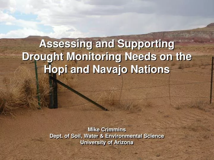
Assessing and Supporting Drought Monitoring Needs on the Hopi and Navajo Nations. Mike Crimmins Dept. of Soil, Water & Environmental Science University of Arizona. Acknowledgements. Clayton Honyumptewa Manager, Hopi Tribe Department of Natural Resources. Dan Ferguson

E N D
Assessing and Supporting Drought Monitoring Needs on the Hopi and Navajo Nations Mike Crimmins Dept. of Soil, Water & Environmental Science University of Arizona
Acknowledgements Clayton Honyumptewa Manager, Hopi Tribe Department of Natural Resources Dan Ferguson University of Arizona CLIMAS/Institute of the Environment Priscilla Pavatea Director Office of Range Management, Hopi Tribe Department of Natural Resources Alison Meadow University of Arizona SW Climate Science Center/ Institute of the Environment and many others from UA, Hopi DNR, Navajo WMB
Overview • NOAA-SARP/NIDIS funding (2010) to support drought monitoring and planning efforts for Hopi Tribe and Navajo Nation • Lingering impacts from 2002 drought and hard hitting ‘flash drought’ 2009 • Concerns over drought detection and response as well as planning at both Hopi and Navajo • 2010-2013: Interviews, focus groups, field visits, working meetings, and presentations • Need for synthesis and interpretation of existing climate information and monitoring products • Focus on existing capacity…local drought impact monitoring
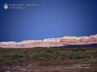
combined area of Hopi and Navajo reservations is ~ 32,000sq. mi or ~83,000 sq km It’s a really big place…
without much data… map courtesy of Zack Guido, University of Arizona
Rapid reversal - wet/dry years 80’s wet period Extended drought period highly variable climate,
Photo: Daniel Ferguson, U of AZ and livelihoods/land uses that are vulnerable to variability. Photo courtesy Hopi Dept. of Natural Resources
Climate/drought concerns • Impact of recent droughts on unique cultural and natural resources range conditions, water resources, dryland agriculture, ecosystems • Shifts in seasonality; snow vs. rain and impact on soil moisture status • Shifts in timing and intensity of precipitation events within seasons; dry spells • Warming temperatures Decision calendar from Hopi DNR Workshop
Reviewing, assessing, and synthesizing regional climate information
Regional Composite Daily Cumulative Precip Snow/water res Snow/water res wildfires dryland agriculture (growing seas) soil moisture recharge rangeland forage Regionally and sectorally specific drought monitoring strategies Winter storm season Spring dry season Summer monsoon season Fall transition season
Regional Composite Daily Cumulative Precip – 1956 vs. 2002 2002 Different ‘flavors’ of drought require new monitoring metrics Cut-off low event Sept 10-13th 1956 Long-term mean Record spring dry spell
Local Drought Impact Monitoring • large, complex landscape • not much quality hydro-meteorological data • highly variable climate Most important: the people who live here know how they are exposed to drought and know what drought looks like in this place.
Existing workforce regularly collecting environmental monitoring data Working to streamline monitoring to inform drought status reporting
available data with new metrics drought impacts obs + Better local characterization of drought
first cut at turning all this data into useful knowledge: Quarterly Four Corners Drought Update modeled on SWCO?
Next Steps • Assess community vulnerabilities to drought • Use results of vulnerability assessment to develop set of drought indicators • Identify data and info that can be used to monitor those indicators
Thanks! crimmins@email.arizona.edu http://cals.arizona.edu/climate