Download
1 / 18
190 likes | 388 Views
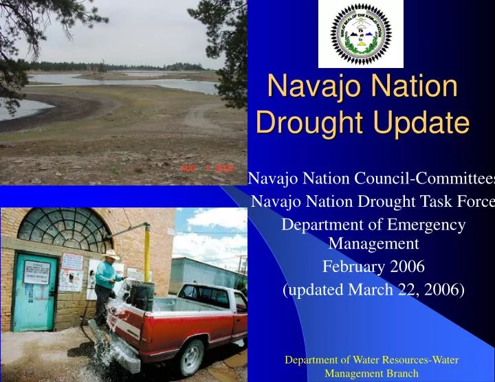
Navajo Nation Drought Update. Navajo Nation Council-Committees Navajo Nation Drought Task Force Department of Emergency Management February 2006 (updated March 22, 2006). Department of Water Resources-Water Management Branch. Drought. What is Drought?

E N D
Navajo Nation Drought Update Navajo Nation Council-Committees Navajo Nation Drought Task Force Department of Emergency Management February 2006 (updated March 22, 2006) Department of Water Resources-Water Management Branch
Drought What is Drought? Drought is commonly defined as a persistent and extended period below normal precipitation causing abnormal moisture deficiency having adverse effects on people, animals, and crops (Hawaii, 2000).
The impacts of drought very depending on the water use sector. Droughts can be define by meteorological, agricultural, hydrologic, or socioeconomic variables.
Latest Developments • CEM passed a resolution on March 8, 2006, re-affirming the Drought Declaration State of Emergency dated March 26, 2002. • CEM issued a Drought Emergency Warning on February 8, 2006. • January 2006: Precipitation for Navajo Nation is far below average. Chinle Agency is 55% of average; Eastern Agency is 40% of average; Ft. Defiance Agency is 48% of average; Shiprock Agency is 63% of average; Western Agency is 21% of average for January,2005 • March 15, 2006: Snowpack measurements are far less than average; for the Chuska Mountains, it is 38% of average.
U.S. Drought Monitor • Substantial precipitation finally fell on parts of the Southwest and the southern Rockies, though not nearly enough to pull water-year precipitation totals (since October 2005) to anywhere near normal levels. Many locations in southwestern California, central and east-central Arizona, north-central New Mexico, southwestern Colorado, and southwestern Utah reported over an inch of precipitation for the week, with 2 to locally 5 inches recorded at scattered sites, particularly in central Arizona and southwestern Colorado. This precipitation eliminated D0 conditions in part of southwestern Colorado and southwestern California, prompted improvement to D2 in a sizeable portion of central Arizona, and led to 1-category improvements for a few other small areas, including the southwestern Sierra Nevada. • Phoenix, AZ reported over an inch of precipitation during March 11 – 12, breaking their string of 143 consecutive days without measurable precipitation. Farther north, more than 29 inches of snow fell on Flagstaff, AZ during March 10 – 12. This was 10 times the total for the previous 160 days, yet seasonal snowfall totals increased only to 40 percent of normal. • As of March 14, the higher elevations from southern sections of Colorado and Utah southward through New Mexico and Arizona reported less than 75 percent of normal water-year-to-date precipitation, and under 60 percent of the typical snowpack water equivalent for mid-March, according to the Natural Resources Conservation Service. High elevation stations across Arizona and all but northernmost New Mexico have recorded just 30 to 50 percent of normal precipitation since October 1, 2005.Drought Impact Type: Agricultural Source: http://www.drought.unl/dm/monitor.html
U.S. Seasonal Drought OutlookNWS-Climate Prediction Center • An extremely dry winter has resulted in the development of moderate to extreme (D1-D3) drought across much of Arizona and New Mexico, as well as extreme southern Colorado. The drought was record breaking in some areas, such as Phoenix where no measurable rainfall was observed for 143 consecutive days. The dry, warm weather resulted in little if any snowpack across in the mountains. However, an early March storm brought relief to parts of the region and generated the first significant precipitation in several months. Additional drought relief is expected during the first few weeks of the outlook period. Despite the short term relief, the dry season is just around the corner and the region will not receive enough rain and snow to make up for the record dryness. Therefore, temporary short term relief will be followed by drought persistence. Source: http://www.cpc.ncep.noaa.gov/products/expert_assessment/seasonal_drought.html
6-Month Standardized Precipitation Index (SPI) • NE AZ: -2.58 Emergency stage • NW NM: -1.30 Warning stage • SE UT: -0.35 Alert stage Source: Western Regional Climate Center http://wrcc.dri.edu/cgi-bin/spiFmap.pl?spi06
Palmer Drought Severity Index • NE AZ: Moderate Drought conditions • NW NM: Near normal conditions • SE UT: Near normal conditions • Palmer: Slow to detect fast-emerging drought conditions Source: http://www.cpc.ncep.noaa.gov/products/analysis_monitoring/regional_monitoring/palmer.gif
NRCS National Water and Climate CenterMountain Snowpack and Streamflow forecast March 2006 Source: http://www.wcc.nrcs.usda.gov/cgibin/westsnow.pl
http://www.cpc.ncep.noaa.gov/products/predictions/multi_season/13_seasonal_outlooks/color/page2.gifhttp://www.cpc.ncep.noaa.gov/products/predictions/multi_season/13_seasonal_outlooks/color/page2.gif
Recent Precipitation Summary maps Source: http://www.hprcc.unl.edu/products/current.html
NOAA’s 2005-2006 Winter Outlook Source: http://www.noaanews.noaa.gov/stories2005/s2520.htm
Monthly Drought Status Report – March 2006 • Current drought: With less than average precipitation and above normal temperatures, expect drought conditions to persist. • NTUA: Still in a Stage Two: Drought Restrictions? • Below average precipitation: 55% for Chinle, 40% for Eastern, 48% for Fort Defiance, 63% for Shiprock, and 21% of average for Western Agency (January 2006). • What do we expect? Expect little or no improvements to forage, range conditions and stressed alluvial municipal-livestock water supplies. Drought conditions to set in as early as spring 2006.
CurrentActivities-DWR • On-going and intensifying Drought Monitoring activities • Drought vulnerability assessment for Navajo Nation public water systems and chapters. • USBR Emergency Drought Assistance, 2005; livestock waterline construction. • Continue Livestock well maintenance. • Contact with federal, state, county, and local entities & municipalities. • Attend Drought Task Force mtgs. (NN NM AZ)
REMEMBER…. • Promote water conservation for public water systems on alluvial sources. • Public outreach to all Navajo Chapters, water users, livestock owners, farmers, customers, etc… • Assessment of conditions across the Navajo Nation is essential • Prepare for emergencies, ie, Drought Contingency Plan • Public Awareness & Education • Navajo Nation Drought Contingency Plan 2003
Thank you Robert Kirk, Senior Hydrologist: robertkirk@navajo.org Chris Adams, Senior Hydrologist: chrisradams@navajo.org Teresa Showa, Principal Hydrologist; teresashowa@navajo.org Department of Water Resources Water Management Branch P.O. Box 678, Fort Defiance, AZ 86504 Phone: (928) 729-4004, FAX; (928) 729-4126 Questions ?? Navajo Nation Drought Contingency Plan 2003 Available at NN Records Management Department-(928) 871-6558 Price: Plan = $11.04 / copy