Download
1 / 14
140 likes | 271 Views
Accessing Drinking Water Data For GIS Aps -- Interim SOP to Ensure Data is Secure. EPA Spring GIS Workgroup Meeting March 26, 2004 Philadelphia, PA. 1. Objectives of Interim SOP.

E N D
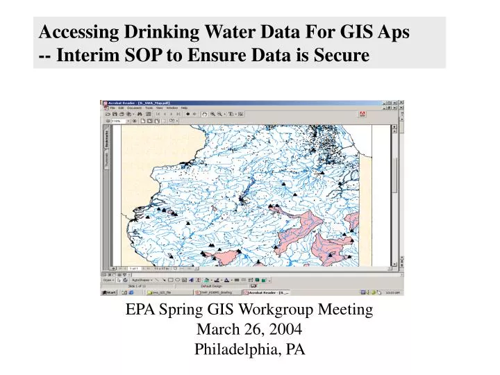
Accessing Drinking Water Data For GIS Aps -- Interim SOP to Ensure Data is Secure EPA Spring GIS Workgroup Meeting March 26, 2004 Philadelphia, PA
1. Objectives of Interim SOP • Provide to any and all Federal GIS customers a single source of high quality drinking water geospatial data managed on a national basis • Implement Interim Standard Operating Procedures (SOP) to assure data is accessed, stored, used, and updated consistent with EPA info security requirements
2. Drinking Water Geospatial Data OGWDW is maintaining drinking water location data sets in the Reach Address Database (RAD) in the WATERS instance on EPA’s Intranet Server • Intake locational data indexed to a unique surface water reach from the National Hydrography Dataset (NHD) in the RAD.Currently, 6,403 of 7,500 intakes have been indexed to NHD. • PWS source facility (I.e., wells, intakes) lat long point coordinates.Currently, 118,334 of 125,549 CWS source facilities have complete lat/long coordinates. (Also have TNCWS and NTNCWS source facility LL) • State Source Water Area (SWA) polygons.Currently, only 3 states are in the RAD, but this will shortly be updated to 17 States. Note: OGWDW also maintains drinking water locational tables in SDWIS/Fed
3. Process to Get Authorized by OGWDW as Primary Usera. Authorization by OGWDW: 1. Request to include: o Name, Ofc location, Telephone o Description of EPA GIS application and steps taken to restrict access to registered users only. o If data to be downloaded and stored, request to incl details about file name and server and security. 2. Review of request to ensure procedures are understood and followed. 3. Required to agree in writing to abide by the SOP. 4. Authorization granted to individual, not transferable. 5. File of all primary users and list of registered secondary users maintained in OGWDW.
3. Process to Get Authorized by OGWDW as Primary User(b) Data Access by Authorized Primary Users: 1. Authorization to access the raw data tables confirmed in e-mail back to the requestor. 2. Copy sent to Cary McElhinney from OST, who controls access to RAD. 3. For instructions to connect directly to the RAD tables, see: http://intranet.epa.gov/waters/data/radconnect.html
Data Handling Procedures[see 3/12 Interim Final SOP] Note: Only persons authorized by OGWDW are allowed access to the RAD drinking water data tables from the Intranet Server. To be authorized, primary users must agree in writing to abide by SOP: • Primary users access to raw RAD data tables • Special procedures for handling downloaded raw RAD data • Secondary users access to data through GIS applications • Public access is prohibited • Securing outputs of GIS applications • Representation of drinking water location data in public reports
SOP 1. Primary Users Access to Raw RAD Data Tables. • Primary users authorized by OGWDW will be given direct access to the raw drinking water RAD data tables • No one may be a primary user other than those listed as “authorized” by OGWDW. • Primary users authorized by OGWDW who are not EPA employees (i.e., other federal agency employees, federal contractors) must be coupled with an EPA primary user, since only EPA employees are able to directly connect to the RAD through EPA’s Intranet server. • Secure transfer of the RAD data tables from EPA’s intranet to secure servers of the non-EPA primary users is the responsibility of the specified EPA primary user.
SOP 2. Special Procedures for Handling Downloaded Raw RAD Data. • Where possible, primary users should connect to the RAD on the EPA Intranet each time they use the data in their GIS applications rather than download and store the raw data tables on their own server or diskette or CD. • Where downloading of data is necessary, primary users must demonstrate to OGWDW before authorization is granted that the downloaded data is secure. • Raw drinking water data tables may be stored on a user’s server or on removable media (e.g., floppy disks, CDS) as long as effective access restrictions are in place. Data may not be stored on an individual PC’s hard drive.
SOP 3. Secondary Users Access to Data Through GIS Applications. • Secondary users may gain access to geospatial representations of the data through secure GIS applications managed by the primary user. Potential secondary users include EPA employees, other federal agency employees, federal contractors, state staff (for their state data only), and PWS staff (for their PWS data only). • Secondary users must register with the primary user to gain access to the GIS application using the drinking water data. GIS applications cannot allow download of the raw drinking water data tables. • All registered secondary users of the GIS application are to receive an orientation on the sensitivity of the data and the security procedures they must follow. • The GIS application must reside on the EPA Intranet or on a secure server and be governed by an approved security plan restricting access to registered users only. • The GIS application and list of registered users will be submitted to OGWDW on a monthly basis.
SOP 4. Public Access is Prohibited. • Access to the raw data or use of the GIS applications other than by the authorized primary users and the registered secondary users (as defined above) is not permitted. • Public access as defined under FOIA is prohibited. • All requests for access to the raw data (or precise GIS representations) by the public under FOIA are to be forwarded to OGWDW for resolution. • EPA will restrict access to the data under FOIA exemption 6 or 9.
SOP 5. Securing Outputs of GIS Applications. • Storage and other dissemination of all electronic or paper outputs of the GIS applications displaying the sensitive drinking water data, including map screen captures and tabular data, must be labeled sensitive and handled according to the approved security plan handling highly sensitive data and the advice of the office’s information security officer.
SOP 6. Representation of Drinking Water Location Data in Public Reports. • Sensitive drinking water data included in published reports accessible to the public should be represented in a form that does not directly or indirectly identify the intake or well location or allow the point locations to be derived from the data or maps that are shown. • Generally, the NHD stream reach identified as having a drinking water intake and the delineated source water area around a well or intake can be included in a report as long as the precise well or intake location cannot be specifically derived from the data shown. • Before any decision is made on if and how to display the sensitive data in published reports, a primary user must consult with the designated OGWDW staff. Disagreements between OGWDW and the primary user on what is acceptable for public reports are to be resolved by the OGWDW Office Director.
Step 1: Initial discussion with State completed. 7 (MS, WV, MT, CO, KY,FL, SD) Step 4: SWA sent to State for validation, awaiting response 6 states (CT, RI, DC, MD,UT, WA) Step 2: SWA File received by OGWDW. 1 State and DC (MA, DC) Step 5: SWA data complete, pending alignment 14 states (ME, NH, NJ, NY,PA, VA, IL, MN,LA, MO,NE, CA,ID,OR Step 3: Preliminary pre-screening complete. 3 states (OH, NC, SC). Step 6: SWA data complete; ready for use, and info security SOP in place (0 states) Populating the Reach Address Database: (a) SWA Polygons – GIS Coverages for 24 States and DC, and Tentative Commitments from 7 other States, As of Dec 18, 2003 DC * NOTE: CA provided test data only