Download
1 / 30
300 likes | 304 Views
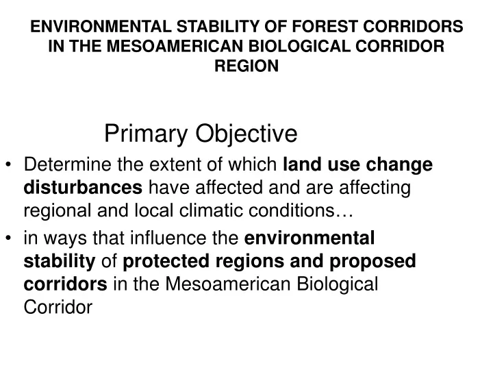
Primary Objective Determine the extent of which land use change disturbances have affected and are affecting regional and local climatic conditions… in ways that influence the environmental stability of protected regions and proposed corridors in the Mesoamerican Biological Corridor.

E N D
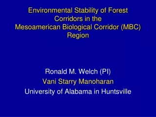
Primary Objective Determine the extent of which land use change disturbances have affected and are affecting regional and local climatic conditions… in ways that influence the environmental stability of protected regions and proposed corridors in the Mesoamerican Biological Corridor ENVIRONMENTAL STABILITY OF FOREST CORRIDORS IN THE MESOAMERICAN BIOLOGICAL CORRIDOR REGION
ContributorsUniversity of Alabama Huntsville Central American Land Use Changes and Climate Ronald Welch, PI Vani Starry Manoharan Robert Lawton Tom Sever Daniel Irwin Robert Griffin Modeling land use change and climate using GEMRAMS Udaysankar Nair Aaron Song Precipitation Procsses over forested and deforested regions John Mecikalski Wayne Mackenzie Todd Berendes Uganda Melanie Phillips Sara Simpson
MODIS Terra and Aqua data from 2000 to 2008 are being utilized to study the impact of land cover change on selected climate variables, primarily Normalized Difference Vegetation Index (NDVI), Land Surface Temperature (LST), Albedo, Soil Moisture (SLM), and Cloud Frequency (CF) of occurrence. • University of Maryland MODIS-derived Ecosystem product is being used with Holdridge Life Zone (HLZ) maps (Holdridge et al., 1965) to examine the various climate variables as a function of ecosystem type and HLZ type. • GOES08 and GOES12 imagery are used to study cumulus cloud frequency of occurrence and cloud convective initiation (using the thirty-minute cloud cooling rate from 1900 to 2000 UTC). • Mesoscale Modeling of Central America using GEMRAMS to study the regional climatic response to land use changes
Central America for March 2001-2008 and cloud top temperature variations. Table 1: Means +/- standard deviations for [MSOffice1] surface temperature, NDVI and soil moisture values as a function of ecosystem in the the month of March averaged over 2001-2008.
1a, 1b, 2, 3, 4, 5 Forested region ; 6a, 6b, 7 Deforested region ; 8, 9, 10 Partially forested region, 11 Bajo, + climatology rain gauge stations
San Pedro Mactun Flores 1a, 1b, 2, 3, 4, 5 Forested region ; 6a, 6b, 7 Deforested region ; 8, 9, 10 Partially forested region, 11 Bajo
3 6a 1a 11 1b 2 6b 8 4 9 10 5 7 7 1a, 1b, 2, 3, 4, 5 Forested region ; 6a, 6b, 7 Deforested region ; 8, 9, 10 Partially forested region, 11 Bajo
SURFACE TEMPERATUREForested: BlueDeforested: RedPartial: Yellow 2000 2008
SURFACE REFLECTIVITY 0.55 µMForests: BlueDeforested: RedPartial: Yellow 2000 2008
GEMRAMSImpact of deforestation on MBC • GEMRAMS: Regional Atmospheric Modeling System (RAMS) coupled with General Energy and Mass Transport Model (GEMTM) (Beltran and Pielke, Sr) • GEMRAMS simulates dynamic interactions between the atmosphere and growing canopy • Impact of deforestation in “protected” and proposed “corridor” regions • Use GEMRAMS to simulate the vegetation in the MBC areas for different scenarios of deforestation in the surroundings
INPUTS NARR Data RAMS USGS Topo MODIS Land use MODIS Land products LEAF2 GEMTM FAO Soil data NARR Soil moisture GEMRAMS • RAMS simulates mesoscale atmospheric processes • GEMTM computes daily gross photosynthesis, considering C3 and C4 photosynthesis • Available carbon pool is then allocated to stem, leaves, roots and reproductive organs
Modeling Deforestation Experiment • A set of 5 year-long runs with varying degrees of deforestation: 25%, 50%, 75%, 100%, and Control run (0%); • “deforestation” is defined as converting from the current landscape to “crop”;
GEMRAMS selected result • Model rainfall anomaly fields (%) showing: Protected areas (Peten) are largely undisturbed, even with various deforestation activities going on in un-protected areas;
GEMRAMS selected result • Accumulated model rainfall (mm) for the Forested (blue), de-forested (red) and partial-forested (black) areas, within the northern Guatemala (Peten region).
GEMRAMS: Cumulative Rainfall • Accumulated model rainfall (mm) averaged within the Corridors for the 5 runs: Control (dash); 25% (black), 50% (red), 75% (green), 100% (blue); • “deforestation”: within the un-protected areas only • Conversion from grassland to corn increases precipitation slightly
GEMRAMS: Guatemala - MarchTemperature (2m), Accumulative Precipitation, Sensible and Latent Heat FluxForests: BlueDeforested: Red Partial: Black
GEMRAMS: Guatemala SeptemberTemperature (2m), Accumulative Precipitation, Sensible and Latent Heat FluxForests: BlueDeforested: Red Partial: Black
Convection Study Goals and Directions 1) Is there a trend in the frequency of cumulus clouds within regions that became deforested between 1988 and 2008? 2) Does the frequency of occurrence of convective cloud types change between forested and deforested regions? 3) Using forested (unchanged) and deforested (unchanged) regions as baselines, plot cumulus cloud frequency as a function of time in regions that have become progressively deforested.
CUMULUS FREQUENCY OF OCCURRENCE: 1800 UTCMarch 2004 March 2007
a) b) c) d) e) f) Convective Cloud Mask MSG Convective Cloud Mask MODIS Convective Cloud Mask Visible Channel Berendes et al. (2008) • Algorithm to classify convective clouds according to type across a scene (see key to right of images). Operates on IR data in 4-8 channels. • Utilizes a multispectral and textural region clustering technique for classifying all scene types (land, water, stratus/fog, cumulus, cirrus) in a GOES/MSG image • Berendes et al. (2008) statistical clustering algorithm, for GOES & MSG
Convection Hypothesis • Regions that underwent deforestation possess a decreased frequency of low, warm water clouds, while possessing an stable frequency of tall, convective clouds. This has the effect of drying cloud forests, and delaying the onset of the rainy season, and the increasing the length of the dry season. Warmer (deforested) regions cause boundary layer depths to be higher, which may have an impact on the amount of rainfall in a region.
Collaboration with Dr. Nadine LaPorte for SE Africa. A very similar situation is found with protected regions and proposed corridors to connect them. Correlation coefficient between soil moisture and albedo for different Holdridge life zones in SE Africa
Conclusions • All deforested regions throughout Central America become progressively hotter and drier as they become deforested from forests to woodlands to grasslands. Latent heat fluxes are larger in forested regions in the dry season (March), but not in the wet season (September) • Cumulative precipitation tends to decrease in deforested regions, but with increased heights of large convective clouds • Large protected regions in the Peten of Guatemala are not affected by land use changes in the surrounding regions. Proposed Corridor regions are affected