Download
1 / 27
270 likes | 369 Views
Environmental Stability of Forest Corridors in the Mesoamerican Biological Corridor (MBC) Region. R. Welch University of Alabama – Huntsville V. S. Manoharan, U. S. Nair, R. Lawton, J.Mecikalski, A. Song, T. Sever, D. Irwin, R. Griffin, T. Berendes, D. Berendes, S. Asefi, D.K. Ray

E N D
Environmental Stability of Forest Corridors in the Mesoamerican Biological Corridor (MBC) Region R. Welch University of Alabama – Huntsville V. S. Manoharan, U. S. Nair, R. Lawton, J.Mecikalski, A. Song, T. Sever, D. Irwin, R. Griffin, T. Berendes, D. Berendes, S. Asefi, D.K. Ray First Year Results
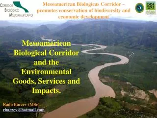
The proposed Mesoamerican Biological Corridor (MBC) is an ambitious effort to stem the erosion of biodiversity in one of the world’s biologically richest regions. The intent is to connect large existing parks and reserves with new protected areas by means of an extensive network of biological corridors within Mesoamerica/Central America to create an environment which provides better prospects for the long-term survival of native species while also addressing the region’s socioeconomic needs.
To what extent are land use change disturbances affecting the environmental stability of protected regions and corridors in the MBC? • Compared to forested habitats in the same life zone, dry season deforested habitats have: • higher daytime temperatures, • are less cloudy, • lower estimated soil moisture and • lower values of Normalized Difference Vegetation Index (NDVI). • The result is hotter and drier air over deforested regions, with lower values of cloud formation and precipitation.
Holdridge Life ZonesEach of the Life Zones is named so as to suggest a vegetation formation. Based on three climate parameters: • 1) Mean Annual Biotemperature; • Mean annual biotemperature is the sum of daily mean temperatures between 0° and 30°C divided by 365. Biotemperature defines the latitudinal or altitudinal belts of life zones. • 2) Annual Precipitation; • 3) Potential Evapotranspiration (PET) Ratio. • PET is a simple empirical linear function of biotemperature, and the PET-ratio is defined as PET divided by annual precipitation. The PET-ratio defines humidity provinces
HYPOTHESIS: Central American deforestation and land use change have altered regional and local climates in ways that influence the conservation utility of MBC core elements and corridors • Precipitation Records • Convective Initialization • GEMRAMS Model IF SO: Can we predict future local climatic conditions and the type of vegetation likely to exist in the altered landscapes?
Precipitation Questions • To what extent does dry season precipitation decrease due to land use disturbances? • Are some Life Zones and Ecosystems more sensitive to land use disturbances? • Are there important scales of deforestation which are important? E.g. ~ 1000 km2 • Do changes upwind impact the precipitation in protected regions?
30-Year Cumulus Cloud Analysis:MBC Region 1977-2007 Goal: Develop a 30-year analysis of dry-season (Feb, Mar, Apr) cumulus cloud frequency towards testing the hypothesis that end-of dry season cumulus clouds are decreasing in coverage, to imply a lengthening of the dry season over MBC regions. A trend of such nature would suggest increasing stress on native flora and fauna in these biologically sensitive regions of Central America. • GOES-8 and GOES-12 • (~1800-2100 UTC; Noon-2 pm Local Time) for eachFebruary, March and April, 1977-2007
Cloud Masking Procedure Visible (above) plus GOES IR channels 6.5, 10.7 and 13.3 m via Berendes et al. (2008) Standard Deviation Limited Adaptive Clustering algorithm.Example CCM (right). Berendes, T. A., J. R. Mecikalski, W. M. Mackenzie, Jr., K. M. Bedka, and U. S. Nair, 2008: Convective cloud identification and classification in daytime satellite imagery using standard deviation limited adaptive clustering. Submitted J. Geosphys. Res.
Cloud-Top Cooling Rate Example Roberts and Rutledge (2003) Cloud-top cooling rates >-4 C/15-min Are highly correlated with the first Occurrence of >35 dBZ rainfall echo at Ground within 1 hour. Defines “Convective Initiation”
Ongoing Work & Immediate Plans: • Develop correlation between cumulus cloud frequency and land-use, and especially with respect to the Life Zone regions. • Process GOES-8 and -12 data from 2007, 2002, 1997, 1992, 1987, 1982 and 1977 to assess if there is a significant signal of change in low-cloud frequency with respect to the Life Zone regions. • If a signal exists, process data from February-March-Aprilfor all years (77-07), for selected times of day (e.g., 20 UTC), to assess the trend in low-clouds. • By late 2008, develop methods for • Estimating if the cumulus that do exist • Grow to produce rainfall. • Use the algorithm of Roberts and • Rutldge (2003) to relate large cloud-top • Cooling rates for cumulus to convective • Initiation (>35 dBZ radar echoes). • Acquire GOES-7/-8/-12 10.7 m data • For estimating cloud-top cooling.
GEMRAMSImpact of deforestation on MBC • GEMRAMS: Regional Atmospheric Modeling System (RAMS) coupled with General Energy and Mass Transport Model (GEMTM) (Beltran and Pielke, Sr) • GEMRAMS simulates dynamic interactions between the atmosphere and growing canopy • Impact of deforestation in the areas surrounding MBC • Use GEMRAMS to simulate how the vegetation in the MBC areas for different scenarios of deforestation in the surroundings
INPUTS NARR Data RAMS USGS Topo MODIS Land use MODIS Land products LEAF2 GEMTM FAO Soil data NARR Soil moisture GEMRAMS • RAMS simulates mesoscale atmospheric processes • GEMTM computes daily gross photosynthesis considering C3 and C4 photosynthesis • Available carbon pool is then allocated to stem, leaves, roots and reproductive organs
Results from this study will be placed into SERVIRother than the Precipitation RecordsQuestions?