Download
1 / 9
90 likes | 103 Views
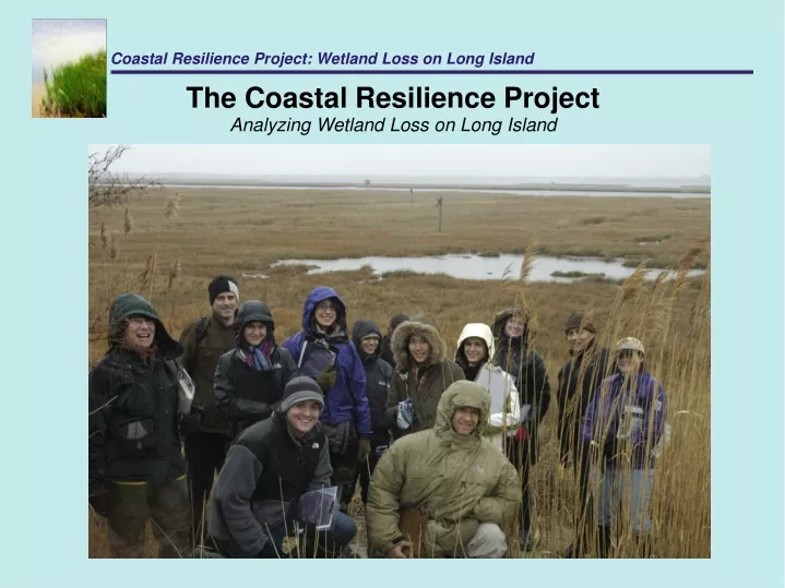
Coastal Resilience Project: Wetland Loss on Long Island. The Coastal Resilience Project Analyzing Wetland Loss on Long Island. Coastal Resilience Project: Wetland Loss on Long Island. The Coastal Resilience Project Analyzing Wetland Loss on Long Island.

E N D
Coastal Resilience Project: Wetland Loss on Long Island The Coastal Resilience Project Analyzing Wetland Loss on Long Island
Coastal Resilience Project: Wetland Loss on Long Island The Coastal Resilience Project Analyzing Wetland Loss on Long Island • This project is in conjunction with the first undergraduate sustainable development practicum at Columbia, led by Professor Stuart Gaffin in partnership with the Nature Conservancy and the Goddard Institute for Space Studies. • The core goals of this project are to: • Use GIS to create polygons that delineate the contemporary boundaries of the tidal wetlands on the South Shore of Long Island. • Conduct a trends analysis comparing 1974 and 2008 infrared aerial imagery that answers the question: how much marsh area has been lost since the 1974 inventory? • Use the results to create sea level rise models as a visualization tool for decision makers • In addition, the project seeks to gain a greater understanding of the broader drivers of wetlands loss, including dredging, ice scouring, watershed development, loss of inorganic matter, shoreline hardening, wind/wave action, and pollution.
Coastal Resilience Project: Wetland Loss on Long Island The Coastal Resilience Project Analyzing Wetland Loss on Long Island • To accomplish these goals, our class will: • Obtain and work with ortho-rectified 2008 images for the five specific areas of interest on Long Island • Draw polygons on 2008 maps, then categorize and classify these polygons in GIS • “Ground truth" these polygons through field trips on Long Island • Make adjustments/corrections to polygons in GIS • Geo-reference 1974 images to 2008 images. Time permitting, edit polygons on 1974 images in order to better compare types of wetland lost, and changes in marsh pannes, mosquito ditches, and channels. • Show changes visually and quantitatively. • Draw broader policy recommendations based on a thorough review of relevant literature and research on the topic.