Download
1 / 41
470 likes | 927 Views
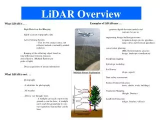
LiDAR. An emerging new technology for terrain analysis. LiDAR. LiDAR is an acronym for Li ght D etection A nd R anging. LiDAR. Lasers with timing systems that are able to measure distances with an accuracy of less than 5 centimeters.

E N D
LiDAR An emerging new technology for terrain analysis
LiDAR LiDAR is an acronym for Light Detection And Ranging.
LiDAR • Lasers with timing systems that are able to measure distances with an accuracy of less than 5 centimeters. • Pulse rate of LIDAR systems of up to 50,000 pulses per second • The light has enough time to travel from the sensor to the ground and back before the next pulse is sent. • A scanning mirror is used to direct the laser pulses back and forth across a wide swath underneath the path of the airplane. • The aircraft typically fly at an altitude of 700 meters, which allows elevation recording across a swath about 300 meters wide depending on the type of instrument used. A series of overlapping, parallel swaths are conducted so the entire study area is mapped. • The precise location of the laser sensor head and attitude of the aircraft must be accurately known in order to individually georeference each laser "hit". • LIDAR is actually the convergence of three technologies: Laser Rangefinding, GPS and INS (Inertial Navigations Systems), Use of LIDAR in Creating Accurate Terrain Elevation Models for Floodplain Mappinghttp://www.emporia.edu/earthsci/student/serr1/project.htm
Light Detection And Ranging • $200–$1000/mi2 • Economy of scale • Extensive filtering to remove tree canopy (first return data)
Boise Valley Study Area • Jointly funded by Natural Resources Conservation Service and Bureau of Reclamation • NRCS – Floodplain and terrace analysis for soil survey investigations • BoR – Rainfall/runoff and hydraulic study in 10 Mile and 15 Mile drainages • Need for higher quality data • 10 m or 30 m cells vs 2 m cells • 6 m vertical accuracy vs 15 cm vertical accuracy • Approximately 100,000 acres • Cost of about $50,000 • Flown in December 2003 • Data was available in 3 months
LiDAR PRODUCTS
Boise Valley LiDAR 1 foot contour showing direction of land leveling
Contrast of Two Technologies Ada County 2000 DEM LiDAR DEM 2003
Applications for Field Investigations • Low relief terrain analysis • Vegetation analyses • Structural identification • Pollution gradients (first uses of LiDAR) • Bathymetric analyses
Conclusions • Have technical staffs become informed • Investigate cooperative funding efforts • Purchase and test on applications
National Agriculture Imagery Program (NAIP) • Provide FSA with color digital imagery (Leaf-On) for annual compliance program • Provide USDA Service Centers with DOQ replacement on a five year or less time cycle
Program Purpose and End Products • FSA Compliance Program: • Two Meter Ortho-rectified Digital Imagery • GIS Orthoimagery Base Update: • One Meter Ortho-rectified Digital Imagery • Also used for FSA Compliance Program • Aerial Photography Film Archive: • Digital and Photographic products made from 1:40,000 scale, Color Positive Film at APFO
NAIP Program Goals • Procurement plan based on “Best-Value” contracting practices • Acquire large format aerial photography, 1:40,000 scale, color positive film • Acquire during the peak agricultural growing season (leaf-on) • Deliver digital imagery (one & two meter), in a county format, within one month of acquisition for FSA Compliance Program
NAIP Program Goals • Provide new photography/digital imagery on an annual basis • Update ortho-image base on 1-5 year cycle (depending on USDA Service Center needs) • Aerial film archived at APFO and made available for photographic products • Digital imagery furnished to the “National Map” concept in place of or to augment the NAPP/NDOP
NAIP Specifications NAIP 2 Meter: • Horizontal accuracy within +/- 30 meters • Does not meet the National Map Accuracy Standards • Up to 10 % cloud cover • Intended for aerial compliance to support crop identification • Horizontal accuracy supports accurate area measurements • Contractors required to supply 2 meter data within 60 days of imagery acquisition
NAIP Specifications NAIP 1 Meter Orthoimagery: • Horizontal accuracy within +/- 3 meters of reference orthoimagery (USGS-NDOP DOQ) for 90% of points measured • Meets the National Map Accuracy Standards • Up to 10% cloud cover • Intended for aerial compliance to support crop identification AND replacement orthoimagery for “Service Center Agency” offices
Canyon County, ID.CIR Image 2000 USGS-NDOP 1992-4 DOQ
Advantages of ADS40 Digital Sensor • Simultaneously Collection of Multiple Bands of Imagery • DOQQ (1 Meter, Quarter Quad) is Imaged in One Pass • Delivery Time for Imagery (Ortho) is Faster • Increased Accuracy through Integrated ABGPS and IMU