Download
1 / 30
300 likes | 505 Views
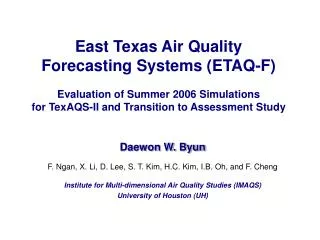
East Texas Air Quality Forecasting Systems (ETAQ-F) Evaluation of Summer 2006 Simulations for TexAQS-II and Transition to Assessment Study. Daewon W. Byun F. Ngan, X. Li, D. Lee, S. T. Kim, H.C. Kim, I.B. Oh, and F. Cheng Institute for Multi-dimensional Air Quality Studies (IMAQS)

E N D
East Texas Air Quality Forecasting Systems (ETAQ-F)Evaluation of Summer 2006 Simulationsfor TexAQS-II and Transition to Assessment Study Daewon W. Byun F. Ngan, X. Li, D. Lee, S. T. Kim, H.C. Kim, I.B. Oh, and F. Cheng Institute for Multi-dimensional Air Quality Studies (IMAQS) University of Houston (UH)
Multi CPU Single CPU Data Flow 2005/2006 UH AQF systems (F-1 & F-2) Download ETA Forecast F1=2000 imputed, Houston; F-2=2005 projected, E-Texas MM5 simulations (24 CPUs) 36 km domain 36 km domain 12 km domain 12 km domain 04 km domain 04 km domain st nd st nd st nd 1 day 2 day 1 day 2 day 1 day 2 day 1 CPU 1 CPU 1 CPU 1 CPU 1 CPU 1 CPU 54 hr forecasting simulation MCIP 36 km MCIP 36 km MCIP 12 km MCIP 12 km MCIP 04 km MCIP 04 km st nd st st st st 1 day 2 day 1 day 1 day 1 day 1 day SMOKE 36 km SMOKE 36 km SMOKE 12 km SMOKE 12 km SMOKE 04 km SMOKE 04 km st 1 day nd nd nd 2 day 1st day 2 day 1st day 2 day Post-Process Visualization Statistics Web Display 36 km domain 36 km domain st nd 1 day 2 day Batch mode operation with minimal intervention 12 km domain 12 km domain nd 2 day st 1 day 04 km domain 04 km domain nd 2 day st 1 day CMAQ simulations (36 CPUs)
Time series of regional daily max ozone June 2005 – May 2006
2006 June – 2006 Oct (TexAQS-II)UH (Univ. of Houston)AQF (Air Quality Forecasting) Systems Spatial Resolution 36 km : U.S. Continent 12 km : East Texas (2005) State of TX, LA, OK, AR, and MS (2006) 04 km : Houston and Galveston Area (F1) / HGA & DFW (F2 & F3) MM5 – 43 layers, CMAQ-23 layers Operation Period and Duration (May 2005 ~ Current) Spin-up : 6 hrs (0th day 18 CST – 0th day 23 CST) Forecasting : 46 hrs (1st day 00 CST – 2nd day 23 CST) Different Air Quality Forecasting Systems Forecast 1 (F1) : MM5 modified by UH + TEI imputed for 2000 + CMAQ v4.4 Forecast 2 (F2) : MM5 modified by UH + TEI imputed & projected for 2005 + CMAQ v4.4
Anthropogenic Emissions: for F1 (2005 & 2006) • TEI 2000 Base5b • TexAQS 2000 episode used for State Implementation Plan • The day of Week • Aug. 25th Friday, Aug. 26th Saturday, Aug. 27th Sunday, Aug. 30th Monday ~ Thursday • CB4, SAPRC99, and RADM2 • Area & Non-road: 2000 Emissions Inventory • NEI99 (Final version 3) • CONUS 36-km domain • Particulate matters and precursors (NH3, SO2) • Processor: SMOKE version 2.1 • Internal database: TCEQ’s (for spatial and temporal allocation) Default & TCEQ’s for chemical speciation
Anthropogenic Emissions for F2 (2006)Projected Texas EGU NOx emissionsafter State Implementation Plan (SIP) 2000 2005 2007 • 2007 emissions inventory were projected from 2000 EI with growth and control factors from TCEQ. • For HG NOx emissions for 2005, a factor of 1.747 was applied on 2007 EI based on the 2005/2007 MECT (Mass Emission Cap and Trade) allowances.
Anthropogenic Emissions: for F2 (2006) VOC emissions for imputation after SIP 2000 2007 • UH AQF system uses additional VOC emissions at the 2007 level.
MOBILE6 NOx emissions for 2000 and 2007 2000 2007 • The emissions amounts for each county, vehicle type, hour and species were determined for 2005 based on those for 2000 and 2007. • Then, the factor was applied on 2007 MOBILE6 emissions to get 2003 emissions.
ETAQF 2006 F1 & F2 Meteorology (F1 & F2 used UH MM5) * improved LULC * improved MRF for stable PBL and transition times (under development) * cloud; both the subgrid scale explicit scheme at 4-km * satellite observed sea surface temperature (in preparation for sensitivity testing) Emissions (F1 = 2000 SIP imputed TEI vs. F2 = 2005* projected) * 2005 TEI (projected from 2000 & 2007) * 2000 HRVOC (instead of 2005 projected) * Mobile projected for 2003 * satellite-observed fire events (in preparation) CMAQ (F1 = HGB 4-km vs. F2 = Extended 4-km (HGB + DFW) * with and w/o cloud attenuation * CB4 for forecasting and SAPRC99 for evaluation (on-going) * Better regional characterization at 12-km resolution What Configurations were used for ETAQ-F 2006?
June 2006 July 2006 rain missed August 2006 September 2006 Aug 19 - pcpn 9/14 upset event 8/23 rain missed
NOx daily mean time series for F1 & F2 Aug 23rd rain missed in AQF 2000 TEI “projected” 2005 TEI Started using projected emissions (July 17)
MM5 re-simulation Improving wind simulation is the most important factor for better AQM performance • FDDA is a proven technique to improve the meteorology reanalysis • Using IMAQS MM5-based Real-Time data assimilation framework, multiple observational datasets from Meteorological Assimilation Data Ingest System (MADIS) and CAMS met data. • A comprehensive surface obs. (SFC – from ASOS by NOAA/NWS) • Improved radiosonde observations (RAOB) • Aircraft sounding (ACARS) winds • Improved NOAA Profiler Network (NPN) data • Tested a variety of assimilation configurations to identify the best combination to arrive at “TMNS11” Start from 36km MM5 simulation using EDAS (to provide BC for nest domain) nest down to 12-kmMADIS & CAMS data to improve MM5 to improve
Data sets used for FDDA Pink dots: CAMS Black dots: MADIS SFC (not shown) Upper air data Profiler data Sounding data Aircraft data Satellite data Multi-step FDDA Grid Nudging 3 hourly – 12 km Hourly – 4km
Multi-Step FDDA with MM5 36km & 12km (3D nudging for u,v for everywhere, T & RH nudging in free atmosphere) 4-km domain grid & surface nudging for wind components only Multi-step FDDA 12-, 4-km domain Multi-step nest-down assimilation Grid Nudging 3 hourly – 12 km Hourly – 4km SFC nudging
8/15 8/16 front 80 ppb front 8/17 110 ppb H 140 ppb H 150 ppb 8/18 high O3 background 8/21 8/20 120 ppb 8/19 Rainfall at 9 – 11 CST 8/14 90 ppb 110 ppb 70 ppb Overview of weather patterns and O3 levels
Does the Assimilation Improve Met Simulations? 8/14 TMNS11 AQF 8/16
Does the Assimilation Improve Met Simulations? 8/17 TMNS11 AQF 8/18
CMAQ re-simulation summary • Better Met. Better Air Quality simulation? AQFn (F2 emissions) vs. TMNS11n • CMAQ re-simulation nickname & description 1) AQFn F1 MM5 fcst + F2 level AQF emission 2) TMNS11n TMNS11/MCIPn + F2 level AQF emission AQFn TMNS11n
August 16, 2006 AQFn vs TMNS11n : High O3 day - Met. changes in AQM changed O3 level & spatial distribution significantly - TMNS11 reproduced O3 conc. better than AQF
August 17, 2006 (1)AQFn vs TMNS11n : High O3 day
August 14, 2006 AQFn vs TMNS11n : Low O3 day - TMNS11 didn’t reproduce O3 conc. better than AQF
Evaluation of CMAQ Assessment Runs < TMNS11,c90,c91 > - Stats. : no big difference - high R,IOA(except 8/19) Mean Bias - low emiss. - bias - high emiss. + bias - all positive (except 8/19) - need further improvement
Summary • MM5 re-simulation results To improve Met simulation : several assimilation methods/data tested TMNS11 provides better met. - removal of some not observed T-storm development - reduction of WD bias - more realistic wind variations overall -but still unwanted flow patterns occurred : 8/18~19 • CMAQ re-simulation results - Assimilation provides better O3 level & spatial distributions more often - Not always improve met & air quality simulation results Careful evaluation with various data necessary for each day to find causes of discrepancy Acknowledgement: HARC, TCEQ, EPA, NASA • http://www.imaqs.uh.edu/