Download
1 / 12
200 likes | 619 Views
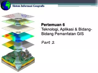
Sistem Informasi Geografis. Pertemuan 6 Teknologi , Aplikasi & Bidang-Bidang Pemanfatan GIS Part 2. GIS Technology.

E N D
SistemInformasiGeografis Pertemuan 6 Teknologi, Aplikasi & Bidang-BidangPemanfatan GIS Part 2
GIS Technology • SIG berbasis desktop berupapengolahan data spasialmenggunakan software SIG seperti ArcGIS atauArcView, danlainnya. SedangkanWeb Gisdan Mobile GIS adalahSIG yang berbasisprogramming.
Teknologi GIS (Geographic Information System) mengalamiperkembangan yang sangatpesat. Esensidari mobile GIS adalahmenunjukkanlokasimenggunakanpeta yang tersediadengan platform mobile device, seperti smartphone. Mobile GIS dimana GIS yang tadinyahanyadigunakan di dalamlingkungankantormenjadisemakinfleksibeldanmampudigunakan di luarkantorsecara mobile. Mobile GIS dapatdigunakanuntukmenangkap, menyimpan, update, manipulasi, analisadanmenampilkaninformasigeografisecaramudah. Mobile GIS
Mobile GIS mengintegrasikansalahsatuataulebihteknologiberikut: • PerangkatMobile • Global Positioning System (GPS) • Wireless communication untukmengaksesInternet GIS. • Biasanya proses mengumpulandan editing data menghabiskanbanyakwaktudanseringterjadikesalahan. Data geographic biasanyadiperolehdarilapanganmelaluilembaran-lembaranpeta. Proses editing dilakukansecara manual dengancaramemasukkannyakedalam database GIS. Hasilnya data menjaditidakup-to-date dantidakakurat Mobile GIS
Denganteknologi Mobile GIS memungkinkan GIS dapatlangsungdiimplementasikandi lapangansebagaipeta digital, mobile computer sehinggainformasidapat di tambahkansecarareal time kedatabasedanapplikasinya, mempercepatanalisis, display, danpengambilankeputusandengan data yang up-to-datedanakurat. Pemadamkebakaran, kepolisian, engineering, surveyor, tentara, pekerjasensus, biologist, danlainnyaadalahpengguna yang paling tepatbagi Mobile GIS. Mobile GIS
Location Based Services (LBS) are services that are distributed wirelessly and provide information relevant to the user’s current location. These services include such things as ‘find my nearest …’, directions, and various vehicle monitoring systems, such as the GM OnStar system amongst others. Location based services are generally run on mobile phones and PDAs, and are intended for use by the general public more than Mobile GIS systems which are geared towards commercial enterprise. Devices can be located by triangulation using the mobile phone network and/or GPS. Device limitations are similar to those for mobile GIS. In addition, any devices that are reliant on WAP will be limited by WAP functionality. Location Based Services (LBS)
Mymenoo | http://www.mymenoo.com/webmenoo/ SuperSurvOnline | http://www.supergeotek.com/products_mobilegis.aspx Streetdirectory | http://www.streetdirectory.com/pda/learn_more.php Mobile GIS Application (Sample) http://www.youtube.com/watch?v=e3o6t_uT7Fs#t=42
Tablets are fast becoming popular for Utility field use. Current high level Mobile GIS requirements can be characterised as: Mobile GIS (Plus & Minus)
Although not all applications of mobile GIS are limited by the device, many are. These limitations are more applicable to smaller devices such as cell phones and PDAs. Such devices have: • Small screens with a poor resolution • Limited memory and processing power • A poor (or no) keyboard • Short battery life • Additional limitations can be found in web client based tablet applications: • Poor web GUI and device integration • On-line reliance • Very limited off-line web client cache Device Limitations
Semuahalbisadipetakan, dankinipemetaanmenjadisalahsatutrenuntukmemvisualisasikansesuatu. • Bidangpolitikmisalnya, seringkalikitamelihathasilpemilu di tiapdaerahditunjukkandalambentukpeta. • Bidanggeologi, di beritatelevisiseringsekalikitaditunjukkandaerahrawangempadalambentukpeta. • BidangPertanahan, betapapetamenjadipoin yang paling pentingdalammenggambarkanbidangtanah. • Bidangkesehatan, berupapetapersebarandaerahrawanpenyakit agar penanggulangannyabisalebihefektifdantepatsasaran. • Bidangbiologi, berupaklasifikasitumbuh-tumbuhandalampenginderaanjauh. • Dan lain-lain BidangPemanfaatan GIS
Buatlahkelompokterdiridari 3-4 orang. Carilah 10 contoh Mobile GIS yang dikembangkanperusahaan. Telaahdanbahaspoin-poin yang disajikandalamaplikasitersebuttersebuttermasuktentang: • Analisistentang user danscopenya (jumlah user) • Deskripsittgfungsionalitasdanfitur-fitur Buatpresentasi (PPTX) hasilpembahasannya. Tugasdikumpulkan via E-mail empribadi@gmail.comdenganpenamaan file ‘mobile gis_kelompok_kelas.zip’. TugasKelompok
TerimaKasih Thank You Xiexie Arigato gozaimas Shukron