Download
1 / 22
230 likes | 563 Views
Geological Investigations Section. National Cooperative Geologic Mapping Program (NCGMP). STATEMAP - State geological survey projects (each federal dollar matched by state dollar) FEDMAP - USGS geologic mapping projects

E N D
National Cooperative Geologic Mapping Program (NCGMP) • STATEMAP - State geological survey projects (each federal dollar matched by state dollar) • FEDMAP - USGS geologic mapping projects • EDMAP - Training the next generation of geologic mappers through university grants • National Geologic Map Database - http://ngmdb.usgs.gov/ improves access to geologic maps on the Internet
1990 – Congress recognizes only 20% of U.S. has detailed geologic maps 1992 – Congress passes National Geologic Mapping Act 1994 – FGS STATEMAP Program Established 1995 – EDMAP is added as a component of the Program 1996 – Congress reauthorizes Act 1999 – Congress reauthorizes Act 2009 – Congress reauthorizes Act for ten years History of the National Cooperative Geologic Mapping Program and STATEMAP
STATEMAP • Objective – to establish the geologic framework of areas determined to be vital to the economic, social, environmental, or scientific welfare of States. • Project funding is awarded via a competitive grant process • Projects must be completed within one year of start date • FGS STATEMAP Projects begin September 1st each year • FGS STATEMAP Projects end August 31st of each year • FGS State Mapping AdivsoryComittee Meeting held in October of each year…
State Mapping AdvisoryCommittee (SMAC) • Required by NCGMP to meet annually in order to revise long-range (3-5 year) geologic mapping plan and prioritize order of proposed study areas for STATEMAP • Representatives include members from: FDEP, WMDs, USGS, Universities, FDOT, FAPG and various Private Consultants • DEP Programs/Projects which we receive input from include: • FAVA • Springs Initiative • DEAR (Status and Trend networks) • TMDL program
STATEMAP Review Panel* • AASG Representatives (State Geologists) • - Past President, 3 Regional reps., 1 At-Large representative. • Geologic Discipline Scientists • - Regional representatives. • *Florida has consistently ranked in top range of proposals nationwide (#5 in 2009)
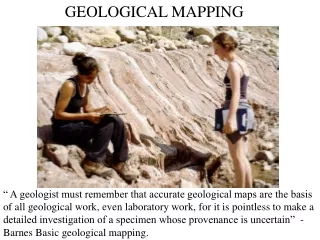
Components of STATEMAP projects: • Field mapping - (1:24,000 scale) several weeks each year • M-Series (outcrop) sample collection • Drilling new cores for cross-section control (Data Acquisition Section) • New formation picks for hundreds of wells made each year • River expeditions - (Coastal Section boats and captains often used for exploring outcrops along rivers in study areas) • All data (field, well picks, M-series, etc.,) is collated and interpreted in GIS framework and final map produced at 1:100,000 scale
Start with incorporating all existing data into a GIS project
Newly collected field data and new cores are incorporated into GIS project
Geology from Scott, et al., (2001) Geology from Green, et al., (2009)
Final Products produced for STATEMAP projects: • Open-File Report
Final Products produced for STATEMAP projects: • Geologic Map
Final Products produced for STATEMAP projects: • Geologic cross-sections
Final Products produced for STATEMAP projects: • Geomorphology Map
To date under STATEMAP Program: • 27% of State mapped • 242 7.5 minute (1:24,000 scale) quads mapped • 8.5 30’ x 60’ (1:100,000 scale) quads mapped • 15,342 Miles2 (39,376 Km2) mapped • 100 Cores and counting • 11,500’+ of new core added to archives • Over 1000 M-series samples collected (out of ~6000 total). • Average Cost/ Mile2 = $205* • Average Cost/Km2 = $79* (*includes State Matching Funds/Staff time)
Total funding to State Geological Surveys since 1993: $81,135,816* *Matched dollar for dollar by State funds
When a bullet goes through my paper map, I may be dead, but my subordinates still have the map. When a bullet goes through my laptop computer with the digital map, both the map and I are gone. (Unidentified Army General, 2000)