Download
1 / 24
250 likes | 474 Views
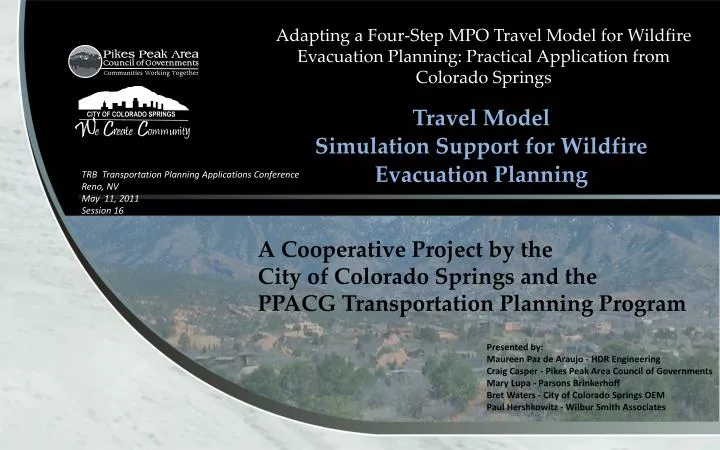
Adapting a Four-Step MPO Travel Model for Wildfire Evacuation Planning: Practical Application from Colorado Springs. Travel Model Simulation Support for Wildfire Evacuation Planning. TRB Transportation Planning Applications Conference Reno, NV May 11, 2011 Session 16 .

E N D
Adapting a Four-Step MPO Travel Model for Wildfire Evacuation Planning: Practical Application from Colorado Springs Travel Model Simulation Support for Wildfire Evacuation Planning TRB Transportation Planning Applications Conference Reno, NV May 11, 2011 Session 16 A Cooperative Project by the City of Colorado Springs and the PPACG Transportation Planning Program Presented by: Maureen Paz de Araujo - HDR Engineering Craig Casper - Pikes Peak Area Council of Governments Mary Lupa - Parsons Brinkerhoff Bret Waters - City of Colorado Springs OEM Paul Hershkowitz - Wilbur Smith Associates
Colorado Springs at Risk for Wildfires A Changing Trend in Wildlife Experience • In the past wildfire incidence primarily affected rural areas • Recent fires signal a change in this pattern. This change is the result of drought conditions that have produced extremely dry vegetation (fuel availability), placing Colorado’s urban areas increasingly at risk from wildfires. • June 2010 – Wildfire burned 700 acres in area 14 miles northwest of Canon City, just north-northeast of Royal Gorge Bridge/Park. The Park was evacuated. • March 2009 – A fire on Fort Carson (US Army) burned more than 6,500 acres. The fire jumped the Post’s eastern boundary, threatened buildings and forced evacuation of the area between Fort Carson and Interstate 25. • February 2009 – Two grass fires burned 131 acres south of Colorado Springs but did not threaten residential areas. • January 2009 – The Orchard Canyon burned 131 acres on Fort Carson, on the south side of Colorado Springs. • August 2008 – A wildfire near Fort Carson burned 100 acres before being contained. • Fall 2007 – Wildfire in Manitou Springs, just south of US 24 burned more than 80 acres. The fire threatened homes, closed roads and the Pikes Peak Cog Railway and forced evacuation of hikers on Barr Trail. With military foam retardant drops, the fire was contained before reaching more populated areas. • September 2002 - The Hayman fire burned over 138,000 acres. Extremely fast-moving, the largest wildfire in Colorado history fire burned 60,000 acres in its first day. Ultimately, the fire cause over $40 million in damages, burning 600 structures (including 133 homes) and forcing evacuation of 5,340 persons. Colorado Springs Area Wildfire Experience
Colorado Springs Office of Emergency Management Response Response Elements • Urban Interface Wildfire Evacuation Plan • Evacuation Traffic Control Plan(s) • Neighborhood Communication/Evacuation Plans • Colorado Springs Office of Emergency Management (OEM) led development of an Urban Interface Wildfire Evacuation Plan • Colorado Springs OEM and Fire Department support development of neighborhood-level Emergency Notification/Evacuation Plans by at-risk neighborhoods • PPACG recruited to support evacuation modeling and Traffic Control Plan development Key Partnerships
Evacuation Modeling Basis – Understanding the Problem Analysis Framework - Data Requirements
PPACG/Colorado Springs Modeling Strategy Use PPACG 4-Step Travel Model for Scenario-Level Analysis • Use PPACG TDM - 2010 Model Scenario used to represent existing conditions • Adapt PM Peak Hour time-of-day model • Use embedded hourly roadway capacity to evaluate “time-to-evacuate” ( modeled link volume to capacity (V/C) ratios) • Assume background, no-evacuation traffic at PM Peak Hour levels (worst-case, highest traffic volumes) • Assume all households at home – requires full evacuation of all households (worst-case, most vehicles to evacuate) • Use U.S Census auto ownership data to estimate household vehicles to be evacuated • Assume each household evacuates two (2) vehicles – adopted after sensitivity testing was performed for one (1) vehicle per household, two (2) vehicles per household and all household vehicles • Assume evacuee destinations to one of four types of destinations as follows (based on Boulder survey of actual evacuation experience): • Official Shelters (15%) • Other households in the area (60%) • Motels (15%) • Out of the County entirely (Denver area, Pueblo area or other – 10%) • Areas west of Colorado Springs (e.g. Teller County – high wildfire threat areas) excluded as destinations for evacuees Adapt PPACG Model for Evacuation Planning
Integrated Model Application and Screening Process STEP 1 STEP 2 STEP 3 STEP 4 STEP 5 Create Inter-Agency Steering Committee Establish Modeling & Evacuation Protocols Develop Modeling Process & Adapt Model • Conduct District-Level Screening Analysis • Identify “pinch points” • Establish traffic control • plan or advance area to Neighborhood-Level • screening Conduct additional Neighborhood-Level Screening Analysis • Conduct additional analysis of evacuation traffic control strategies: • Contra-flow operations • analysis • Travel restrictions • analysis (e.g. road • closures) • Prepare Traffic Control Plan for each of Eight (8) Colorado Springs Evacuation Districts plus Manitou Springs: • Prepare District-Level • traffic control plans for six (6) Districts and Manitou Springs • Prepare traffic control • plans for two (2) • Districts at the Neighborhood-Level
Step 1: Form Planning Team/Establish Modeling Protocols/Adapt Model Establish Technical Steering Committee • Consultant Project Team • PPACG Modeling Staff • Colorado Springs Office of Emergency Management • Colorado Springs Engineering – TOC • Colorado Springs Police Department • Colorado Springs Fire Department • Choice of background traffic conditions • Population/vehicles to be evacuated – restrictions/shared responsibilities • Evacuee destinations – “shelter-in-place,” official shelters, other • Contra-flow/ no contra-flow • Required “time-to-evacuate” • Restrictions on residents to retrieve belongings? • Other Establish Modeling/Evacuation Protocols
Step 2: Conduct District-Level Screening Analysis • Model / evaluate eight (8) • wildfire at-risk districts, • each incorporating multiple • emergency response • neighborhoods • Model “times-to-evacuate” • and screen for “pinch points” - • Use one-hour roadway capacity • as the reference criteria • Identify alternative routing • by district or select • districts to be advanced to more detailed neighborhood-level analysis
Step 3: Conduct Neighborhood-Level Screening Analysis • Model evacuation of selected • neighborhoods at risk for wildfire • Model “times-to-evacuate” • and screen neighborhoods relative • to one-hour roadway capacity reference • Identify neighborhood evacuation • “pinch-points” based on “times-to • evacuate” that exceed one hour • (based on one-hour V/C ratios > 1.0) • Identify alternative routing by • neighborhood and select neighborhoods • for additional operational analysis as • needed
Step 4: Conduct District/Neighborhood Traffic Control Strategy Analysis Conduct Indicated Detailed Operational Analysis • Contra-flow special operations analysis • Travel restriction – roadway closure analysis
Step 5: Develop Subarea Evacuation Traffic Control Plans Wildland Urban Interface – Woodman Area / Fire Evacuation Traffic Control Plan • Identify no-entry area • Identify egress route restrictions • Identify test contra-flow operations Fire Evacuation Area Sheet 4 Fire Evacuation Area Overview
Example Step 2: District-Level Screening District 1 District 1 is bounded by the U.S. Air Force Academy on the north, I-25 on the east, Garden of the Gods Road on the south and the foothills on the west. The estimated number of households in District 1 is 12,300. The east-west distance across District 1 is about 4 miles; the north-south distance across the district is also about 4 miles. Major portals for egress from District 1 are 30thStreet, Centennial Boulevard, Chestnut Street, Garden of the Gods Road, the Nevada-Rockrimmon at I-25 and Woodmen Road. I-25 will play a vital role in providing exit routes to evacuation traffic from District 1. District Characteristics Woodmen Rockrimmon Garden of the Gods 30th Centennial Chestnut
Fire Evacuation Model Study Year 2010 District 1 Evacuation Traffic Annotated with Volume to Capacity Ratio (V/C) Color Coded • Red links are over capacity with background and evacuation traffic • Green links have adequate capacity; gold links are near capacity with combined traffic • Annotated value is the is directional evacuation traffic volume only LEGEND Volume to Capacity Ratio > = 1 From 0.85 to 1 < = 0.85
Fire Evacuation Model Study Year 2010 District 1 Evacuation and Background Traffic (Hourly PM) with Volume to Capacity Ratio (V/C) Annotated • Red links are over capacity with background and evacuation traffic • Green links have adequate capacity; gold links are near capacity with combined traffic • Annotated value is the V/C ratio for the combined directional link traffic volume LEGEND Volume to Capacity Ratio > = 1 From 0.85 to 1 < = 0.85
Example Step 3: Neighborhood-Level Screening District 1-Neighborhood 2 Neighborhood 2, in District 1 is bordered by the US Air Force Academy on the north, I-25 on the east, Rockrimmon Boulevard on the south and the foothills on the west. The estimated number of households in Neighborhood 2 is 6,700. The east-west distance across Neighborhood 2 is about 4 miles; the north-south extent of the neighborhood is about 3 miles. Major portals for egress from the neighborhood are: Centennial Boulevard and the Rockrimmon Boulevard and Woodmen Road I-25 interchanges. I-25 will play a vital role in providing exit routes to neighborhood evacuation traffic. Neighborhood Characteristics Woodmen Road/ I-25 Interchange Centennial Boulevard at Vindicator Drive Rockrimmon Boulevard/ I-25 Interchange
Fire Evacuation Model Study Year 2010 District 1-Neighborhood 2 Evacuation Traffic Annotated with Volume to Capacity Ratio (V/C) Color Coded • Red links are over capacity with background and evacuation traffic • Green links have adequate capacity; gold links are near capacity • Annotated value is the is directional evacuation traffic volume only LEGEND Volume to Capacity Ratio > = 1 From 0.85 to 1 < = 0.85
Fire Evacuation Model Study Year 2010 District 1-Neighborhood 2 Evacuation and Background Traffic (Hourly PM) with Volume to Capacity Ratio (V/C) Annotated • Red links are over • capacity with background and evacuation traffic • Green links have adequate capacity; gold links are near capacity • Annotated value is the V/C ratio for the combined directional link traffic volume LEGEND Volume to Capacity Ratio > = 1 From 0.85 to 1 < = 0.85
Step 4: Traffic Control and Contra-flow Operations Analysis Traffic Operations Analysis Process Step 1: Review baseline modeling result to: 1) assess “time-to-evacuate” performance, 2) evaluate the role of background pass-through traffic in creating evacuation delay, 3) identify evacuation route restriction requirements, and 4) identify contra-flow operations opportunities. Step 2: Model baseline operational scenario with pass-through traffic prohibition and evacuation route restriction implemented. Step 3: Model contra-flow alternatives iteratively (optional). Step 4: Use micro-simulation to evaluate traffic operations performance (optional). Step 5: Prepare traffic control plan for final evacuation scenario.
Example: Contra-flow Options District 1-Neighborhood 2 • Refine modeled traffic control to eliminate any cut-through traffic • Identify remaining overburdened internal evacuation routes • Identify potential contra-flow routes • Iteratively test contra-flow options to achieve optimal result
Baseline Model Results District 1-Neighborhood 2 • Cut-through traffic is eliminated in the baseline • Overburdened routes and potential contra-flow routes are identified
Initial Contra-flow Results District 1-Neighborhood 2 • Iteration 1 contra-flow scenario results are examined as basis for developing the Iteration 2 contra-flow scenario
Contra-flow Option Results District 1-Neighborhood 2 • Iterative modeling of refined contra-flow alternatives is used to identify a final “best result” contra-flow scenario for inclusion in the Traffic Control Plan
District 1-Neighborhood 2 –Traffic Control Plan Overview Sheet Wildland Urban Interface – Woodman Area / Fire Evacuation Traffic Control Plan Colorado Springs Wildfire Evacuation Traffic Control Plan PPACG Travel Model Simulation Support A Cooperative Project by the City of Colorado Springs and PPACG Transportation Planning Program Colorado Springs, Colorado January 2011 Presented by: Pikes Peak Area Council of Governments Wilbur Smith Associates & HDR, Inc
District 1-Neighborhood 2 Traffic Control Plan – Sample Map Sheets Wildland Urban Interface – Woodmen Area / Fire Evacuation Traffic Control Plan