Download
1 / 53
530 likes | 738 Views
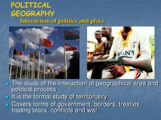
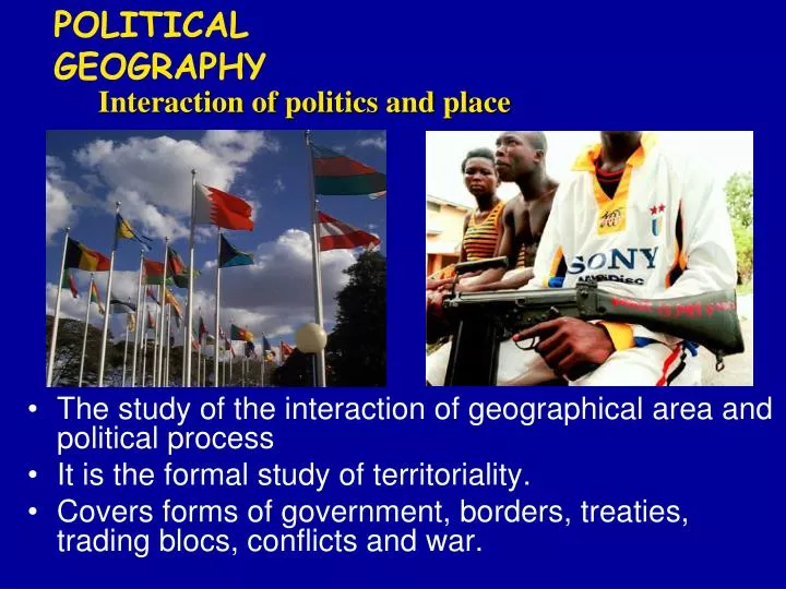
POLITICAL GEOGRAPHY. Interaction of politics and place . The study of the interaction of geographical area and political process It is the formal study of territoriality. Covers forms of government, borders, treaties, trading blocs, conflicts and war. STATE.

E N D
POLITICAL GEOGRAPHY Interaction of politics and place • The study of the interaction of geographical area and political process • It is the formal study of territoriality. • Covers forms of government, borders, treaties, trading blocs, conflicts and war.
STATE • A politically organized territory • Administered by a sovereign government • Recognized by a significant portion of the international community. A state must also contain: • a permanent resident population • an organized economy
■ State: “…an independent political unit occupying a defined, • permanently populated territory and having full sovereign • control over its internal and foreign affairs” • • Example: Bhutan, Saudi Arabia, United States, Laos • ■ State: Any of the political units forming a [federal] • University • government
■ Nation: “…a group of people with a common culture • occupying a particular territory, bound together by a strong • sense of unity arising from shared beliefs and customs” • • Examples: Cree nation, Kurdish nation
Defining States and Development of the State Concept • Problems of defining states • Korea: one state or two? • China and Taiwan: one state or two? • Western Sahara • Varying sizes of states • Development of the state concept • Ancient and medieval states • Colonies
NATION - STATE • A country whose population possesses a substantial degree of cultural homogeneity and unity. Classic Example of a Nation-State: Japan
Western Evolution: • • Ancient Greece‐ Republic. Mesopotamia‐ City state • • Roman‐ principalities • • Universal idea of the modern state developed by European • political philosophers in the 18th century • • European Nationalism • • Nation state‐ right to self governance without external • intervention
Forms of Government Source: Matthew White, 2003. http://users.erols.com/mwhite28/othergov.htm Adapted from FreedomHouse.org
Source: Matthew White, 2003. http://users.erols.com/mwhite28/othergov.htm Adapted from FreedomHouse.org
Source: Matthew White, 2003. http://users.erols.com/mwhite28/othergov.htm Adapted from FreedomHouse.org
Politics of Geography Effect of place on politics Example: Political Borders
U.S.- Canada boundary Alberta- Montana
U.S.- Mexico boundary Calexico, California- Mexicali, Mexico
GEOPOLITICS State’s power to control territory, shape international policy and other states’ foreign policy
East versus West: View of Communist “Red Bloc” during Cold War Lumping failed to recognize differences among Communists, or local causes of conflict
Enlargement of Soviet bloc after World War II Berlin Wall, 1961-89
European Boundary Changes Fig. 8-13: Twentieth-century boundary changes in Europe, 1914 to 2003. Germany’s boundaries changed after each world war and the collapse of the Soviet Union.
African colonies
International CooperationTreaties and Trading Blocs • Economic Treaties and Free Trade Agreements • Military Alliances • Supranational Agreements Map of NATO Countries
OPEC The Organization of the Petroleum Exporting Countries (OPEC) is a large group of countries[1][2] made up of Algeria, Angola, Indonesia, Iran, Iraq, Kuwait, Libya, Nigeria, Qatar, Saudi Arabia, the United Arab Emirates, Venezuela, and Ecuador (which rejoined OPEC in November 2007)
European Union Began as European Economic Community (EEC), 1957. Stronger in 1994 10 new members joined, 2004 Turkey and Romania want to join but have faced resistance.
United Nations Member States (192) The United Nations System is based on five active principal organs UN General Assembly UN Security Council UN Economic and Social Council UN Secretariat International Court of Justice Non-member States Taiwan (China) Vatican City Western Sahara (territory of Morocco) Palestinian Territories Tibet (China)
Sample United Nations Organizations UNDP - United Nations Development Programme UNIFEM - United Nations Development Fund for Women UNV - United Nations Volunteers UNEP - United Nations Environment Programme UNFPA - United Nations Fund for Population Activities UNHCR - Office of the United Nations High Commissioner for Refugees UN-HABITAT - United Nations Human Settlements Programme (UN-HABITAT) UNICEF - United Nations Children's Fund
Boundaries and Boundary Problems of States • Shapes of states • Five basic shapes • Landlocked states • Types of boundaries • Physical boundaries • Cultural boundaries • Boundaries inside states • Unitary and federal states • Trend toward federal government • Electoral geography
■ What is the ideal shape of a country? ■ As a rule, the more compact the territory the better ■ Theoretically, the most desirable shape for a country is round or hexagonal • Allow short communication lines • Minimizes amount of border to be defended • No country has this ideal degree of compactness • Some countries come close—France, Poland, Zaire, and Brazil
ELECTORAL GEOGRAPHY Political Geography of Elections Variation of voting districts and voting patterns
“Gerrymandering” Redistricting for partisan purposes
U.S. congressional delegation redistricting Reapportionment : allocating seats to a geographic area (normally done after every census)
Tom Delay’s District in Texas After Texas Republicans won a majority in 2002, they enacted redistricting legislation to protect their wins.
1860 Presidential Vote Led to Southern secession, Civil War
Davis (D) 48% Simon (R) 42% Camejo (G) 5% Copeland (L) 2%
205 229 1 I