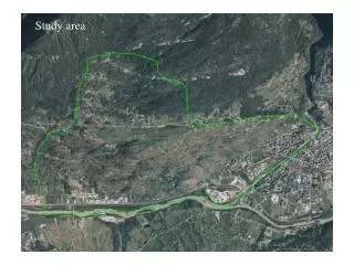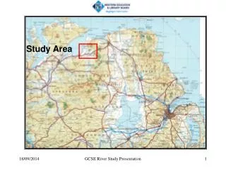
The study area
This study by Ward Sanford, Niel Plummer, Doug McAda, Laura Bexfield, and Scott Anderholm of USGS explores the calibration of a groundwater model in the Middle Rio Grande Basin using environmental tracers. Geologic, hydrologic, and geochemical data were integral to constructing and calibrating the model, revealing lower recharge rates than previously estimated. The research sheds light on spatial features in water table and geochemical zones.

The study area
E N D
Presentation Transcript
Using Environmental Tracers to Help Calibrate a Ground-Water Model ofThe Middle Rio Grande Basin The study area Ward Sanford and Niel Plummer USGS National Research Program, Reston, VA Doug McAda, Laura Bexfield & Scott Anderholm USGS Water Science Center, Albuquerque, NM
Information Used to Construct and Calibrate the Model • Geologic Information • Hydrologic Information • Geochemical Information • MODFLOW, MODPATH and UCODE
Geologic Studies were used to Develop the Model Geometry and Zonation Geologic model of the Middle Rio Grande Basin constrained by gravity data (Grauch)
Inner Valley Alluvium River Gravels Ceja Gravels Medium to Coarse Sand Layer 1 Layer 2 Silts Medium Sand Fine to Medium Sand Eolian Sand Volcanic Sand Piedmont Slope Deposits Volcanic Flows Volcanic Intrusions
Inner Valley Alluvium River Gravels Ceja Gravels Medium to Coarse Sand Layer 5 Layer 6 Silts Medium Sand Fine to Medium Sand Eolian Sand Volcanic Sand Piedmont Slope Deposits Volcanic Flows Volcanic Intrusions
Middle Rio-Grande Basin Water Table in 1960 N Albuquerque
Jemez Mountain-Front Recharge and Underflow Boundary Conditions Jemez River Western Basin Underflow Basin Underflow Rio Puerco Rio Grande Tijeras Arroyo Middle Rio-Grande Basin Boundary Eastern Mountain - Front Recharge Southwestern Basin Underflow Abo Arroyo Rio Salado
Deuterium Carbon-14 Middle Rio-Grande Basin Boundary pmC per mil 100 -120 80 -110 60 -100 -90 40 -80 -70 20 -60 0 -50
Local northwest recharge Northern MF Recharge Hagan basin underflow Jemez underflow Rio Puerco Rio Grande Eastern Mountain Front Ladron Peak Abo Arroyo Basin Discharge
Creating a “Trough” with Low Recharge Western Recharge Northwestern Recharge River Water Northeastern Recharge Eastern Recharge 40 km
Water Levels For Layer 2
Summary and Conclusions • Environmental Tracers are an important source of data to use in addition to geology and water levels to calibrate regional groundwater models • Recharge in the Middle Rio Grande Basin is much less than previously estimated, but was higher in the past. • The lower recharge rates can explain spatial features in both the water table and geochemical zones