Download
1 / 23
240 likes | 390 Views
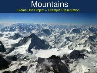
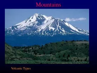
MOUNTAINS AT RISK. Both high elevation and high latitude systems have been identified as being at risk to a variety of anthropogenic materials added to the atmosphere. We believe that high elevation lakes and treeline may be the locations to expect the first negative impacts

E N D
MOUNTAINS AT RISK Both high elevation and high latitude systems have been identified as being at risk to a variety of anthropogenic materials added to the atmosphere. We believe that high elevation lakes and treeline may be the locations to expect the first negative impacts of these materials due to amplification effects of transport processes.
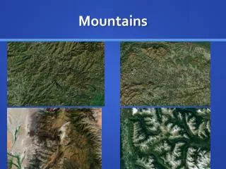
WHY MOUNTAINS ARE AT RISK The ability of natural terrestrial landscapes found adjacent to human dominated systems to persist in their present composition and functioning is a growing concern. This proximity causes modifications to microclimate and atmospheric inputs and alters natural disturbance regimes. Our research indicates that what may appear to be relatively small changes in environmental drivers can be amplified within ALPINE ecosystems due to the significance of transport processes in redistributing materials across the landscape.
Alpine areas: early warning indicators • Organisms on edge of environmental tolerance • Same processes as downstream forested and grassland ecosystems • Less capacity! Less “buffering” • Snow: moderates soil temperature, stores water and chemical, released at once
LANDSCAPE CONTINUUM MODEL (LCM) The LCM provides a conceptual framework required to understand high elevation systems from a biogeochemical perspective, and how these systems might change in response to directional change in precipitation and atmospheric chemistry. The model emphasizes landscape variation in the patterns of biogeochemical cycles, carbon fluxes, and NPP, and makes predictions about growth strategies and nutrient characteristics of plants
Arapahoe glacier above Boulder. High-elevation areas are characterized by having large areas covered by snow and rock. Materials transported from these areas supplement water and nutrients from precipitation to tundra, forest, streams and lakes.
Green Lakes 4 and 5. Niwot Ridge above them. These lakes are considered vulnerable to atmospheric pollution because of limited vegetation and soils, along with steep slopes.
Changes in ice thickness at Green Lake 4 over time. Ice thickness has decline while there has been no change in air temperature.
Nitrate concentrations and loading at Niwot Ridge as measured by the NAPD. Both concentrations and loading of nitrogen are increasing over time.
Export of nitrate in stream waters as a function of elevation and basin area. Average wetfall estimates are from the NADP site on Niwot Ridge.
LANDSCAPECONTINUUM MODEL
Landscape Continuum Characteristics • Mountains form a barrier to incoming air masses. Forced to rise, the air cools and triggers precipitation; thus, precipitation generally increases with increasing altitude • Colder temperatures at higher altitudes result in lower evapotranspiration rates so that the overall water balance in the mountains is positive and produces substantial accumulations of snow and runoff.
LCM Characteristics 2 • Increasing precipitation amounts result in increasing deposition of inorganic nitrogen, other nutrients, and a host of materials of human origin. • Precipitation as snow results in temporary storage of this water equivalent and any pollution this snow contains for 6-8 months. • During this period these materials are frequently redistributed across the landscape by winds.
LCM Characteristics 3 • Water and pollutants are then released during snowmelt runoff, which moves as a pulse through terrestrial and aquatic communities over a period of days to weeks. • Snowmelt over frozen soils results in water moving directly to aquatic systems without being processed on or within the soil. • The transfer of water, nutrients and particulates from the mountaintops downward makes this uppermost zone a ‘source area’ for these materials.
LCM Characteristics 4 • high elevation systems receive potentially large energy and nutrient subsidies from "upstream" sites. • exhibit zones where the ratios of production and decomposition vary. • mediate anthropogenic and natural environmental changes via biotic responses that both affect and are affected by transport processes.
HYPOTHESIS 1 Lakes within or below block fields and talus areas will receive the largest increases of nutrients per unit area of catchment (Figure 7). Net primary production (P) is believed to exceed in situ respiration (R), and these lakes will show the greatest changes in species composition and production of all high elevation ecosystems to increasing deposition of inorganic nitrogen.
HYPOTHESIS 2 Fellfield and dry meadow areas of alpine receive only a fraction of the precipitation and nutrients from atmospheric deposition that falls as snow in sheltered areas. These sites also lose a fraction of the organic matter and nutrients contained in plant litter to wind scour. Therefore, these dominant communities of the alpine landscape are not experiencing the magnitude of nutrient enrichment caused by anthropogenic changes to other portions of the landscape. These areas will exhibit less change in plant productivity and species composition through time than more mesic areas capable of retaining atmospheric inputs.
HYPOTHESIS 3 Treeline areas receive among the largest subsidies of snow and particulates and are beneficiaries of the losses from fellfields and dry meadows. These systems should already consist of vegetation adapted to high nutrient availability. Forest production of subalpine ecosystems should be maximized at treeline, and these sites would be the first terrestrial areas to experience characteristics of nitrogen saturation as described by Willliams and Tonnesson (2000).
LANDSCAPECONTINUUM MODEL