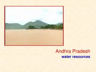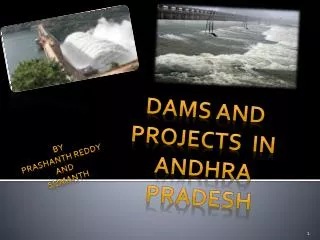
DAMS AND PROJECTS IN ANDHRA PRADESH
350 likes | 1.31k Views
DAMS AND PROJECTS IN ANDHRA PRADESH. BY PRASHANTH REDDY AND SUMANTH. Why do we build Dams?. Dams are important because they provide water for domestic, industry and irrigation purposes.

DAMS AND PROJECTS IN ANDHRA PRADESH
E N D
Presentation Transcript
DAMS AND PROJECTS IN ANDHRA PRADESH BY PRASHANTH REDDY AND SUMANTH
Why do we build Dams? • Dams are important because they provide water for domestic, industry and irrigation purposes. • Dams often also provide hydroelectric power production and river navigation. Domestic use includes everyday activities such as water for drinking, cooking, bathing, washing, and lawn and garden watering. • Dams and their reservoirs provide recreation areas for fishing and boating. They help people by reducing or preventing floods. • During times of excess water flow, dams store water in the reservoir; then they release water during times of low flow, when natural flows are inadequate to meet water demand. • When engineers design and maintain dams, they consider all these purposes
Before going to the discussion on DAMS AND PROJECTS IN ANDHRA PRADESH Let us discuss about ENGINEERS DAY in india. • Engineer's Day is observed in India on September 15 in honour of Sir Mokshagundam Visvesvaraya who was born on the day in 1860. • He was the chief designer of the flood protection system designed and built for the city of Hyderabad, as well as the chief engineer responsible for the construction of the Krishna Raja Sagara dam in Mysore which created the largest reservoir in Asia at that time. • He also designed and patented a system of automatic weir water floodgates that were first installed in 1903 at the Khadakvasla Reservoir near Pune
These gates were employed to raise the flood supply level of storage in the reservoir to the highest level likely to be attained by a flood without causing any damage to the dam. • Based on the success of these gates, the same system was replicated at the Tigra Dam project in Gwalior and the Krishna Raja Sagara project in Karnataka. • Not only these he had constructed many dams and reservoirs , on behalf of his service to india . engineer’s day was celebrated.
DAMS AND PROJECTS IN ANDHRA PRADESH List of dams and reservoirs in Andhra Pradesh 1.Dowleswaram Barrage on the Godavari River in the East Godavari district. 2. Penna Reservoir on the penna river in nellore dist 3.Joorala Reservoir on the Krishna River in Mahbubnagar district 4.Nagarjuna Sagar Dam on the Krishna River in the Nalgonda and Guntur district 5.Osman Sagar Reservoir on the Musi River in Hyderabad 6.Nizam Sagar Reservoir on the Manjira River in the Nizamabad district 7.Prakasham Barrage on the Krishna River 8.Sriram Sagar Reservoir on the Godavari River between Adilabad and Nizamabad districts 9.Srisailam Dam on the Krishna River in Kurnool district 10.Rajolibanda Dam
11.Telugu Ganga 12.Polavaram Project on Godavari River 13.Koil Sagar, a Dam in Mahbubnagar district on Godavari river 14.Lower Manair Reservoir on the canal of Sriram Sagar Project (SRSP) in Karimnagar district 15.Himayath Sagar, reservoir in Hyderabad 16.Dindi Reservoir 17.Somasila in Mahbubnagar district 18.Kandaleru Dam 19.Gandipalem Reservoir 20.Tatipudi Reservoir 21.Icchampally Project on the river Godavari and an inter state project Andhra pradesh, Maharastra, Chattisghad 22.Pulichintala on the river Krishna in Nalgonda district 23.Ellammpalli 24.Singur Dam 25.Dummagudem 26.Sunkesula 27.Musi Reservoir
28.Pothireddypadu Reservoir near kund 29.Ramagundam Dam on the river Godavari in Karimnagar District 30.Pranahita Chevella on the river Godavari in Adilabad District 31.Jeri Dam 32.Brmham sagar 33.Polavaram Project 34.Handri-Neeva 35.Mylavaram Dam 36.PABR Dam 37.MPR Dam
THE MOST IMPORTANT AMONG THEM ARE : • SRI SAILAM DAM • NAGARJUNA SAGAR DAM • JURALA PROJECT • DOWALESWARAM BARRAGE • PRAKASAM BARRAGE
SRI SAILAM DAM • The Srisailam Dam is a dam constructed across the Krishna River at Srisailam in the Kurnool district in the state of Andhra Pradesh in India and is the 2nd largest capacityhydroelectric project in the country. • The dam was constructed in a deep gorge in the Nallamala Hills, 300 m (980 ft) above sea level. It is 512 m (1,680 ft) long, 145 m (476 ft) high and has12 radial crest gates. It has a reservoir of 800 km2 (310 sq mi). The left bank power station houses 6 × 150 MW reversible Francis-pump turbines (forpumped-storage) and the right bank contains 7 × 110 MW Francis-turbine generators.
Project history The Srisailam project began in 1960, initially as a power project, across the Krishna, near Srisailam in Andhra Pradesh. After several delays, the main dam was finally completed twenty years later in 1981. In the meantime the project was converted into a multipurpose facility with a generating capacity of 770 MW by its second stage which was expected to be completed in 1987. The dam is to provide water for an estimated 2,000 km2(770 sq mi) with its catchment area of 206,040 km2 (79,552 sq mi) and water spread of 1,595 km2 (616 sq mi). Under the right branch canal 790 km2(310 sq mi) in Kurnool and Kaddapa districts will have assured irrigation. From the initial modest estimate of Rs.384.7 million for a power project the total cost of the multipurpose project was estimated to cross Rs.10 billion in its enlarged form. The 143 m (469 ft) high and 512 m (1,680 ft) wide dam has alone cost Rs.4.04 billion together with the installation of four generating sets of 110 MW each. The right branch canal is estimated to costRs.4.49 billion and the initial investment of Rs.1.4 billion has been provided by the World Bank. The projected cost-benefit ratio of the project has been worked out at 1:1.91 at 10% interest on capital outlay. On 2 October 2009, Srisailam dam experienced a record inflow which threatened the dam.
Salient data • Catchment Area : 215000 km² (83012 sq mi) • Location of dam : Nalgonda(District) • Reservoir • Water spread area at FRL of dam : 285 km2 • Masonry dam • Spillway of dam : 471 m • Non-over flow dam : 979 m • Length of Masonry dam : 1450 m • Maximum height : 125 m • Earth dam • Total Length of Earth dam : 3414 m • Maximum height : 128 m • Power Generation • Power Units : 1 No. conventional (110 MW capacity), 7 no’s Reversible (100 MW capacity) • Canal Power House • Right side : 3 units 30 MW (each) • Left side : 2 units 30 MW (each)
The construction duration of the dam was between the years of 1955 and 1967. The dam created a water reservoir whose capacity is 11,472 million cubic meters. The dam is 490 ft (150 m). Tall and 1.6 km long with 26 gates which are 42 ft (13 m). Wide and 45 ft (14 m). Tall. • Nagarjuna Sagar was the earliest in the series of large infrastructure projects initiated for the Green Revolution in India; it also is one of the earliest multi-purpose irrigation and hydro-electric projects in India. The dam provides irrigation water to the Nalgonda District, Prakasam District, Khammam District, Krishna District and GunturDistrict and electric power to the national grid. • The proposal to construct a dam to use the excess waters of the Krishna river was sketched out by the British Engineers in 1903 on the supervision of Hyderabad Nizams. • The perseverance of the Raja of Muktyala paved way for the site identification, design and construction of the dam. Nagarjuna Sagar was the earliest in the series of "modern temples" taken up to usher in the India. • Project construction was officially inaugurated by Prime Minister Jawaharlal Nehru, on 10 December 1955, and proceeded for the next twelve years. • The reservoir water was released into the left and right bank canals by Prime Minister, Indira Gandhi in 1967. • Construction of the hydropower plant followed, with generation increasing between 1978 and 1985, as additional units came into service. The construction of the dam submerged an ancient Buddhist settlement, Nagarjuna konda, which was the capital of the Ikshvaku dynasty in the 1st and 2nd centuries, the successors of the Satavahanas in the Eastern Deccan
Excavations here had yielded 30 Buddhist monasteries The right canal (a.k.a. Jawahar canal) is 203 km long and irrigates 1.113 million acres (4,500 km²) of land. The left canal (a.k.a. Lalbahadur Shastri canal) is 295 km long and irrigates 0.32 million acres (800 km²) of land in Nalgonda and Khammam districts of Telangana region. • Thehydroelectric plant has a power generation capacity of 815.6 MW with 8 units (1x110 MW+7x100.8 MW). First unit was commissioned on 7 March 1978 and 8th unit on 24 December 1985. • The right canal plant has a power generation capacity of 90 MW with 3 units of 30 MW each. The left canal plant has a power generation capacity of 60 MW with 2 units of 30 MW each.
Dowleswaram Barrage: • The Dowleswaram Barrage (Telugu: ధవళేశ్వరం ఆనకట్ట) is an irrigation structure which is built on the last stretch of the Godavari River before it empties into the Bay of Bengal. • It was built by a British irrigation engineer, Sir Arthur Thomas Cotton. Cotton Museum is constructed on behalf of Sir Cotton's memory. It has been a tourist attraction in Rajahmundry. • The Godavari River empties its water into the Bay of Bengal after flowing a few miles from the Dowleswaram Barrage. Sir Arthur Thomas Cotton, a British irrigation engineer, constructed the Dowleswaram Barrage. • The village of Dowleshwaram is at a distance of eight kilometres downstream of Rajahmundry. The river is divided into two streams; the Gautami to the left and the Vasistha to the right, forms the dividing line between the West Godavari and the East Godavari districts. • The Dowleswaram Barrage is 15 feet high and 3.5 km wide. Its construction was completed in the 1850. Adjoining two mid-stream islands, the barrage is constructed in four sections. • The Godavari crossed the first warning level of 43 feet at Bhadrachalam on 21st august evening and poised to surpass the second warning level of 48 feet by 22nd august morning with all its tributaries in spate due to incessant rains in the upper reaches of the river.
The authorities sounded a flood alert and activated the official machinery to deal with any exigency. According to official sources, the flood level in Bhadrachalam was expected to rise steeply; it was likely to touch the third warning level of 53 feet if the heavy rains continued upstream. • Nearly 30 villages, including 25 in Wajedu mandal, remained cut off from the outside world as Cheekuvagu and Kongalavagu continued to flow over low-level causeways. Heavy rains wreaked havoc in R. Kothagudem village in Charla mandal where several huts collapsed under the impact of strong gales and heavy downpour. Dowleswaram barrage during floods
Prakasam Barrage • The impressive construction of Prakasam Barrage is 1223.5m long, Road Bridge and modern regulator that was built in the year 1957.This bridge is placed over the Krishna River. The panoramic lake of the Prakasam Barrage and the 3 canals gives Vijayawada an Italian feeling • . This idea of building a barrage over the Krishna River was escorted sometime in 1798.But the project saw light in the year 1839 and this Barrage was again revised in the year 1841. • The construction of this barrage was approved by the East India Company in the year 1850 and construction of the barrage was started in the year 1852 and was completed in the year 1855.Later it was reconstructed and named after the 1st chief minister of Andhra Pradesh Sri Tanguturi Prakasam. • The overall journey of the river is of 720km in the state of Andhra Pradesh. An evening walk by the barrage is the best way to rejuvenate you from the stress.
The serene breeze that comes from the sanctified waters of River Krishna • freshens up evening strollers and tourists. • The Buckingham Canal is a 421.55 kilometres (261.9 mi) long fresh water navigationcanal, running parallel to the Coromandel Coast ofSouth India from Vijayawada in Andhra Pradesh to Villupuram District in Tamil Nadu.
Thank you From PrasanthReddy and Sumanth