Download
1 / 1
10 likes | 92 Views
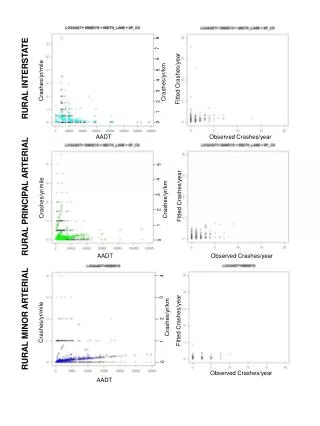
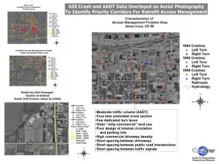
Use GIS technology to overlay crash and AADT data on aerial photography to identify retrofit access management priorities. Focus on moderate traffic volume, four-lane undivided cross-sections, few dedicated turn lanes, strip commercial land use, poor internal circulation design, high commercial driveway density, and short spacings between driveways, intersections, and signals.

E N D
GIS Crash and AADT Data Overlayed on Aerial Photography To Identify Priority Corridors For Retrofit Access Management • Moderate traffic volume (AADT) • Four lane undivided cross section • Few dedicated turn lanes • Older “strip commercial” land use • Poor design of internal circulation and parking lots • High commercial driveway density • Short spacing between driveways • Short spacing between public road intersections • Short spacing between traffic signals