Download
1 / 17
300 likes | 796 Views
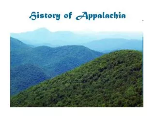
History of Appalachia. Geography. States: New York Pennsylvania Ohio West Virginia Maryland Kentucky Virginia Tennessee North Carolina South Carolina Georgia Alabama Mississippi.

E N D
Geography States: New York Pennsylvania Ohio West Virginia Maryland Kentucky Virginia Tennessee North Carolina South Carolina Georgia Alabama Mississippi
Most of the Scots-Irish immigrants coming to Pennsylvania came as indentured servants. When their terms of service were over they found the local land too expensive and went south into the southern Appalachian Mountains. Most never re-located because the highlands of the southern mountains reminded them of the highlands of Scotland.
These mountains were shaped over 500 million years in three separate building periods called oroginies. • During the first period, the Taconic, and the second, the Acadian, North America, Greenland, Ireland, and Scotland were all one land mass called Laurentia. At this time the Caledonia Mountains rose up and wore down before the Atlantic Ocean started to split the continent. • This is why the mountains of the Scottish Highlands and the Appalachians seem so similar; they were the same range!
During the third period, the Alleghenian, the Laurentian and West African continents smashed together, causing the Appalachians to curve like a half moon, mirroring the bulge in Africa. Two hundred million years of erosion turned the Appalachians from high, Alp-like peaks into rounded hills, but ridges of hard quartz sandstone survived, forming long valleys of softer shale.
When they were formed they wereestimated to be higher than 20,000 feet, as high or higher than the Himalayas. These mountains are not onlyolder than the dinosaurs, they are older than all land animals.
This produced a long range of accordion-like steep ridges, full of foliage entanglements like mountain laurel, and therefore difficult to transverse, alongside valleys and 'hollers' full of generally agriculturally useless soil. The Appalachians therefore tended to attract poorer people looking for cheaper or unwanted land.
There were other reasons that postponed settlement of this region than geography: • It was populated by Native Americans justifiably hostile to white settlement. • There was heavy rivalry between the English and French over the fur trade there. • Political intrigues before unification of the states made land rights uncertain. • Any good farm land that did exist was annexed by land companies.
Immigration to Appalachia During the seventeenth century the largest and most influential group of American immigrants sharing an ethnic heritage were those from England, Scotland, Ireland, and Wales. They generally settled the Eastern Seaboard while the French worked their way up the Mississippi River. In the early 1700s immigration pushed westward but, barred by the continuous ridges of the Appalachians, people settled more on the Piedmont between the coast and the mountains.
Cumberland Gap In 1750 an opening called the Cumberland Gap was discovered, leading to the fertile bluegrass country of Kentucky, but the mountains in that area were still not successfully settled until 1835, when President Jackson relocated the local native population to Oklahoma under a fake treaty
Cumberland Gap It is, without a doubt, one of the most important pieces of land in American history. The Cumberland Gap is a low point in the Cumberland Mountains where the states of Tennessee, Kentucky and Virginia all meet. Historians now estimate that between 1760 and 1850, almost 300,000 people walked, rode, or were carried through the Cumberland Gap.
The American pioneers weren't the ones who first "discovered" the Gap. Buffalo were migrating through the Cumberland Gap long before human beings did. Then, Native Americans used the gap for centuries, sometimes in peaceful trade missions and sometimes on the way to attack other tribes.
Daniel Boone In 1775 Boone and 30 other woodsmen were hired to improve the trails between the Carolinas and the west. The resulting route reached into the heart of Kentucky and became known as the "Wilderness Road." That same year Boone built a fort and village called Boonesborough in Kentucky, and moved his family over the Wilderness Trail to their new home.
It is generally perceived that this 'lower' class of immigrant resulted in the 'poor white trash' or 'hillbillies' of Deliverance fame, although the truth is that to survive in the Southern Mountains you needed to be resourceful, healthy, and knowledgeable.
By 1790 any good land was taken or too expensive for most. Still, communities were settled rather late; at the time of the Civil War (1860s) most settlements did not average more than three generations back. All this tended to produce communities that were isolated geographically and unstable, at least compared with the higher degree of order, law, and precedent found on the Eastern Seaboard. Frontier life was rigorous and a struggle; people needed to rely upon each other, and anything social, including religion, was highly important, producing a generally deeply religious population.