Download
1 / 7
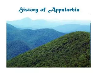
Geographic Overview of Appalachia: Mountain Ranges and Major Rivers
80 likes | 231 Views
This resource highlights the geographic significance of Appalachia, showcasing the mountain ranges defined by John C. Campbell in 1921 and further elaborated by USDA maps in 1935. The region is characterized by its distinct topography and major rivers, which play a critical role in its ecology and the culture of its inhabitants. This overview aims to provide insight into the natural landscape of Appalachia, as recognized by Congress, contributing to a deeper understanding of this unique area.
Download Presentation 
Geographic Overview of Appalachia: Mountain Ranges and Major Rivers
An Image/Link below is provided (as is) to download presentation
Download Policy: Content on the Website is provided to you AS IS for your information and personal use and may not be sold / licensed / shared on other websites without getting consent from its author.
Content is provided to you AS IS for your information and personal use only.
Download presentation by click this link.
While downloading, if for some reason you are not able to download a presentation, the publisher may have deleted the file from their server.
During download, if you can't get a presentation, the file might be deleted by the publisher.
E N D
Presentation Transcript
Appalachia Geography
The Mountain Ranges of Appalachia http://cva.morehead-st.edu/landscape/mountain_ranges.html


More Related