Download
1 / 41
410 likes | 674 Views
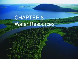
Chapter 9 Water Resources. Geosystems 6e An Introduction to Physical Geography. Robert W. Christopherson Charles E. Thomsen. Chapter 9. You are responsible for pages 245-248 in chapter 9. Water. Constantly cycling through the environment

E N D
Chapter 9Water Resources Geosystems 6e An Introduction to Physical Geography Robert W. Christopherson Charles E. Thomsen
Chapter 9 • You are responsible for pages 245-248 in chapter 9
Water • Constantly cycling through the environment • Water spends time in the ocean, the air, on the surface, and underground. • Hydrologic Cycle: the circulation and transformation of water through Earth’s atmosphere, hydrosphere, lithosphere, and biosphere. • Water-resource management: • Wells, reservoirs, dams
97% of Earth’s water in the ocean, so most precipitation and evaporation takes place there • The bulk of global precipitation comes from ocean water
86% of all evaporation traced to ocean • 14% of all evaporation traced to the land
Transpiration • The movement of water vapor through the pores of leaves and into plants through roots from soil moisture.
Evaporation • The movement of free water molecules away from a wet surface into the air that is less saturated.
Water spends 10 days (on average) in the atmosphere • Water spends 3,000-10,000 years in deep-ocean circulation, groundwater aquifers, glacial ice
End of Chapter 9 Geosystems 6e An Introduction to Physical Geography Robert W. Christopherson Charles E. Thomsen
Chapter 10Global Climate Systems Geosystems 6e An Introduction to Physical Geography Robert W. Christopherson Charles E. Thomsen
Climate • Climate is weather averaged over time over broader geographic areas. • Usually averaged over 30-yr periods. • Climatology is the study of climate over both time and space. • One central goal is to determine climatic regions, areas with similar weather statistics. • Another central goal is to analyze climate variability over time (like global warming!).
Ecosystems • Climates influence the location of an ecosystem • Ecosystem: the natural, self-regulating communities formed by plants and animals in their nonliving environment. • Biome: A large terrestrial ecosystem characterized by specific plant communities and formations
Biomes • Usually named after the predominant vegetation in the region • Examples: savanna, forest, grassland, tundra, desert • Each biome is a collection of animals, plants, and soils • Biomes constantly changing and adapting to changes in climate
Climate Classification • Provides an organized and manageable source of information that simplifies rather complex patterns in the real world • Also gives us a common short hand way to describe climates quickly and easily • By using 2 principal climatic components, temperature and precipitation, general climate types are revealed
Koppen • Koppen climate classification • Developed 1918 • Developed to correlate the spatial distribution of plants to the spatial distribution of climate • The Koppen-Geiger climate classification system is the updated version in your text
Köppen’s Climate Classifications Primary Letters • Tropical Climates (A) • Average temp of every month > 18ºC • Mesothermal Climates (C) • Coldest month average temperature < 18ºC but >-3ºC • At least 1 month average temperature > 10ºC • Microthermal Climates (D) • Average temperature of warmest month >10ºC • Average temperature of coldest month < -3ºC
Köppen’s Climate Classifications Primary Letters • Polar Climates (E) • Average temperature of all months < 10ºC • Dry Arid and Semiarid Climates (B) • Evaporation > precipitation • Highland (H)
Köppen’s Climate Classifications Secondary Letters • These letters are based primarily on seasonal precipitation: • f = adequate rainfall all through the year, no distinct dry season • w = winter dry, if 70% or more of annual rainfall occurs in summer • s = summer dry, if 70% or more of annual rainfall occurs in winter • m = extremely wet summer = monsoon. A climate only.
Köppen’s Climate Classifications Secondary Letters • For B climateonly: • S = semiarid = steppe • W = arid = desert • which results in either BS or BW. • For E climateonly: • T = tundra • F = perpetual frost = permanent ice • which results in either ET or EF.
Köppen’s Climate Classifications Tertiary Letters • The third letters in the system are based exclusively on seasonal and annual temperature: • a = hot summer, warmest month > 22°C; C and D only • b = warm summer, warmest month < 22°C; C and D only • c = cool summer, < 4 months over 10°C; C and D only • d = very cold winter, coldest month < -38°C; D only • h = dry-hot, annual temperature > 18°C; B only • k = dry-cold, annual temperature < 18°C; B only
Köppen’s Climate Classifications Examples of Combinations • Af = Tropical Rainforest climate type • Am = Tropical Monsoon climate type • BWh = Low-Latitude Hot Desert climate type • Cfa = Humid Subtropical climate type • Csa = Mediterranean climate type • Dfb = Humid Continental climate type • ET = Tundra climate type
World Climate Classification Figure 10.5
Tropical Climates (A) • Tropical Rain Forest Climates (Af) • Tropical Monsoon Climates (Am) • Tropical Savanna Climates (Aw) • Consistent daylength and insolation input • = consistent warm temperatures • Dominance by ITCZ • Shifts seasonally with high sun period • Warm ocean currents, unstable maritime air masses
Arid and Semiarid Climates (B) • Köppen system: • W = Desert (arid), S = Steppe (semiarid) • h = hot (mean annual temp > 18°C) • usually found in lower latitudes • k = cold/cool (mean annual temp < 18°C) • usually found in the midlatitudes • Low-Latitude Hot Desert Climates (BWh) • Midlatitude Cold Desert Climates (BWk) • Low-Latitude Hot Steppe Climates (BSh) • Midlatitude Cold Steppe Climates (BSk)
Arid and Semiarid Climates (B) • Potential for evaporation exceeds rainfall • Cover 35% of Earth’s surface • Most extensive geographically of the major climate groups • One-third of U.S. is classified as arid/semiarid
Mesothermal Climates (C) • Humid Subtropical (Hot-Summer) Climates (Cfa) • Humid Subtropical (Winter-Dry) Climates (Cwa) • Marine West Coast Climates (Cfb, Cfc) • Mediterranean Dry-Summer Climates (Csa, Csb)
Mesothermal Climates (C) • Humid Subtropical (Hot-Summer) Climates (Cfa) C = warmest month above 10ºC, coldest month above -3ºC = seasonal climates • a = hot summer, warmest month above 22ºC • f = year-round precipitation • w = winter dry (> 70% of rainfall concentrated in summer months)
Mesothermal Climates (C) • Humid Subtropical (Winter-Dry) Climates (Cwa) C = warmest month above 10ºC, coldest month above -3ºC = seasonal climates • a = hot summer, warmest month above 22ºC • w = winter dry (> 70% of rainfall concentrated in summer months)
Mediterranean Climates (Csa, Csb) • Wet winters, dry summers = “s” • 70% of precipitation in winter Marine West Coast Climates • Mild winters, cool summers • Unusual climates for their latitude, extending close to Arctic Circle. • Maritime polar air masses (mP) dominate.
Microthermal Climates (D) • Also called “cool temperate” or “snow climates.” • Average temperature of warmest month above 10°C. • Average temperature of coldest month below 0°C. • Distinct strong seasonality in temperature ranges throughout the year. • 21% of land surface in Microthermal climates. • Occurs due to continental locations (cP air masses common). • In Southern Hemisphere, found only in highlands.
Microthermal Climates • Humid Continental Hot-Summer Climates • Dfa, Dwa • Humid Continental Mild-Summer Climates • Dfb, Dwb • Subarctic Climates • Subarctic Cool-Summer: Dfc, Dwc • Subarctic Extreme-Winter: Dfd, Dwd
Microthermal Climates (D) • Humid Continental Mild-Summer Climates (Dfb, Dwb) • Found poleward of Dfa and Dwa climates. • Cold temperatures in winter primarily due to: • continental locations • higher latitudes • cP air masses • Less precipitation than hot summer climates • Heavier snowfall
Microthermal Climates (D) • Subarctic Climates (Dfc, Dwc, Dwd) • Found poleward of Dfb and Dwb climate. • Extensive geographically: • North America, stretching from Atlantic to Pacific. • Eurasia, stretching from Scandinavia to the Pacific. • Subarctic extreme-winter found only in eastern Asia • Most extreme temperature ranges of all climates • Extremely cold temperatures in winter primarily due to: • continental locations = Siberian High in winter • higher latitudes • cP air masses
Polar and Highland Climates • Tundra Climate (ET) • Ice Cap and Ice Sheet Climates (EF) • Polar Marine Climate (aka “Polar Maritime”) EM • More moderate than other two polar climates (why?) • No month below -7°C (20°F), but not as warm as tundra climate • Low annual range of temperature • Exists only along very fringes of highest latitudes • Bering Sea (Alaska, Russia), southern Greenland, northern Iceland, Norway)