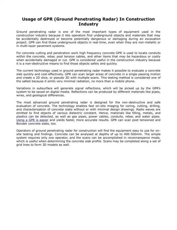
Download
1 / 42
460 likes | 698 Views
Ground-Penetrating Radar Investigations of Nearshore Sediments of Eastern Lake Michigan. William A. Sauck, W. R. Laton, D. L. Seng, and M. A. VanderEide Institute for Water Sciences Dept. of Geosciences Western Michigan University Kalamazoo, MI 49008. IAGLR, May, 2000. Acknowledgements.

E N D
Ground-Penetrating Radar Investigations of Nearshore Sediments of Eastern Lake Michigan William A. Sauck, W. R. Laton, D. L. Seng, and M. A. VanderEide Institute for Water Sciences Dept. of Geosciences Western Michigan University Kalamazoo, MI 49008 IAGLR, May, 2000
Acknowledgements • USGS: Woods Hole (1991-93 funding). • US Army Corps of Engineers (1992-93) • US EPA - Univ. of Mich. (1993-94) • COE-Toltest Contract (1997-98). • Student helpers
Outline • Introduction • Review of Equipment Used • Results • “Modern or Mobile” Sand Thickness • Channel-forms at River Mouths • Glacial Drift Lithologies • Discovery of submerged aeolian sand deposit • Conclusions • Recommendations
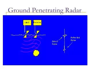
Introduction • History of GPR Use in Lakes and Rivers. • Purpose of these investigations. • Chippewa low stage of L. Michigan. • Relative permittivity controls GPR velocity. • Conductivity controls GPR attenuation. • Innovations in this study.
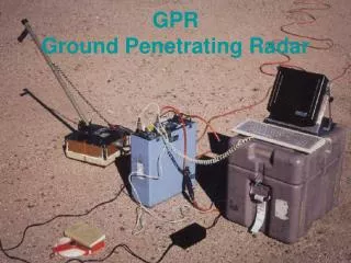
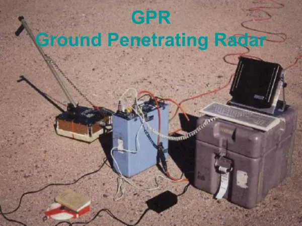
Equipment Used • 7 m work boat (MonArk) or 6 m Carolina Skiff. • GSSI SIR-10A+ GPR System, with custom 35 m Tescorp cable. • Custom 55 cm monostatic dipole antenna. • Differential GPS (Magellan ProMark X-CP), using Milwaukee USCG Diff. Beacon Transmitter. • Lowrance X-16 analog sonar (upward-looking, bottom-sled mounted)
GPR, Sonar, and Differential GPS Radio Beacon Receiver installed in 19’ Carolina Skiff.
The Bottom-towed GPR Antenna • Built to obtain uniform sub-bottom penetration regardless of water depth. • 55 cm monostatic dipole (145 MHz) with GSSI 769DA transceiver antenna driver card. • Enclosed in larger diameter PVC pipe. • Strapped to bottom sled made of 2” diam. PVC pipe filled with concrete ballast. • Upward looking SONAR transducer mounted on front corner of sled.
Underwater GPR antenna mounted on weighted bottom sled, being deployed at shore from Monark work boat.
Results: Warren Dunes
Results: St. Joseph-Benton Harbor Channel-forms • Shore-parallel profiles • Stacked channels buried below “modern” sands; relict from rise of Lake level after Chippewa low stage. • Possible location of north wall of large valley excavated during Chippewa low stage.
St. Joseph- Benton Harbor Profiles
Miami Park GPR Profiles
Little Sable Point
ManisteeGPR Profiles
(1/3) NNE
(2/3) NNE
(3/3) NNE
Manistee: Submerged dune field • Shore-Parallel Line (3 slides)
(2/3) NNE
(3/3) NNE
Manistee: Submerged dune field. • Shore-perpendicular line (2 slides).
(1/2) WNW
(2/2) WNW
Conclusions • More than 50 line kilometers have been surveyed in Lake Michigan. • The base of “modern” sands / top of older substrate is a strong reflector at all sites. • GPR has been very useful for sand thickness studies. • Penetration in sands and gravels is 6-10 meters. • Some lithologies can be identified or inferred. • Numerous peri-glacial, lacustrine, aeolian, and fluvial depositional environments can be recognized.
Recommendations • Improve antenna system; minimize top-of-water reflection. • Test in more regions and different lake environments. • Add other sensors to bottom sled. • Longer cable for use in water depths greater than ten meters. • GPR is best used in sand/gravel environments; clays are relatively impenetrable. Thus, GPR and seismic methods are complementary.
GSSI SIR-10A+; Mainframe Below, Control / Readout Console Above.
Map of area just north of Manistee (1 km grid)
DGPS boat tracks of GPR survey lines; Manistee. Real time corrections from Milwaukee Coast Guard Transmitter. (1000 ft grid)