Download
1 / 20
200 likes | 467 Views
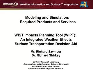
Weather Information and Surface Transportation Modeling and Simulation: Required Products and Services. WIST Impacts Planning Tool (WIPT): An Integrated Weather Effects Surface Transportation Decision Aid Mr. Richard Szymber Dr. Richard Shirkey US Army Research Laboratory

E N D
Weather Information and Surface Transportation Modeling and Simulation: Required Products and Services WIST Impacts Planning Tool (WIPT): An Integrated Weather Effects Surface Transportation Decision Aid Mr. Richard Szymber Dr. Richard Shirkey US Army Research Laboratory Computational and Information Sciences Directorate Battlefield Environment Division White Sands Missile range, NM 88002-5501
Outline • Overview of the Integrated Weather Effects Decision Aid (IWEDA) • Ongoing R&D related to IWEDA • Weather Running Estimate / Nowcasting • Uncertainty tolerance • Critical Values – The “Rules” • Notional WIST Impact Planning Tool (WIPT)
IWEDA Overview • The Tri-Service Integrated Weather Effects Decision Aid (IWEDA) is fielded to the US Army, Navy and Air Force • Provides weather impacts on military assets (missions, operations, systems, equipment, resources/infrastructure) • Compares critical environmental thresholds (rules) against forecast values for environmental data parameters. Threshold criteria for IWEDA rules:
IWEDA Overview IWEDA derives and depicts environmental impacts by generating easy-to-understand tabular and graphical products. • Weather Effects Matrix (WEM) showing forecast weather hazard conditions with time • Map overlay depicting spatial distribution of impacts
IWEDA Overview Clicking anywhere on the map displays full impact statements for all adverse weather impacts on the asset for that specific location and time.
Related R&D Forecast level of detail Military System Requirements and Civil National Needs Documents (OFCM, WIST, FM-R-18-2002) identify that 5 km or less resolution is required • The Army does not produce operational forecasts • Uses USAF Weather Agency forecast data feeds to run IWEDA in the field • ARL R&D is developing a diagnostic data assimilation and short term nowcasting capability called the Weather Running Estimate / Nowcast (WRE-N) • Uses Local Area Prediction System (LAPS) type assimilation methods using forward area data
Local short term forecasts Nowcast (short term forecast) - run hourly, forecasting the next 3 hours on a 1 to 2 km grid over 150 x 150 km or smaller domains. WRE-N WRE (advanced local analysis) – run every 15-30 minutes on a 1 km grid over a domain within the Nowcast - Integrates local and non-conventional observations (METSAT, UAS sensor data, robotic wind sensors) into current nowcast – example: LAPS Diagnostic High Resolution Models – fast running (< 5 min) boundary layer wind model at 10-100 m resolution for complex and urban terrain effects on wind flow – can use local observations Local Analysis Prediction System (LAPS) assimilates data Diagnostic urban wind model running as embedded client Weather Running Estimate / Nowcast – WRE-N Forecast- Operational Center (AFWA) Mesoscale MM5/WRF Forecast for next 36-72 hours, 2-4 times daily, 45 to15 km resolution on a “global” domain
Related R&D Dealing with Weather Uncertainty • Under Small Business Innovative Research (SBIR) Program, ARL has supported Next Century Corp., Columbia, MD to develop the “Weather Risk Analysis and Portrayal System (WRAP) • WRAP portrays the uncertainty based on risk tolerance from an ensemble of synoptic scale forecasts (Global Ensemble and Mesoscale Ensemble modeling from approximately 70 km down to 1 km resolution) • WRAP uses IWEDA Rule Sets to identify impact thresholds • Outputs are IWEDA-like map displays of impacts with uncertainties related to thresholds and probability of being impacted • USAF Weather Agency interest in WRAP is to integrate it to the Joint Ensemble Forecast System (JEFS) and for use with Army Battlefield Weather Teams
Weather Risk Analysis and Portrayal - WRAP Given uncertain weather, lower acceptable risk means less certainty in the desired outcome. Stochastic / Ensemble Weather Data • WRAP • Risk Calculations • Stop-light style decision inputs • Portrayal Techniques User Risk Tolerance Asset Risk Rules
“Rule-based” - critical weather threshold definitions: • If {weather variable} is {>,<, or “any occurrence of” } • {critical threshold value} • then weather impact is {red, amber, green} Critical Values (Rules) The “rule” form of the IWEDA rule-based weather impacts
Integrating Surface Transportation Weather Forecasting and Weather Effects Decision Aid System Development Understanding the nuances of surface transportation applications • ARL’s Database contains Army impact thresholds and rules for U.S. Military Services Transportation Operations (land, sea and air logistics) • US Transportation Command assets & operations • Air Mobility Command assets & operations • Military Sealift Command assets & operations • Military Traffic Management Command assets & operations • Army 7th Transportation Group assets & operations • Army Transportation School & Center assets & operations
IWEDA Rules All the information is available to determine the Red-Amber-Green impact criteria for the WIST rules Example showing the similarity of WIST and IWEDA rules for visibility and wind effects on transport operations
WIST Rules Example showing the similarity of WIST and IWEDA rules for visibility and wind effects on transport operations
Condensed View of Impacts from the Weather Effects Matrix View MTS Pipelines Personnel Roadways Oil Pipeline Railways Component Control Center has marginal impact: Lightning Distance Component Distribution Terminal has marginal impact: Reduced Visibility Component Offshore drill platform has severe impact: High Sea State Component Tank Farm has marginal impact: Flooding WIST Impact Planning Tool (WIPT)
Integrating Surface Transportation Weather Forecasting and Weather Effects Decision Aid System Development • ARL is prepared to integrate the WIST thresholds & impacts with the IWEDA Rules to produce a Joint Civil – Military Operations capability for surface transportation decision aids • Will include U.S. Civil Sectors Transportation Operations: • Roadways activities & operations • Federal Highways activities & operations • Long-Haul Railways activities & operations • Marine Transportation System activities & operations • Pipeline Systems activities & operations • Rural and Urban Transit Systems activities & operations • Airport Ground Operations activities
Integrating Surface Transportation Weather Forecasting and Weather Effects Decision Aid System Development What is needed to develop and test tools to facilitate integrated Surface Transportation Weather Forecasting and Weather Effects Decision Aid System Development? • ARL has T-IWEDA technology developed over 10 years at a cost > $ 1M which can be leveraged • Our experience can merge military weather impacts with civil weather impacts • WIST rule base to produce a Joint Civil-Military Operations capability for weather impacts/warnings • Tailored applications • We are in the process of producing a web-based capability to both access weather inputs and provide access to users through client applications
Conclusions • Benefits to Surface Transportation Decision Makers; WIST – IWEDA Impact Planning Tool would include: • IWEDA and WIST templates that would be fully compatible (incorporating WIST mitigation action and lead time fields) • Civil Sectors merged with Military Services T-IWEDA CRDB to establish a Joint Civil-Military Operations capability for Weather Impacts • Automated production of weather impacts on civil-military surface transportation operations and activities, and visualization of effects in decision aids. • Support to planning and operational needs of the civil-military surface transportation community. • Cost-benefit savings by leveraging civil and military capabilities in surface transportation applications.
Points of Contact: • Mr. Richard Szymber • Army Lead on Weather Impact Rules Development • (505) 678-0634; Richard.Szymber@us.army.mil • Dr. Richard Shirkey • Lead DoD Tri-Service IWEDA Consortium • (505) 678-5470; Richard.Shirkey@us.army.mil • US Army Research Laboratory • CISD/Battlefield Environment Division • AMSRD-ARL-CI-ED • White sands Missile range, NM 88002-5501
FCM-R18-2002 Weather Information for Surface Transportation National Needs Assessment Report (December 2002) Weather Information for Surface Transportation (WIST) Initiative Document (September 2005) FCM-R26-2006 Weather Information for Surface Transportation Update on Weather Impacts and WIST Results (August 2006) Joint Publication 3-26 Homeland Security (August 2005) Joint Publication 3-57 Joint Doctrine for Civil-Military Operations (February 2001) FCM-P11-2001 National Severe Local Storms Operations Plan (May 2001) FCM-P12-2006 National Hurricane Operations Plan (May 2006) FCM-P13-2005 National Winter Storms Operations Plan (December 2005) Primary References for WIPT 20