Download

1 / 20
200 likes | 318 Views
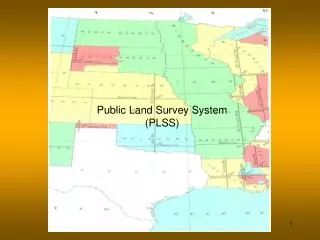
(PLSS). The Public Land Survey System. Control Point Inventory. Minnesota Department of Natural Resources Division of Lands and Minerals by Larry D. Swenson August 2009. Public Land Survey System ( PLSS).

E N D
(PLSS) The Public Land Survey System Control Point Inventory Minnesota Department of Natural Resources Division of Lands and Minerals by Larry D. Swenson August 2009
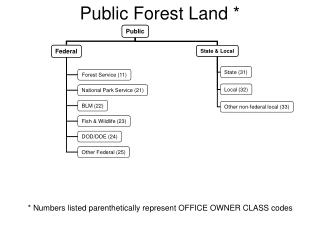
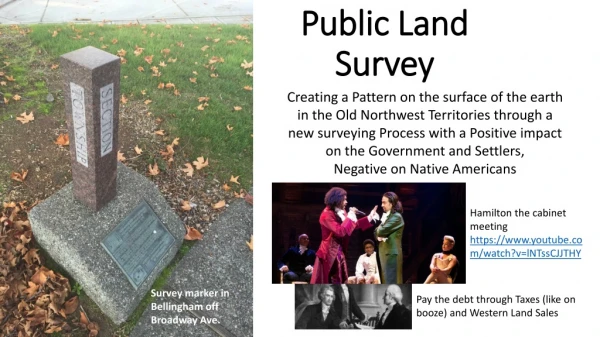
Public Land Survey System (PLSS) • In the original thirteen colonies, plus Hawaii, Kentucky, Maine, Texas, Tennessee, Vermont, West Virginia, and parts of Ohio (the state land states), land boundaries are identified according to the indiscriminate survey system, more commonly referred to as metes and bounds. • The Public Land Survey System (PLSS) as developed by Thomas Jefferson and approved by the Continental Congress was built to replace the common practice of describing land by metes and bounds. • The beginning of the current day PLSS occurred with the passage of the Land Ordnance Act of 1785. Which established General Land Office (GLO) for the survey and disposal of land. All lands in the public domain are subject to subdivision by this rectangular system of surveys, which is regulated by the U.S. Department of the Interior, Bureau of Land Management (BLM). Purpose: To facilitate disposal (either via sale or simple giveaways) of lands west of the Appalachian Mountains that the U.S. government had acquired from the British after the end of the Revolutionary War.
Disposing of this land was a very high priority for the young U.S. Government, for several reasons: • 1. U.S. soldiers had been promised land in return for their service during the Revolutionary War. • 2. The government needed the money from the land sales (there was no tax system in place at that time). • 3. Settlers were needed in the western lands to defend the nation's frontier from ongoing Indian attacks. The Public Land Survey System provided other advantages: • A unique and much simpler system of locating and describing lands (compared to the metes and bounds descriptions). • Inventory of how much land there was and its quality. • Information about the land, such as timber, roads, lakes, rivers, springs, swamps, topography, minerals, soils and existing development.
Public Land Survey Principal Meridians and Base Lines Based on 32 Initial points and 32 Baselines
Standard parallels are East-West lines that are parallel to the base line. • They are numbered north and south of the base line. • Standard parallels are 24 miles apart. • Guide meridians are established at 24 mile intervals along the base line and standard parallels. • Guide meridians are not parallel to the principle meridian because they are 90° to the base line, or standard parallel. The base line and standard parallels are curved lines. • Guide meridians are not continuous. There is an offset at each standard parallel (24 miles). Standard Parallels and Guide Meridians
Method of numbering townships 6 miles T 3 N T3N R2E Range Line 6 miles T 2 N Township Line Each township is 6 miles x 6 miles T 1 N R 3 W R 2 W R 1 W R 1 E R 2 E R 3 E Baseline Meridian Range Line T 1 S Initial Point T2S R3W T 2 S Township Line T 3 S
Section Numbering Each township is further divided into 36 sections, each section 1 mile x 1 mile. 6 miles 1 township = 36 sections 23,040 acres 6 miles X 6 miles 36 miles2 6 miles 1 section = 640 acres
Section 21 1 section= 1 mile2 =5280 ft X 5280 ft 640 acres 6400 chains2 80 chains X 80 chains NW ¼ NW ¼ NE ¼ NW ¼ NE ¼ ¼-section = 160 acres 2640 ft X 2640 ft ½ mile X ½ mile 40 chains X 40 chains 1600 chains2 SW ¼ NW ¼ SE ¼ NW ¼ 21 N ½ SW ¼ ¼ of ¼-section = 40 acres 1320ft X 1320ft ¼ mile X ¼ mile 20 chains X 20 chains 400 chains2 W ½ SE ¼ E ½ SE ¼ Gov’t Lot 1 Gov’t Lot 2 1 chain = 66 ft 1 acre = 43,560 ft2 Mud Lake
Sample of Field Notes T 28 N, R 23 W PLSS Measurement Units • All U.S. Government Land Surveys are measured in chains and links. • Fundamental unit of measure used in distance measurement is the surveyor’s, or Gunter’s, chain = 66 feet. • Further divided into 100 equal parts, called a link = 0.66 feet = 7.92 inches.
Public Land Survey System (PLSS) in Minnesota • Original Survey from 1847 to 1907 • Surveyed in the 4th and 5th Principals Meridians. • 8 Correction lines in the 4th P.M. • 6 Guide Meridians & 15 Standard Parallels in the 5th P.M. • T 26 to 71 N – R 1 to 32 W in the 4th P.M. • T 61 to 65 N – R 1 to 7 E in the 4th P.M. • T 101 to 168 N – R 3 to 49 W in the 5th P.M. • One Half Township – T58½N, R17W • Two Half Ranges – T159N, R42½W & T160N, R42½W • Contains ~ 2530 Townships • ~ 84,000 Sections • ~ 1,300,000 Government Lots and 40’s (Quarter-Quarter sections) • ~ 53,000,000 acres of land
GLO Plat Coding Types Fractional parts vs Government Lots
(CPI) - Public Land Survey Control Point Inventory • CPI was built in dBase IV (DOS based) programming language used to display information, coordinate conversions, import points, computations – intersects, proportion, adjust traverse, rotate/translate, information checking/filling/editing, data export to Oracle database, DXF, ASCii points files, • CPI data has been exported to Oracle Spatial database files as all CPI Points and Best PLS Corner Points • Current CPI information: ~828,866 points August 3, 2009 • Better than digitized positions 143,058 points for PLS Corners • 125,747 Digitized positions (does not including PLSS40 points for meander lines, reservation lines and County lines (along rivers)) • CPI information: ~714,000 points October 24, 2007 • Better than digitized positions 66,319 points for PLS Corners • 146,400 Digitized positions (does not including PLSS40 points (meander lines)
Public Land Survey System 40 acre subdivsion layer (PLSS40) • The PLSS40 layer used control points from the CPI: 123,861 points • Better than digitized positions 12,468 points • Digitized positions used 111,393 points • Subdivision of the sections down to the quarter-quarter level (40 acres) using the original General Land Office (GLO) survey plats (2530 townships). • Township subdivisions were done using CMM software (Cadatral Measurement Management developed for BLM). • Information Imported into ArcInfo where all meander line information was computed (closed and adjusted) from original GLO survey notes (All entered bearings and distances was then deleted). • Government Lots located as shown on the GLO Survey Plats • Government Lot numbers add from GLO Survey Plats • Control points for these subdivsions came from the PLS Control Point Inventory (CPI). • The base data set for the CPI was from Land Management Information Center (LMIC) digitized section corners call GISMO points. (~125,000 corners section corners ONLY).
(CPI) - PLS Control Point Inventory - Recent Activities • Adding parcels not in PLSS40* – to match DNR land records because of – Lands Transferred to the State of Minnesota under the MN Public Lands Improvement Act of 1990 P.L. 101-442, 104 Stat. 1019 * Tracts as surveyed by the BLM – Tracts start at 37 to ** * Updating Coding Scheme to match land records (Tracts are coded at the Section Level (first level subdivision of a township)) * Unsurveyed Islands plus a Coding scheme to match land records & digitizing polygons (currently is a point coverage) • Add DNR Survey Projects as completed • Adding non-digital DNR Survey Projects • Updating information from County sources • Creating GIS shape files of CPI points – PLS_Corners & Corners • Correction of errors – meander lines, coding errors … • Meanders for Rivers meandered on only one bank
Where do we go from here? Distribution – Public –or- by Request Costs Requesting additional information Make PLSS40 GIS layer Dynamic with CPI updates Questions ?