Download
1 / 49
490 likes | 673 Views
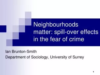
Neighbourhoods matter: spill-over effects in the fear of crime. Ian Brunton-Smith Department of Sociology, University of Surrey. Motivation. Increasing interest in influence of neighbourhood on crime and disorder (and public concerns)

E N D
Neighbourhoods matter: spill-over effects in the fear of crime Ian Brunton-Smith Department of Sociology, University of Surrey
Motivation Increasing interest in influence of neighbourhood on crime and disorder (and public concerns) Academic – social disorganisation; collective efficacy, neighbourhood disorder, subcultural diversity Policy – community policing, safer neighbourhoods, reassurance policing, CSOs But limited understanding of ‘neighbourhood’ and methodological weaknesses
Our study • The role of neighbourhoods in shaping individual fear • Key mechanisms, limitations of existing work • Detailed neighbourhood analysis • Defining neighbourhoods, • Composition and dependency • Spillover effects
Fear of crime • Important component of subjective well-being and community health • Frequently employed as performance target for police/government • More important than crime itself? • Safer neighbourhoods scheme • Neighbourhood mechanisms shaping fear • Research inconclusive – ‘paradoxical’ nature of fear
1. Incidence of crime • For several reasons neighbourhoods experience widely different levels of crime • If individuals respond rationally to objective risk, expressed fear should be higher in areas where crime is higher (Lewis and Maxfield, 1980) • But evidence for this relationship is surprisingly thin/inconsistent • Limitations of existing evidence – spatial scale, crime measure, metropolitan focus
2. Visible signs of disorder • Hunter (1978) – low level disorder serves as important symbol of victimization risk • Graffiti, litter, teenage gangs, drug-taking • Can be more important than actual incidence of crime – visibility and scope • ‘Broken windows’ theory (Wilson and Kelling 1982); Signal crimes (Innes, 2004) • Existing evidence relies on perception measures to capture disorder • Systematic social observation finds no clear link
3. Social-structural characteristics • Social disorganisation theory (Shaw and Mckay (1942) • Collective efficacy – (Sampson et al.,) • Residential mobility, ethnic diversity, and economic disadvantage reduce community cohesion • which weakens mechanisms of informal control • which leads to an increase in criminal and disorderly behaviour • which in turn reduces community cohesion • …and so on
Key limitations of existing studies • Failure to account for non-independence of individuals within neighbourhoods • More recent studies using multilevel provide clearer evidence • Reliance on respondent assessments of disorder, crime and structural characteristics (often examined in isolation) • Theoretically weak neighbourhood definitions – wards, census tracts, regions • Insufficient compositional controls
Our analysis • Neighbourhood effects on fear across England • Full range of urban, rural and metropolitan areas • Adjust for dependency using multilevel models • Detailed characterisation of local neighbourhoods using full range of census and administrative data • Independent of sample • Spillover effects
Data • British Crime Survey 2002-2005 • Victimization survey of adults 16+ in private households • Response rate = 74%
Defining neighbourhoods • Studies generally rely on available boundaries – wards, census tracts, PSU, region • Vary widely in size and not very meaningful in terms of ‘neighbourhood’ (Lupton, 2003) • BCS sample point? = postcode sector • We use Middle Super Output Area (MSOA) geography created in 2001 by ONS • Still large, but stable and closer to ‘neighbourhood’
Defining neighbourhoods - MSOA • Middle Layer Super Output Areas • 2,000 households • 7,200 individuals • Boundaries determined in collaboration with community to represent ‘local area’ • Sufficient sample clustering for analysis (n=20)
The national picture 6,781 MSOA across England Census and other administrative data available on all residents
Multi-level Model yij = β0ij + β1x1ij + α1w1j + α2w1jx1ij β0ij = β0 + u0j + e0ij
Spatial autocorrelation Individual assessments of fear also influenced by surrounding neighbourhoods May draw on environmental cues from surrounding areas Residents from a number of spatially proximal areas may all be influenced by a single crime hotspot Routine activities
Including neighbouring neighbourhoods • Allow for possibility that neighbouring areas also influence fear • Spillover effects • Saliency effects • Identify all areas that touch neighbourhood boundaries
Including neighbouring neighbourhoods • Allow for possibility that neighbouring areas also influence fear • Spillover effects • Saliency effects • Identify all areas that touch neighbourhood boundaries
Including neighbouring neighbourhoods • Allow for possibility that neighbouring areas also influence fear • Spillover effects • Saliency effects • Identify all areas that touch neighbourhood boundaries
Including neighbouring neighbourhoods • Allow for possibility that neighbouring areas also influence fear • Spillover effects • Saliency effects • Identify all areas that touch neighbourhood boundaries
Including neighbouring neighbourhoods • Allow for possibility that neighbouring areas also influence fear • Spillover effects • Saliency effects • Identify all areas that touch neighbourhood boundaries
Including neighbouring neighbourhoods • Allow for possibility that neighbouring areas also influence fear • Spillover effects • Saliency effects • Identify all areas that touch neighbourhood boundaries
Including neighbouring neighbourhoods • Allow for possibility that neighbouring areas also influence fear • Spillover effects • Saliency effects • Identify all areas that touch neighbourhood boundaries
The national picture Generates ‘adjacency matrix’ detailing surrounding neighbourhoods for each sampled MSOA Each surrounding area given equal weight Attach area information (crime and disorder) as ‘weighted average’ across neighbours
The spatially adjusted multilevel model yijk = β0ijk + β1x1ijk + α1w1jk + α2w1jkx1ijk + α3w3k β0ijk = β0 + ∑zjkvk+ ujk + eijk j≠k * * vkis the effect of each neighbourhood on its neighbours zjk is a weight term, equal to 1/nj when neighourhood k is on the boundary of neighbourhood j, and 0 otherwise α3w3k is surrounding measure of crime/disorder (spatially lagged variable – weighted sum of all neighbours)
Fear of crime measure • First principal component of: • How worried are you about being mugged or robbed? • How worried are you about being physically attacked by strangers? • How worried are you about being insulted or pestered by anybody, while in the street or any other public place? • ‘not at all worried’ (1), to ‘very worried’ (4)
Measuring neighbourhood difference – Social structural variables Range of neighbourhood measures identified to capture social and organisational structure Factorial ecology approach used to identify key dimensions of neighbourhood difference
Measuring neighbourhood difference – Social structural variables
Measuring neighbourhood difference – Social structural variables
Measuring neighbourhood difference – Social structural variables
Measuring neighbourhood difference – Social structural variables
Measuring neighbourhood difference – Social structural variables
Measuring neighbourhood difference – Social structural variables
Measuring neighbourhood difference – Social structural variables n ELF = 1-∑Si 2 i=1 • We also include a measure of ethnic diversity • White, black, asian, or other • Capturing the degree of neighbourhood homogeneity
Visual signs of disorder • Usually derived from survey respondents • Some have used pictures and video recording which is later coded • We use principal component of interviewer assessments of level of: • 1. litter • 2. graffiti & vandalism • 3. run-down property • measured on a 4-point scale from ‘not at all common’ to ‘very common’ • High scale reliability (0.93)
Recorded crime • Police recorded crime aggregated to MSOA level • Composite index of 33 different offences in 4 major categories: • Burglary • Theft • Criminal damage • Violence
Individual fixed effects • More fearful groups: • Women, younger people, ethnic minorities, less educated, previous victimization experience, tabloid readers, students, those in poorer health, being married, longer term residents • Neighbourhood (and surrounding area) effects – 7.5% of total variation
Neighbourhood effects Neighbourhood levels of crime and disorder significantly related to individual fear
Individuals also influenced by the levels of crime and disorder in the surrounding area
Conclusions • Neighbourhoods matter • Fear of crime survey questions sensitive to variation in objective risk • Visual signs of disorder magnify crime-related anxiety • Neighbourhood characteristics accentuate the effects of individual level causes of fear (Brunton-Smith & Sturgis, 2011) • Residents influenced by surrounding areas (in addition to their own neighbourhood) • Crime and disorder in surrounding areas important to assessments of victimisation risk • But MSOA still spatially large – LSOA?
Defining neighbourhoods – LSOA? • Lower Layer Super Output Areas • 400 households (minimum) • 1,500 individuals • Suitable individual level data only available for London (Metpas)
Defining neighbourhoods – LSOA? • Lower Layer Super Output Areas • 400 households (minimum) • 1,500 individuals • Suitable individual level data only available for London (Metpas)
Defining neighbourhoods – LSOA? • Lower Layer Super Output Areas • 400 households (minimum) • 1,500 individuals • Suitable individual level data only available for London (Metpas)
Defining neighbourhoods – LSOA? • Lower Layer Super Output Areas • 400 households (minimum) • 1,500 individuals • Suitable individual level data only available for London (Metpas)
Defining neighbourhoods – LSOA? • Lower Layer Super Output Areas • 400 households (minimum) • 1,500 individuals • Suitable individual level data only available for London (Metpas)
Defining neighbourhoods – LSOA? • Lower Layer Super Output Areas • 400 households (minimum) • 1,500 individuals • Suitable individual level data only available for London (Metpas)