Download
1 / 17
170 likes | 200 Views
PlanCoast aims to foster sustainable development in the Baltic, Adriatic, and Black Sea coastal zones, implementing maritime spatial planning strategies to mitigate conflicts and maximize synergies between various interest groups. The project involves developing GIS databases, enhancing ICZM strategies, and adhering to European policies and national strategies.

E N D
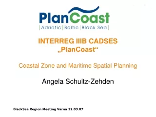
INTERREG IIIB CADSES „PlanCoast“Coastal Zone and Maritime Spatial Planning Angela Schultz-Zehden
Overall Objective • Foster sustainable development in the coastal zones • (land- and sea-side) of the • Baltic Sea, Adriatic Sea and Black Sea • and support the • EU maritime strategy
Challenges • The coastal zones of the Adriatic, Baltic and Black Sea face severe pressure from development. • Multiple sea and coast-based activities such as tourism, transport, fishery / aquaculture, shipping and energy generation are growing. • Combined with the requirements for nature protection and the effects of global climate change these uses implicate numerous actual and potential conflicts. • These conflicts are not limited to the landside areas, but will affect offshore areaseven more strongly. • The challenge is to make the most of the economic potential of the seas in a sustainable manner by avoiding conflicts and creating maximum synergies between the various interest groups.
Basic Facts • Project Region: Coastal and Maritime Zones (esp. 12 sm zone) of the Baltic Sea, Adriatic Sea and Black Sea • Lead Partner: Ministry of Traffic, Building and Regional Development – Mecklenburg-Vorpommern, spatial planning department (Germany) • Project Partners: 15 Spatial Planning Departments or Regional Authorities responsible for the spatial planning for coastal and maritime areas in their partner countries
Goals • Setting up comparable GIS databases laying the ground for transnational co-ordination of different uses in coastal zones and maritime areas • Developing, introducing and implementing the new tool of spatial planning in maritime areas in a coherent manner complying to international standards but reflecting local and regional needs • Strengthening the implementation of ICZM national strategies in EU coastal zones by enhancing the role of spatial planning within ICZM in a selected number of pilot projects • Contribute to the implementation of European policies and national strategies on coastal zones and maritime areas
What is ICZM? • Integrated Coastal Zone Management • is a dynamic, multi-disciplinary and • participatory process • to promote sustainable management of • coastal zones from off-shore areas • up to their hinterlands • and covers the full cycle of • information collection, planning, public participation, decision making, management and monitoring of policy implementation.
Current focal points of EU policy • Integrated Coastal Zone management (ICZM) • Development of national ICZM-strategies until 2006 • European Maritime Policy • Green paper on integrated maritime policy June 7, 2006
Central questions of the EU Green Paper of Maritime Policy concerning ICZM and Spatial Planning • How can ICZM be successfully implemented? • What are the principles and mechanisms that should underpin maritime spatial planning systems? • How can systems for planning on land and sea be made compatible?
What can Spatial Planning offer to ICZM and the EU Maritime Strategy? • Proven methods of participation and conflict management • Binding results based on statutory plans • Provision of space oriented data through Geographical Information Systems (GIS)
Laying the Ground for ICZM Actions • Assessment of Status Quo • National reports on current policy, legal basis and procedures of spatial planning in coastal and maritime areas (land- and sea-side) in all participating countries • Transnational, comparative study on current role of spatial planning in National ICZM strategies and identification of opportunities/threats - strengths/weaknesses – gaps/best practice • Creation of GIS Databases for Coastal Plans • Agreement on common type of basic information to be included in all GIS databases • Creation or update of GIS Databases for Coastal Zones accordingly in all participating regions
Pilot Projects • Sea-Use-Planning in Action • Preparation of Sea-Use-Plans for 12 sm zone in Mecklenburg-Vorpommern (Germany), Gdansk region (Poland), Trieste Bay (Slovenia), Varna (Bulgaria), Constanta (Romania), Boka Kotorska Bay (Montenegro), Odessa (Ukraine) • Sea-Use-Planning training programme for spatial planners from all participating countries • Spatial Planning in ICZM in Action • Preparation of new coastal plans according to ICZM principles for Palombina Beach (Italy), Pommerania (Poland), Piran (Slovenia), Albania, Varna (Bulgaria), Constanta (Romania) and the Tulcea/Danube Delta Biological Reservation (Romania)
Activities Bulgaria • Partners • Varna regional Administration • Black Sea NGO Network • Activities • GIS Database Development • Update of 7 Spatial Plans according to ICZM Principles • Introduction / Proposal for Sea Use Plan
Financing • EFRE 595.000 EUR • CARDS 493.678 EUR • PHARE 334.200 EUR • TACIS 120.600 EUR • EU Financing 1.488.478 EUR • EU Co-Financing + 317.000 EUR • Non EU Co-Financing + 173.542 EUR • Total 1.979.020 EUR
Contact • Lead Partner • Ministry of Traffic, Building and Regional • Development Mecklenburg-Vorpommern • Dr. Bernhard Heinrichs · Susan Toben • 19048 Schwerin • Tel. +49 385 / 588-0 · Fax: +49 385 / 588-3982 • Project Co-ordination Office • sustainable projects · Angela-Schultz Zehden • Bundesallee 130 · 12161 Berlin • Tel. +49 30 / 32 66 74-60 · Fax. +49 30 / 32 66 74-59 • info@plancoast.eu · www.plancoast.eu