Download
1 / 17
170 likes | 413 Views
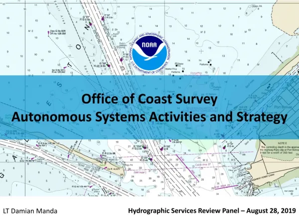
Office of Coast Survey Autonomous Systems Activities and Strategy. Hydrographic Services Review Panel – August 28, 2019. LT Damian Manda. Background. Office of Coast Survey. CO-OPS. Coast Survey Development Lab. Geodetic Survey. Hydrographic Systems and Technologies Branch

E N D
Office of Coast SurveyAutonomous Systems Activities and Strategy Hydrographic Services Review Panel – August 28, 2019 LT Damian Manda
Background Office of Coast Survey CO-OPS Coast Survey Development Lab Geodetic Survey • Hydrographic Systems and Technologies Branch • Development and testing of ocean mapping technologies OMAO Ships & IT NOAA Fisheries Centers for Coastal and Ocean Science Hydrographic Surveys Division Navigation Services Division Marine Chart Division
Coast Survey UxS Vision Coast Survey UxS Vision OCS Strategic Plan: Integrate new and innovative technologies into mission priorities. Develop and utilize unmanned systems for more efficient and effective acquisition of data to support NOAA’s navigation products and services.
Primary Impacts and Use Cases Unmanned Surface Vessels • Shallow water mapping (small platforms) • Dangerous or unknown situations • Long duration missions Unmanned Underwater Vessels • Response (small platforms) • Deepwater high resolution mapping Conversion/Multimodal • More utilization of existing platforms • Workforce preparation for next generation Unmanned Aerial Systems • Faster shoreline • Response imagery/assessment • Shallow water bathymetry
Enabling Technologies – Processing Automation Data Collection Charlene Charlene Features Processing MBES Processing SSS Processing SHAM Feature QC Rough Cleaning SSS Contact Selection CARIS ML SSS ML Data QC and Metrics QC Tools Auto DR Reports Final QC LTD, Checksum, QC Tools Submission
Enabling Technologies Wireless Data Transfer
Operational Platform Expertise Coast Survey’s Unmanned Systems In Operation or Evaluated Navigation Response Team - Stennis, MS Bay Hydrographer II • 2019 Activities • Official transition of assets to NRT • Certification of Echoboat for NOAA survey acquisition • Operational use of REMUS 600 on NOAA Ship OkeanosExplorer, training for NRT • Team Lead arrives to NRT-Stennis, working toward full staffing Hydroid REMUS-100 Hydroid REMUS-600 Seafloor Systems Echoboat (2) Teledyne Oceanscience Z-Boat (2)
Operational Innovation Optionally Manned Launch • Purpose • Maximize current infrastructure and expertise • Allow for expedited, moderately priced, and scalable means to integrate unmanned systems • Expected Benefits • Platform to develop and test enabling technologies & operational concepts • More effective use of survey personnel • Preparation for USV mission integration • Increased survey efficiency • Timeline • Feb 2019 – Technical acceptance of 1st launch conversion on NOAA Ship Rainier • Mar 2019 – Installation & acceptance of 2nd launch conversion • May - Sept 2019 – At-sea operational testing • Winter 2019-20 – Additional conversions
Operational Innovation Shoreline via UAS • 2019 Activities • Training program at NGS facility in Corbin, VA • Processing pipeline development • Operational Field use of UAS with NRT in Cheboygan, MI
Collaboration - Navy • CENOTE legislation - leverage expertise in the development and operational transition of UMS • Annex 23 to NOAA-Navy MOA • Coordinate and collaborate on hydrographic survey initiatives • Includes procurement, testing and training for unmanned systems • NAVO optionally manned launch conversion • Software collaboration and workshops
Collaboration - University of New Hampshire • Arctic USV Survey – July 2018 • UNH’s ASV C-Worker 4 • Collaboration with UNH CCOM/JHC, NOAA Ship Fairweather • Tested new operational models, identified and solved technical short-comings, and provided experience to the ship’s crew in the operations and support of unmanned systems. • iXBlueDriXUSV • Testing and evaluation of the long endurance iXBlueDriXUSV through UNH’s industrial partners program • Field Trial in NH Dec 2018 • Meets NOAA survey requirements at 12 kts
Collaboration - University of New Hampshire • 2019 Activities • C-Worker BEN • Shore based C-Worker operations in Thunder Bay NMS • Pacific Islands mapping projects • Robotics system improvements for the C-Worker • Machine learning application to camera image recognition • Testing of processing algorithms to improve survey efficiency • DriX • Testing of launch and recovery system on NOAA Ship Thomas Jefferson • Investigation of survey methodologies in conjunction with Thomas Jefferson
Collaboration – University of Southern Mississippi • 2019 Activities • Saildrone • Integration of MBES on Saildrone • Survey testsin Gulf of Mexico • Identification of benefits to charting mission, concept of operations • C-Worker 5 • Outfitting and use for training
Activities Summary Strategy • Develop Enabling Technologies • Activities - Software Development (Charlene, SSS, SHAM), Data Radio Installations • 2019 Goal - Reduce shipboard data processing effort 50% from 2017 level • Build and Maintain Operational Expertise • Activities – UxS Operational Team in Stennis, UAS Training • 2019 Goal – Team fully staffed and resourced to conduct Coast Survey and inter-disciplinary missions, OCS specific UAS training for field units • Operational Innovation • Activities – Optionally-manned Launch Conversions, Shoreline UAS • 2019 Goal – Operational use of launch in unmanned configuration, UAS shoreline field use • Collaborate • Activities – SailDrone CRADA, Navy, USM and UNH partnerships • 2019 Goal – Integration and operation of seafloor mapping sonar on SailDrone. DriX testing aboard Thomas Jefferson.
LT Damian Manda NOAA Hydrographic Systems and Technologies Branch damian.manda@noaa.gov