Download
1 / 26
260 likes | 405 Views
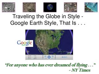
Traveling the Globe in Style - Google Earth Style, That Is. “For anyone who has ever dreamed of flying . . .” - NY Times. Google Earth – Explore, Search and Discover.

E N D
Traveling the Globe in Style - Google Earth Style, That Is . . . “For anyone who has ever dreamed of flying . . .” - NY Times
Google Earth – Explore, Search and Discover • Google Earth combines satellite imagery, maps and the power of Google Search to put the world's geographic information at your fingertips. • Fly from space to your neighborhood. Type in an address and zoom right in. • Search for schools, parks, restaurants, and hotels. Get driving directions. • Tilt and rotate the view to see 3D terrain and buildings. • Save and share your searches and favorites. Even add your own annotations. • Free for personal use
Google Earth Free Downloadhttp://earth.google.com/ • Broadband, 3D application that not all computers can run • Desktop computers older than 4 years old may not be able to run it. • Notebook computers older than 2 years old may not be able to run it. • Minimum System Configuration • OS: Windows 2000, XP, or Mac OS X (10.4) • CPU: 600MHz • Free Hard Disk Space: 400 MB • System RAM: 128 MB • Video RAM: 16 MB • Screen Resolution: 1024x768, 32-bit color • Internet: 128 Kbps ("broadband")
Google Earth – A 3D Interface to the Planet • Ready. Set. Discover. • Type in a street address and zoom from space to street level views. • Find businesses, parks, school & more • Enter a business name (e.g. “Hilton”) or a category (e.g. “hotels”). • Map Community • Thousands of users are sharing their views of the planet on Google Earth Community (http://bbs.keyhole.com/)
Keyhole Communityhttp://bbs.keyhole.com • Share saved searches in an XML format called KML • Thousands of interesting layers and views available for download • Created by travelers annotating favorite destinations or individuals writing about the community they live in
Top 10 Sites (week of 1/23/2006)http://earth.google.com/sites/ • Grand Canyon • Lincoln Memorial • The Colosseum • Cabo San Lucas • Eiffel Tower • Venice • Bermuda • Golden Gate Bridge • Sedan Crater • Hoover Dam Explore Popular Places from Google Earth Gallery http://earth.google.com/gallery/
Online Guidefor Getting Startedhttp://www.keyhole.com/GoogleEarthHelp/GoogleEarth.htm • Easier Quick Start Tour to help you dive right in: http://earth.google.com/tour/index.html
3D Viewer Navigation The following keystrokes control navigation of the viewer. Note: The focus must be in the 3D viewer in order for these controls to take effect. Simply click anywhere in the 3D viewer to change focus. TIP: Use the ALT key in combination with most of these keystrokes to move more slowly in the indicated direction.
Layers – Showing & Hiding Points of Interest • Lists of points of interest you can turn on to display in 3D viewer • Businesses (banks, restaurants, gas stations) • Restaurants • Parks • Airports, hospitals, and schools • Postal, city, and school boundaries • Select “check box” in Layers panel to turn on • Clear check box to turn off • Navigation Dashboard – most comonly used layers
Search Features • Fly To • Address, place name, cross street, or simple Latitude/Longitude coordinates • Zooms you quickly to specified location • Altitude about 3,000 feet above ground • Local Search • Business Type & Location • Displayed with icons on satellite image & as list of text results beneath search box (left of screen) • Click link to get printable view • Directions • Driving directions To & From places in US, Canada & western Europe • Route overlaid on an image • “Fly” feature
Local Search • Using Google local search to search a combination of Yellow Page listings along with web page information for that region. • The search terms you enter are also matched against web pages in that region containing those terms. (For example, you might search Shell Oil and see a result for an investment company with holdings in Shell Oil Co. and whose web site also references the term Shell Oil.) • Your search terms for both What and Whereare saved in the entry history (indicated by the small black triangle on the right of the search input). • When you log out of Google Earth, the last 10 search entries are saved for the next session. (This location search history is independent of the location search history for the Fly To search panel.) Tip: A local search starts in a radius either from the center of the current view, or from the center of the location indicated in the Where input box. So, if you want to search for a movie theater close to a restaurant where you are having dinner, try entering the address of the restaurant in the Where input box when searching the term movie theater.
Getting Directions • Right click on icon or listing result • Click on To here or From here link in information balloon • Enter starting and ending points in the Directions tab
Driving Directions • Click the “Directions” tab to get turn by turn driving directions. • Enter your street address or click on the “From Here” or “To Here” link in any balloon window. • But wait, there’s more! Click the VCR like “Play” button located under the directions. Google Earth will FLY you along the route!
Print, Save, and Email • Email driving directions to a friend • As a JPG • As a KMZ (Placemark) to another Google Earth user • Google Earth Pro ($$) • Print as high as 2400 pizels and up to 4800 pixels with premium print option.
Save Your Search Results • Revisit your search results • Save a result or even an entire folder of results to the Places • Custom icons and descriptions • Share them with your “Google Earth” friends • Double clicking on a saved place will fly you back to that location • Select multiple placemarks and hit the play button in order to tour the selected placemarks.
Creating a New Placemark • To add a new placemark to any spot in the viewer: • Position the viewer to contain the spot you want to placemark. (Consider zooming into the best viewing level for the desired location. • Choose any one of the following ways to stsart: The New Placemark dialog appears and a New Placemark icon is centered in the viewer inside a flashing yellow square.
Position the Placemark 3. Position the cursor on the placemark until the cursor changes to a pointing finger and drag it to the desired location. (Cursor changes to a finger pointing icon to indicate you can move the placemark.)
Set Properties for Placemark 4. You can set the following properties for the new placemark: • Name for the placemark • Icon to represent the placemark • Destination folder Select a folder or create a new one. • Description (including HTML text) • Style (Advanced – lets you change style of icons & labels)) • Location (Advanced) • View (Advanced) 5. Click OK to apply the information you entered in the placemark dialog. (Placemark position and properties can always be edited later. Placemark appears in the 3D viewer and as an entry in the selected folder.)
Writing Description • Room for detailed descriptions. • Description appears in the information balloon that pops up when you click on a placemark. • Scroll bar appears when the description is too long to fit in the entire balloon. In the Places pane, a small amount, or snippet of the description appears beneath the folder or item.
Writing Descriptions Keep in mind the following points about text in the description field: • Valid web URLs are automatically converted to HTML and can be clicked on from the info balloon to produce the related web page in the web window. • Carriage returns in the description are treated as HTML line breaks. • Many HTML tags are respected, such as font, style, and table tags. If you are familiar with HTML, you can be quite creative in how your descriptions are formatted! All HTML tags should be properly closed. • You can include images in your description using the IMG HTML tag to refer to either: • images stored on your computer's hard drive (e.g., <img src="C:\Documents and Settings\HP\My Documents\Pictures\myDescriptiveImage.jpg">) • images on the internet (e.g. <img src="http://www.test.com/images/myDescriptiveImage.jpg">). • When you email that placemark to another person, local images are included.
3D Buildings and Terrain • See buildings in 3D from the “ground up” in 38 US cities • Activate the “buildings” layer on the bottom navigation panel. • Tilt the screen in order to see the buildings in 3D. • Terrrain also mapped in 3D • See mountains, valleys and canyons in Google Earth.
Measure Distance • How far is the train station from your home? • Click on the “Measure” tool located under the Tools menu. • Change units of measurement as needed. • Measure the radius, perimeter, and area
Classroom Resources for Geography Earth Observation Satellites http://science.nasa.gov/Realtime/JTrack/eos.html NASA Earth Observatory http://earthobservatory.nasa.gov/ TerraServer Image Database http://terraserver.homeadvisor.msn.com/
More Classroom Resources for Geography USGS TerraWeb for Kids http://terraweb.wr.usgs.gov/TRS/kids/ USGS Educational Resources for Teachers http://education.usgs.gov/ • See links for GIS – Especially ESRI! Digital Globe Globe Explorer – Create custom posters http://imageatlas.globexplorer.com Type in Address & Click on “Find Image” – takes awhile to load – purchase prints/posters