Download
1 / 6
60 likes | 81 Views
Explore the integrated system of observations and models to enhance coastal, ocean, and marine condition predictions. Learn about the dynamic relationship between data collection and modeling for accurate assessments. Discover how advancements in technology can optimize data collection methods and improve model performance.

E N D
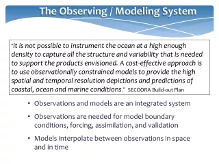
The Observing / Modeling System “It is not possible to instrument the ocean at a high enough density to capture all the structure and variability that is needed to support the products envisioned. A cost-effective approach is to use observationally constrained models to provide the high spatial and temporal resolution depictions and predictions of coastal, ocean and marine conditions.” SECOORA Build-out Plan • Observations and models are an integrated system • Observations are needed for model boundary conditions, forcing, assimilation, and validation • Models interpolate between observations in space and in time
The Observing / Modeling System Hyperspectral image Chesapeake Bay 10/07/09 Courtesy of NASA Somewhat artificial to consider numbers of different types of platforms separately • gliders could be substituted for moorings • new/better remote sensing capabilities may reduce need for in-situ observations Sea surface salinity
The Observing / Modeling System 119 FTEs requested in 2009 plan and in total of build-out plans, but the regional distribution is not necessarily the same One way to get to a national plan, is to look across a broad spectrum of user needs for a given variable, and design a system that meets a large number of those needs. This has been done for surface currents and waves. Each of those efforts took expert panels years to complete.
The Observing / Modeling System • This workshop might lead to further national measurement design efforts AND /OR • National efforts focused on designing optimum multi-component systems to meet a particular user need or set of products • Given an agreed upon list of needs, expert panels would have to assess the best technology, spatial and temporal resolution, and packaging and product distribution to meet those needs
The Observing / Modeling System • Some capabilities rest solely within the regions, such as HF radars and gliders • Some capabilities rest almost solely at the Federal level, such as the water level observing network • Some capabilities are spread across the regional and national levels, such as wave measurements
Questions to Consider during Following Sessions • What are the commonalities among regions on measurements and models to meet common product needs? • What are the emerging technologies that may replace present-day systems over the next 10 years ? • Will improvements in model performance over the next decade decrease (or increase?) the need for some types of measurements? • Are there new developments in remote sensing that will lessen the need for some types of in-situ measurements over the next decade ? • How do we handle the different mixes of regional and national assets in the synthesis document?