Using GIS for Space Planning & Management
280 likes | 539 Views
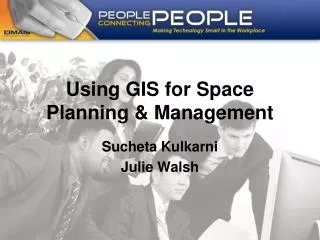
Using GIS for Space Planning & Management. Sucheta Kulkarni Julie Walsh. Medical School Needs. Background: Large Enterprise with 1.4 million NASF UMHS strategic goal - USE SPACE EFFICIENTLY Need to combat rising utility costs Effective resource management is key to success

Using GIS for Space Planning & Management
E N D
Presentation Transcript
Using GIS for Space Planning & Management Sucheta Kulkarni Julie Walsh
Medical School Needs Background: • Large Enterprise with 1.4 million NASF • UMHS strategic goal - USE SPACE EFFICIENTLY • Need to combat rising utility costs • Effective resource management is key to success • Historically, analysis done with manual process utilizing data from disparate sources • Challenges: resource intensive, time consuming, data inconsistency • Increasing need for analysis and decision support for facility management • Analysis becoming multi-dimensional; needing both geographical and business data • Leading to initiative to build capability for efficient facilities planning & management
GIS based FM initiative • Geographic Information System (GIS) is a technological tool for comprehending geography and making intelligent decisions • GIS at Medical School helps to: • Visualize facilities and business information • Support tactical space planning activities • Process data from a variety of sources and integrate it to perform single or multi-dimensional analyses • Support space productivity analyses using direct and indirect costs • Reduce Facilities staff and resource time • Ensure data consistency with other Medical School reporting tools
FM Process Transformation Before GIS After GIS 4
Scope • Scope • 25 buildings • 18 Floors; GIS File structure by Floor • Ground cover with streets, sidewalks and parking structures • Room information on area, ownership, usage, occupancy and capacity • Research Grants • Space Productivity • Analysis capabilities: Single or multi-dimensional spatial analyses using data attributes • Information update frequency: Monthly • Resources • Cross functional team to setup the initial scope (Med School Facilities & Finance, AEC, MSIS) • GIS Expert (part-time)
Key Capabilities • Ability for all departments to view “ALL SPACE” • Ability to look at the Medical School buildings by floor to analyze: • Occupying Departments • Room Types and Function • Square Footage • Workstations in Rooms • Research Activity – Grants and Principal Investigators • Room Occupants • PI Space Productivity • Department Space Productivity • Fixed Assets in Rooms – Lab Furniture • Delivery: ArcMap and ArcReader
Technical solution details Software: • ArcGIS 9.2 – to create, view, analyze geo-located business information. • ArcReader 9.2 - a web-based light wt viewer used by majority of end users (“general users”) to view and print geo-located business information • Oracle – Ora9i - business information repository • BrioQuery Explorer 5.5 – data exchange between Oracle and ArcGIS using M/S Excel format • Microstation XM – CAD software for floor plans Hardware: • Server - Novel file server HP Proliant DL280 ; 1.4 GHZ Pentium processor and 2-4 GB RAM ; holds GIS data • End user Desktops - Intel Core 2 Duo E6550 2.33 GHZ processor with 4GB of RAM and an 80 GB of hard drive
Data Architecture: Microstation CAD floorplans M-Pathways Data Warehouse Space info Usage info ArcGIS 9.2 (GIS analysis) UMMS Data Warehouse Business info Financial info ArcReader 9.2 (Viewer only) GIS Data in 2D & 3D GIS graphical outputs
Value to Medical School • Significant process efficiency gains … Reduced time to generate space utilization drawings per building from 8 hours to 10 minutes…Julie Walsh, OSM Director • Data accuracy and fidelity …………The ability to look at space on floor plans with up-to-date text information is very beneficial and aids in our work …. Jeanie Hutchins, Research Facilities Manager • Data visualization ……ArcReader has been a wonderful asset in my job. We are looking at moving faculty around, and just to print and look at sq footage is an invaluable asset…..Carol Cottrell, Division Administrator • Increased ability to respond to space requests ……..The ArcGIS tool has dramatically increased our ability to analyze space assignment issues and respond to requests by departments as well as the Deans' questions….Horace Bomar ,Director • Applying productivity metrics for space utilization ………It was very helpful to see how you're starting to tie productivity data to space data Frances Mueller, Space Utilization Initiative
Achievements • Positive feedback from peer Institutions • AAMC – Requests to mentor groups at other colleges and universities • NCFMTC • “Honorable Mention” at the 2008 UM Business Intelligence Awards …… for excellent demonstration of using data and Geographical Information Systems technology to making informed decisions. • Leveraged Medical School capabilities and experience to drive planning for new 270,000 sq.ft. facility at Ross School of Business (RSB)
GIS on Campus • RSB GIS Initiative enabled: • Faculty and Program assignment • Kiosks “Way finding” Application • Future initiatives to support recruitment, alumni analyses • Space Information and Real Estate Planning – Campus GIS • School of Natural Resources • Utilities and Plant Engineering: • interested in leveraging GIS for HVAC planning to combat rising energy costs • CSCAR • MAP Library • School of Public Health
Deployment Status • Phase 1 & 2 completed • Develop, test and tune • Phase 3 - WIP • Deployment to wider user base in progress • Total users (50) • User makeup (Space managers, Department administrators, Assoc. Deans) • Positive response for current capabilities • Strong demand for future business analysis capabilities from user base • Phase 4 – n: • Expand capabilities to include- • Display real time data • Automation of monthly deployment • Standard automated analysis • Output customization • Process for data fidelity check (cross-referencing)
Lessons Learnt • GIS is invaluable to Medical School • GIS Initiative needs strong support from IT department • GIS needs a strong vision & commitment from the management • GIS is only as accurate as the data • Resist “over” customization of the program • Beta Group critical to identify & prioritize users needs • Stay away from “one-size–fits-all” policy
Conclusion • Medical School GIS Initiative has established the base infrastructure to enable space planning & management • This experience has been leveraged at the Business School to start similar initiative • Medical School GIS & Business School are ready to expand scope to meet other business needs such as fixed asset management, space utilization & compliance studies etc • Other Schools & Colleges can leverage the experience of the Medical School GIS to start their GIS initiatives
Geographical Coverage Map showing 3rd floor of Medical School Buildings
Facilities Analyses Space Utilization by Departments Fixed Assets Inventory Space Utilization by Room Usage
Complex Query: Pathology Research Labs =>100 sqft Multi-dimensional Analysis