Download
1 / 34
350 likes | 533 Views
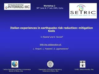
Workshop 2 30 th June & 1 st July 2005, Certu. Italian experiences in earthquake risk reduction: mitigation tools V. Pessina 1 and E. Faccioli 2. With the collaboration of: L. Finazzi 2 , L. Frassine 2 , S. Lagomarsiono 3.

E N D
Workshop 230th June & 1st July 2005, Certu Italian experiences in earthquake risk reduction: mitigation tools V. Pessina1 and E. Faccioli2 With the collaboration of: L. Finazzi2, L. Frassine2, S. Lagomarsiono3 1 Istituto Nazionale di Geofisica e Vulcanologia 2 Department of Structural Engineering, 3 DISEG, Genoa University, Italy Sezione di Milano, Italy Politecnico di Milano, Italy
Naevsted Cologne Prague Paris Bologna Marseille Siena GLOBAL SEISMIC HAZARD ASSESSMENT PROGRAM
CATANIA Outline of presentation : • Distinctive features of Catania • Earthquake hazard assessment • Vulnerability assessment of current buildings • Seismic risk scenarios • Appropriation of seismic problems by the city representatives
Distribution ofpopulation density 1991 census data Growth of the city population: 1946 250.000 1971 400.000 1991 331.503 Distribution of the prevailing building types
Scope and main tools • Knowledge transfer between seismic research community and local administrators • Providing useful risk indicators to local administrators for planning purposes and emergency action response • DESCRIPTION OF THE WORK • Choice of the most significant elements at risk • Generation of a damage scenario for M=7.2 maximum historical event • Damage assessment for residential buildings • Assessment of loss estimation (casualties and severely injured, homeless) • Proposal of a simplify method for debris assessment • Identification of safety routes • Hazardous fire zones identification • Assessment of potential seismic hazard for hospitals
Characteristic features analysed: Residential buildings Public buildings (schools) Emergency areas Traffic flow Lifelines facilities (gas lifelines) Choice of the test area
1693 - 1 - 11 Earthquake hazard assessment: deterministic approach Level I scenario M7.3 earthquake of January 11, 1693, a destructive event Historical intensity map X-XI ground shaking maps for amax (g)
Vulnerability Index for specific building type Regional Vulnerability factor Behaviour Modifier factor Vulnerability assessment of current buildings VI = VI* + DVR + DVm MASONRY buildings REINFORCED CONCRETE buildings
LSU survey (1998-2001) r.c. masonry Structural types (according to LSU) Structural types (visual survey) Residential buildings: high level of incertenties on the data collection
Damage grade 0 1 2 3 4 5 VI index 0 - 0.25 0.25 -0.50 0.50 - 0.750.75 -1 Damage Scenario Vulnerability Index
V (RISK-UE) No damage Slight Moderate Heavy Very heavy Collapse Seismic risk scenarios: estimation of direct physical losses Level I method Vulnerability and damage maps for the 1693 event Mean damage grade d is estimated for each census tract, as average damage for all building categories present in the tract.
No damage Slight Moderate Heavy Very heavy Collapse Seismic risk scenarios: estimation of direct physical losses Map of probability of collapse 1693 event Probability of collapse
40%+100%+70% 30% 3728 Homeless 0 50 50 150 150 300 300 500 500 1300 Casualties estimation Test area 0 Casualties Tot. Residents = 6548 Estimation of victims for the surveyed area of Catania (about 70% of the total buildings) 123 Casualties 160877 Homeless
Primary school C.D Rapisardi Structural type: Masonry Age of building construction: 1919-1945 Number of stories: 4 Vulnerability Index: moderate-low Number of pupils: 900 School High school University Administrative office Cinema Court Hospital Emergency shelter area Strategic buildings
Natural Gas network Potable water network Water network Waste water network Compressor station Boreholes Analysedarea: PGV = 0.30 m/s on rockPGV = 0.40 m/s on soft soil Soft soil stiff soil rock R.R. Repair rate Number of repairs vs.length of pipe R.R. < 0.043 on rockR.R. = 0.050 – 0.060 on soft soil Comparison of RR values for iron pipelines subjected to the same shaking level (35 cm/s) of others events: Emergency area The geological discontinuities represent critical situation for pipelines. 1D linear equivalent analysys show a possible increment of the expected maximum velocity (about 1.18 – 1.30) Gas network risk assessment
The debris obstruction of the street depends on: • high bldgs damage • narrow street • bldgs elevation Crucial node because of heavy traffic, narrow street and heavy damaging buildings Masonry buildings Damage grade 0 1 2 3 4 5 Damage grade 0 1 2 3 4 5 0 500 500 1000 1000 2000 2000 3000 3000 5000 The traffic flow Cars/hour
filled volume = 30% building volume H obstruction D debris volume r obstruction X debris volume H obstruction D debris volume Debris assessment: MASONRY buildings hypothesis F 45° friction degree of debris Isolated building Confined building
3 floors 2.5 m 3 floors 9.8 m Damage grade 0 1 2 3 4 5 2 floors 2 floors 8 m 9.8 m 1.3 m
Hospital Emergency area School Damage grade 0 1 2 3 4 5 Safety routes
Travel post earthquake: 234 seconds Buildings with damage level “very heavy” or “collapse” Vulnerability assessment of lifelines and essential facilities Transportation accessibility assessment of roadways RESULTS: Assuming that routes adjacent to buildings with “very heavy damage” or “collapse” are obstructed, the transportation accessibility results reduced to 60% in zone shown (for 1818 scenario earthquake) APPLICATION: Estimation of minimum distance (minimum travel time) between a school and a hospital Travel before earthquake:124 seconds
- damage scenario - critical zone for lifelines Planning actions • - casualties and severely injured • safety routes • zone exposed to fire hazard Emergency actions - homeless - debris volume assessment Post earthquake actions First conclusions Important indicators of seismic risk level have been provided for:
Appropriation of seismic problems by the city representatives • Meetings with Catania representatives during the project: • July 2002: meeting with the Mayor and city administrators • September 2002: Risk-UE meeeting in Catania • February 2004: meeting with the Mayor and city administrators The Mayor of Catania has special powers for handling traffic emergencies, which enable him to plan and operate interventions on the roadway system in order to improve the seismic safety of the city. • Decisions already taken to decrease the seismic risk in the future: • improvement of highway transportation system • construction of new hospitals and relocation of existing ones • improvement of critical structures for civil defence and • emergency management
3 1 2 4 5 6 8 9 7 Rapid visual screening of Catania hospitals for potential seismic hazards • RVSProcedure (Rapid Visual Screening): data collectionbased on visual observation of the building from outside, and if possible, from inside (FEMA 154 handbook). • The RVS procedure enables to classify the surveyed buildings into two categories: • buildings that may be seismically hazardous: S 2 • buildings with acceptable seismic performance: S > 2 The final score S has been calculated for every building belonging to each hospital; the global evaluation of the condition of each hospital Saverage is defined as weighted average of final scores S HospitalSaverage 1 Policlinico 2.5 2 Ascoli-Tomaselli 2.3 3 Cannizzaro 2.9 4 S.Luigi Currò 2.4 5 Garibaldi 2.9 6 Ferrarotto 2.4 7 Vittorio Emanuele 1.4 8 S.Bambino 2.6 9 S.Marta 2.1 Saverage
Improvement of highway transportation system Infrastructures under improvement: main road Infrastructures under costruction: main road roundabout exchange parking
New Garibaldi Hospital rock stiff soft Hospital S.Marco Hospital Civil Defence Fire Brigades Improvement of critical structures for civil defence and emergency management • Existing buildings: • 9 hospitals (medium-high vulnerability) • 1 Civil Defence centre • 1 Fire Brigade centre Buildings under construction: • 2 hospitals: S.Marcoand New Garibaldi • 1 provincial centre ofCivil Defence • 2 Fire Brigade centres
Prefecture Fire Brigades Municipal Police City emergency centre (receives calls) Civil Defence centre Operational room • Supporting actions: • Volunteer organisations • Materials, means and essential services • Damage and casualties survey • Handling traffic emergencies • Telecommunications • Assistance to citizens Local Plan of Civil Defence: structures for seismic emergency management Issue of an alarm First evaluation of emergency Activation of rescue operation
Exposition factor: inhabited centres in Imperia province and historical elements
Damage analysis: average damage in Taggia for residential buildings
Damage analysis: average damage in Taggia for aggregate and historical monuments
http://gndt.ingv.it/Pubblicazioni/Pubblicazioni_home.htm http://www.risk-ue.net/ http://adic.diseg.unige.it/gndt-liguria/index.html Reference web sites: