Download
1 / 27
270 likes | 282 Views
This joint forum meeting in Spokane, WA provides an update on the progress of the fire emissions inventories project, including the viewing of data for air quality planning and the decision-making process for modeling different fire emission suites.

E N D
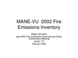
Fire Emissions Inventories (almost) Closeout-- Ph IV Projections – Fire Emissions Joint Forum Meeting Spokane, WA Day 1 – 1015a part A Dave Randall Air Sciences Inc.
Outline • Update on where we are in the project. • Viewing the data with air quality planning in mind. • Which suite(s) should the FEJF put in the queue for modeling?
Phases of Fire EIs • Phase II (historical 2002) • Baseline (Phase III) (nominal 2000-2004) • Projections (Phase IV) (nominal 2018)Activity Scenarios for each fire type • Less • Likely • More Note: The PLANNING inventories (Phase III & IV) are unique EI’s…unique from each other AND unique from Phase II
Where are we on the project? • Base-Case Planning Fire Files (Ph III) delivered (PT files for modeling). • Projection Planning Fire Files (Ph IV) generated and ready for posting (PT files for modeling). • Projection Tool developed and tested in-house. • Finalizing documentation.
What still remains to be done? • Decision on NIF format for projection files. • Recommend NOT preparing these files at this point. • Decision on what Fire/Air Quality Planning suites to put in queue for RMC modeling. • Final Postings and Documentation. • Post Projection Tool.
2 Mistakes • NAT/ANTH assignment method • Ph III files delivered with “old” method (NFDRS based). • Alternative method (that we put through the Strawman process) was to use FCCS and FRCC to categorize events. • To keep Ph III and Ph IV comparable, we’ve prepared Ph IV using the “old” method.
FCCS-method Total acres (Phase II Prescribed data) of FCCS fuel models assigned ANTH: 323K 214K acres > 7 tons/acre 30.7K Tons of PM2.5 Total acres (Phase II Prescribed data) of FCCS fuel models assigned NAT: 326K 240K acres < 15 tons/acre 50.1K Tons of PM2.5 NFDRS-method Total acres (Phase II Prescribed data) of NFDRS fuel models assigned ANTH: 301K 235K acres > 7 tons/acre 39.7K Tons of PM2.5 Total acres (Phase II Prescribed data) of NFDRS fuel models assigned NAT: 348K 243K acres < 15 tons/acre 41.0K Tons of PM2.5 Nat/Anth Assignment(Based on PH II [2002] Fire Data)
2 Mistakes (continued) • This issue involved Baseline (Ph III) events that were missing emissions because they were missing smoldering records. • SAME MISTAKE made in the Baseline and Baseline Control EI files. • Approximate Impact to EIs: • Wildfire PM2.5 Tons: 19,147 (4% of total WF emissions) • WFU PM2.5 Tons: 1.579 (2% of total WFU emissions) • Recommended Remedy – • Document the issue; • Fix the problems in the Projections (Ph IV); • Leave Baseline (Ph III) as is.
Ph IV Data Review with Air Qualty Planning in Mind • Devise a couple of Threshold Questions we’d like to have answered by RMC Modeling. • Review the data to determine which Air Quality Planning Suite(s) best answer that question. • The best focus appears to be on the difference between Base-Case and Max-App of RX fire.
WRAP Phase IV 2018 Fire Projection EITreated AcresPrescribed Burning, Base Case
WRAP Phase IV 2018 Fire Projection EITreated AcresPrescribed Burning, Max Case
WRAP Phase IV 2018 Fire Projection EITreated AcresPrescribed Burning, Net Difference (Max minus Base)
WRAP Phase IV 2018 Fire Projection EITons of PM2.5Prescribed Burning, Base Case
WRAP Phase IV 2018 Fire Projection EITons of PM2.5Prescribed Burning, Max Case
WRAP Phase IV 2018 Fire Projection EITons of PM2.5Prescribed Burning, Net Difference (Max minus Base)
Baseline Emission Inventory – Wildfire and Prescribed Fire Occurrence
Base-Case Planning Suite – Wildfire and Prescribed Fire Occurrence
Max Application of Rx Fire Planning Suite – Prescribed Fire Occurrence
Baseline Annual PM2.5 Emissions by County Case Study Area: Sawtooth Wilderness
Baseline Control Case Annual PM2.5 Emissions by County Case Study Area: Sawtooth Wilderness
Basecase Annual PM2.5 Emissions by County Case Study Area: Sawtooth Wilderness
Climate Conditions / Resource Limited Annual PM2.5 Emissions by County Case Study Area: Sawtooth Wilderness
Max Application of Prescribed Fire Annual PM2.5 Emissions by County Case Study Area: Sawtooth Wilderness