Download
1 / 28
280 likes | 303 Views
Explore a variational framework combining radar, lidar, and radiometers for ice cloud retrievals. Evaluate A-Train data, compare with MODIS, and analyze ice cloud morphology. Understand the formulation and solution method for accurate retrievals.

E N D
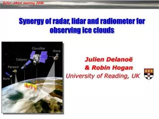
Radar/lidar/radiometer retrievals of ice clouds from the A-train Robin Hogan, Julien Delanoe Department of Meteorology, University of Reading, UK Richard Forbes European Centre for Medium Range Weather Forecasts Alejandro Bodas-Salcedo Met Office, UK
Motivation • Clouds are important for climate due to interaction with radiation • A good cloud retrieval must be consistent with broadband fluxes at surface and top-of-atmosphere (TOA) • Advantages of combining radar, lidar and radiometers • Radar ZD6, lidar b’D2 so the combination provides particle size • Radiances ensure that the retrieved profiles can be used for radiative transfer studies • How do we do we combine them optimally? • Use a “variational” framework: takes full account of observational errors • Straightforward to add extra constraints and extra instruments • Allows seamless retrieval between regions of different instrument sensitivity • In this talk a new variational radar-lidar-radiometer algorithm is applied to a month of A-Train data • Comparison with MODIS retrievals • Evaluation of Met Office and ECMWF model ice clouds • Investigation of the morphology of tropical cirrus
Formulation of variational scheme Ice visible extinction coefficient profile Attenuated lidar backscatter profile Ice normalized number conc. profile Radar reflectivity factor profile (on different grid) Extinction/backscatter ratio for ice Infrared radiance (TBD) Liquid water path and number conc. for each liquid layer Visible optical depth Radiance difference (TBD) Aerosol visible extinction coefficient profile For each ray of data we define: • Observation vector • State vector • Elements may be missing • Logarithms prevent unphysical negative values
Solution method New ray of data Locate cloud with radar & lidar Define elements of x First guess of x • An iterative method is required to minimize the cost function Forward model Predict measurements y from state vector x using forward modelH(x) Predict the JacobianH=yi/xj Gauss-Newton iteration step Predict new state vector: xk+1= xk+A-1{HTR-1[y-H(xk)] -B-1(xk-b)-Txk} where the Hessian is A=HTR-1H+B-1+T No Has solution converged? 2 convergence test Yes Calculate error in retrieval Proceed to next ray
Lidar forward model: multiple scattering Wide field-of-view: forward scattered photons may be returned Narrow field-of-view: forward scattered photons escape • 90-m footprint of Calipso means that multiple scattering is a problem • Eloranta’s (1998) model • O (N m/m !) efficient for N points in profile and m-order scattering • Too expensive to take to more than 3rd or 4th order in retrieval (not enough) • New method: treats third and higher orders together • O (N 2) efficient • As accurate as Eloranta when taken to ~6th order • 3-4 orders of magnitude faster for N =50 (~ 0.1 ms) Ice cloud Molecules Liquid cloud Aerosol Hogan (Applied Optics, 2006). Code: www.met.rdg.ac.uk/clouds
Wide-angle multiple scattering • To extend to precip, need to model radar multiple scattering • Talk on Wednesday, session B! CloudSat multiple scattering New model agrees well with Monte Carlo
Radiance forward model • MODIS and CALIPSO each have 3 thermalinfrared channels in the atmospheric window region • Radiance depends on vertical distribution of microphysical properties • Single channel: information on extinction near cloud top • Pair of channels: ice particle size information near cloud top • Radiance model uses the 2-stream source function method • Efficient yet sufficiently accurate method that includes scattering • Provides important constraint for ice clouds detected only by lidar • Ice single-scatter properties from Anthony Baran’s aggregate model • Correlated-k-distribution for gaseous absorption (from David Donovan and Seiji Kato) • MODIS solar channels provide an estimate of optical depth • Only available in daylight • Likely to be degraded by 3D radiative transfer effects • Only usable when no liquid clouds in profile … currently not used
Ice cloud: non-variational retrieval Donovan et al. (2000) Aircraft-simulated profiles with noise (from Hogan et al. 2006) • Donovan et al. (2000) algorithm can only be applied where both lidar and radar have signal Observations State variables Derived variables Retrieval is accurate but not perfectly stable where lidar loses signal
Variational radar/lidar retrieval • Noise in lidar backscatter feeds through to retrieved extinction Observations State variables Derived variables Lidar noise matched by retrieval Noise feeds through to other variables
…add smoothness constraint • Smoothness constraint: add a term to cost function to penalize curvature in the solution (J’ = l Sid2ai/dz2) Observations State variables Derived variables Retrieval reverts to a-priori N0 Extinction and IWC too low in radar-only region
…add a-priori error correlation • Use B (the a priori error covariance matrix) to smooth the N0 information in the vertical Observations State variables Derived variables Vertical correlation of error in N0 Extinction and IWC now more accurate
CloudSat-CALIPSO-MODIS example Lidar observations Radar observations 1000 km
Lidar observations Lidar forward model Radar observations Radar forward model CloudSat-CALIPSO-MODIS example
Extinction coefficient Ice water content Effective radius Radar-lidar retrieval Forward model MODIS 10.8-mm observations
Radiances matched by increasing extinction near cloud top …add infrared radiances Forward model MODIS 10.8-mm observations
A-Train Model Comparison with Met Office model Arctic Ocean South Atlantic Central Pacific Central Atlantic Russia Antarctica log10(IWC[kg m-3])
Effective radius versus temperature An effective radius parameterization? All clouds
Mean and variance of IWC both increase with temperature Clearly need both radar and lidar to detect full range of ice clouds Frequency of IWC vs. temperature Radar+lidar only log10(IWC) Radar only Lidar only log10(IWC) log10(IWC) log10(IWC [kg m-3])
Comparison of mean effective radius • July 2006 mean value of re=3IWP/2tri from CloudSat-CALIPSO only • Just the top 500 m of cloud • MODIS/Aqua standard product
Comparison of ice water path CloudSat-CALIPSO MODIS Mean of all skies Mean of clouds • Need longer period than just one month (July 2006) to obtain adequate statistics from poorer sampling of radar and lidar
Comparison of optical depth CloudSat-CALIPSO MODIS Mean of all skies Mean of clouds • Mean optical depth from CloudSat-CALIPSO is lower than MODIS simply because CALIPSO detected many more optically thin clouds not seen by MODIS • Hence need to compare PDFs as well
Global forecast model data extracted underneath A-Train A-Train ice water content averaged to model grid Met Office model lacks observed variability ECMWF model has artificial threshold for snow at around 10-4 kg m-3 Comparison with model IWC A-Train Met Office ECMWF Temperature (°C) Temperature (°C)
Tropical Indian Ocean cirrus Stratiform region in upper half of cloud? Turbulent fall-streaks in lower half of cloud? MODIS infrared window radiance • Observations • Note limitation of each instrument • Retrievals
600 km 120 km A-Train data show quite different structure above ~12.5 km in tropical cirrus: gravity waves? Stratiform upper region dominated by larger scales 1300 km 320 km Mid-latitude cirrus Tropical cirrus Outer scale 90 km -5/3 law Hogan and Kew (QJ 2005) found that mid-latitude cirrus structure affected by cloud top turbulence with a typical outer scale of 50-100 km
Summary and future work New dataset provides a unique perspective on global ice clouds • Planned retrieval enhancements • Retrieve liquid clouds and precipitation at the same time to provide a truly seamless retrieval from the thinnest to the thickest clouds • Incorporate microwave and visible radiances • Adapt for EarthCARE satellite (ESA/JAXA: launch 2013) • Model evaluation • How can Met Office and ECMWF model cloud schemes be improved? • High-resolution simulations of tropical convection in “CASCADE” • Use CERES to determine the radiative error associated with misrepresented clouds in model • Cloud structure and microphysics • What is the explanation for the different regions in tropical cirrus? • What determines the outer scale of variability? • Can we represent tropical cirrus in the Hogan & Kew fractal model? • Can we resolve the “small crystal” controversy?
Convergence • The solution generally converges after two or three iterations • When formulated in terms of ln(a), ln(b’) rather than a, b’, the forward model is much more linear so the minimum of the cost function is reached rapidly