Download
1 / 4
40 likes | 193 Views
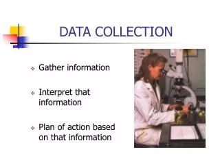
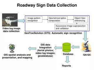
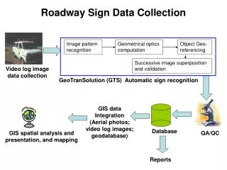
Roadway Sign Data Collection. Image pattern recognition. Geometrical optics computation. Object Geo-referencing. Successive image superposition and validation. Video log image data collection. GeoTranSolution (GTS) Automatic sign recognition.

E N D
Roadway Sign Data Collection Image pattern recognition Geometrical optics computation Object Geo-referencing Successive image superposition and validation Video log image data collection GeoTranSolution (GTS) Automatic sign recognition GIS data Integration (Aerial photos; video log images; geodatabase) Database GIS spatial analysis and presentation, and mapping QA/QC Reports
Color Segmentation ROI Extraction Sign Detection Sign Recognition Image Processing Algorithm
Sign Extraction Image containing speed limit Processed binary image after color segmentation Final speed limit extraction