Download

1 / 28
310 likes | 584 Views
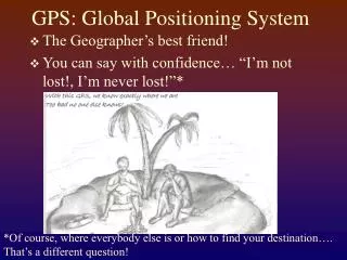
GPS THE GLOBAL POSITIONING SYSTEM. GPS It’s in cars, boats, planes, tractors, golf carts, cell phones, shoes. What is GPS?.

E N D
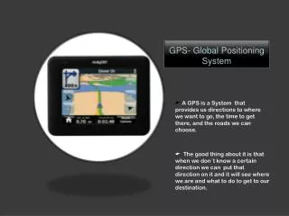
GPSIt’s in cars, boats, planes, tractors, golf carts, cell phones, shoes What is GPS?
GPS technology has matured into a resource that goes far beyond its original design goals. These days scientists, sportsmen, farmers, soldiers, pilots, surveyors, hikers, delivery drivers, sailors, dispatchers, lumberjacks, fire-fighters, and people from many other walks of life are using GPS in ways that make their work more productive, safer, and sometimes easier. These applications fall into five broad categories:Location - determining a basic position Navigation - getting from one location to another Tracking - monitoring the movement of people and things Mapping - creating maps of the world Timing - bringing precise timing to the world
What is GPS? • GPS is a satellite-based radio navigation system that allows anyone anywhere on the planet to determine their 3D position with great accuracy and precision. • Because there are still security issues (this was created by the DOD) there are places where signals don’t always pick up with high precision. • The system does undergo uprades periodically so signals may not be accurate “forever”
Who maintains GPS? • DOD - NAVSTAR • Russia -GLONASS • EEC - Under development
The system is composed of three segments • Space - The orbiting satellites • Control - The monitoring stations on earth • User - The GPS units such as you will use today.
A NAVSTAR satellite. • Life expectancy of about 10 years….new ones are being put in to orbit annually. • They are approx. 11,000 miles above the earth. • Each one weighs about 2,000 pounds and span about 17 feet across. • They are powered by solar panels
Control - The monitoring stations on earth • The system is composed of three segments • Space - The orbiting satellites
The GPS pre-test: • When was GPS first used? • Sputnik…1957 • TRANSIT…1960’s • NAVSTAR…1970’s
How many satellites make up a GPS? • 27 at the current time • 24 to maintain a system Your GPS receiver must track at least 3 satellites to give you an accurate position location. 4 for an accurate elevation measurement.
From Circles to Waves These two graphs both represent The NAVSTAR constellation of satellites. How would you describe the path of a single satellite in each graph? How would you explain the transition from one graph to the other?
Who uses GPS? • Government • Military • Agencies - Conservation, Weather, Rescue • Industry • Transportation • Fishing • Agriculture • General Public • Recreation • Emergency / Security Reasons • Health Related Reasons
How does GPS Work? • Each GPS satellite transmits an accurate position and time signal. • The user’s receiver measures the time delay for the signal to reach the receiver. • Measurements collected from 4 satellites are processed to solve for the 3D position, velocity and time.
Your Task Outside 1) Get a locked reading on your unit. 2) Chose a direction either east-west, or north-south. 3) Walk along the direction vector until the reading on your unit changes. 4) Design a method for finding the circumference of the earth based on your observations.
What you discovered outside. 1) Did you all get the exact same reading? 2) How did you know your direction? 3) How many paces until the reading on your unit changed? 4) What was your method for finding the circumference of the earth? 5) Would the circumference be the same for N/S as E/W?
A Sample Lesson From: Mission Mathematics A NASA/NCTM Project
How Does This Fit Into a Math Class?! • Pre Algebra: Latitude and Longitude, Integers • Algebra I: Linear Systems, Absolute Value • Geometry: Degree Measure, Circles, Spherical Geometry • Algebra II: Systems of Circles, 3D Graphing
How Does This Fit Into a Math Class?! • Trigonometry: Orbits as Sinusoids, Bearing, • College Algebra: Conic Sections, 3D Systems • Pre Calculus: Accuracy, Precision, Error • Calculus: • Discrete Math: Circuits, Paths, Triangulation
Available Materials Overview of GPS: http://www.utexas.edu/depts/grg/gcraft/notes/gps/gps.html U.S. Coast Guard: http://www.navcen.uscg.mil Inst. of Navigation: http://www.ion.org GLONASS info: http://www.rssi.ru/SFCSIC/SFCSIC_main .html GPS sites: http://www.inmet.com/~pwt/gps_gen.htm "GPS for Fun": http://www.gps4fun.com SpatialTek: http://www.mapfacts.com/gps/history.asp Craig Haggart: http://vancouver~webpages.com/peter/gpswork.txt Trimble:http://www.trimble.com/gps/ Science Junction: http://www.ncsu.edu/science junction Lesson Plans: http://wwwedu.ssc.nasa.gov/Itp/LessonPlans/ • The WEB: