Download
1 / 21
210 likes | 236 Views
This beginner's guide presentation by Jennifer Brennan at the ESA Annual Meeting provides an overview of NASA Eosdis services, including data archive management, product generation, and user support. Learn about NASA's Earth Observation data sources and disciplines such as atmosphere, cryosphere, and human interactions with the environment. Discover how to access atmospheric, cryospheric, human dimensions, and land processes data using various Distributed Active Archive Centers. Visit NASA Earthdata for additional resources and tools to access and visualize these datasets.

E N D
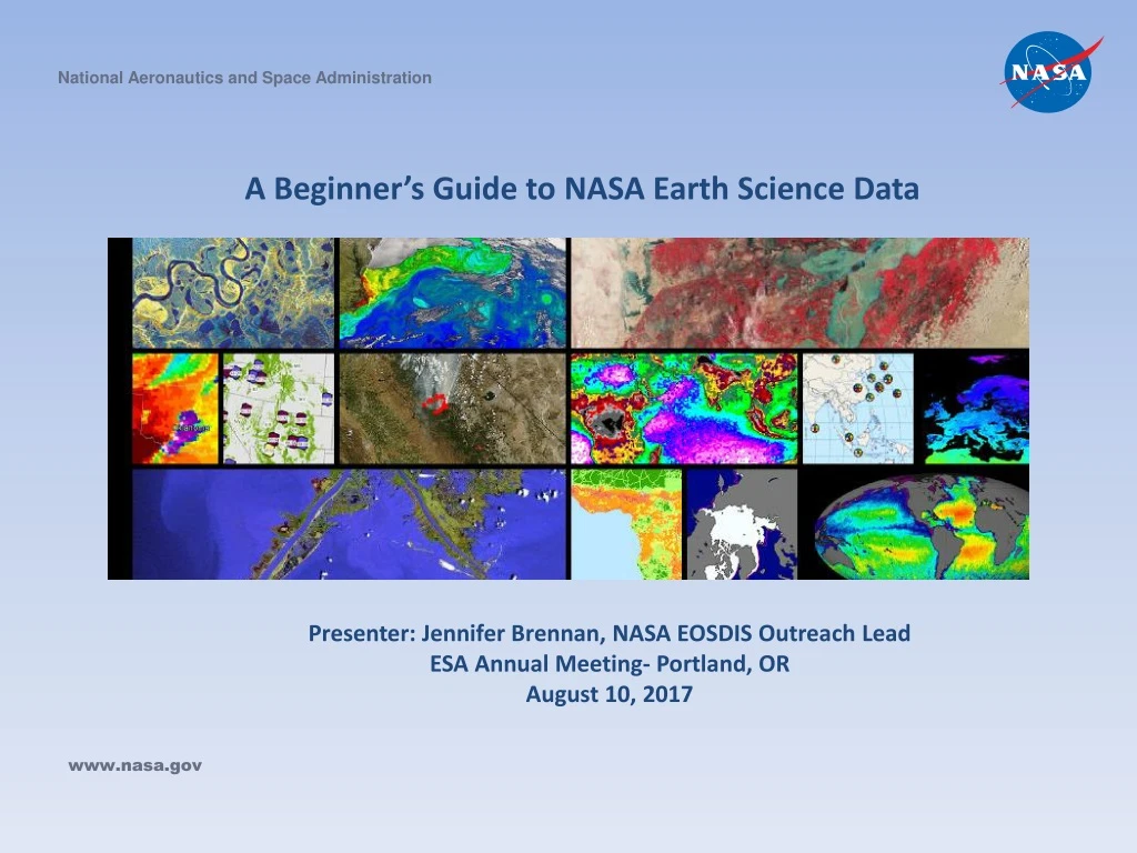
National Aeronautics and Space Administration A Beginner’s Guide to NASA Earth Science Data Presenter: Jennifer Brennan, NASA EOSDIS Outreach Lead ESA Annual Meeting- Portland, OR August 10, 2017 www.nasa.gov
Presentation Outline • NASA EOSDIS Overview (5 minutes) • Available Measurements • Tour of the NASA Earthdata website • NASA Worldview (Live Demo) (5 minutes) • Learn how to : add layers, apply filters (discipline, natural hazard or by current event), find data layer information, capture a snapshot, create data animation (daily, monthly or yearly) ,download underlying data and more. • Hands-on Demo- NASA Earthdata Search (6 minutes) • NASA Soil Moisture Active Passive Mission (SMAP) seasonal soil moisture data for Denver, CO
About NASA EOSDIS NASA’s Earth Observing System Data and Information System (EOSDIS) provides end-to-end capabilities for managing NASA’s Earth science data. The primary services provided by EOSDIS are data archive, management, and distribution; information management; product generation; and user support services. These services are managed by NASA’s Earth Science Data and Information System (ESDIS) Project.
What kind of Earth Observation Data does NASA Provide? • NASA provides data from a variety of sources including satellites, airborne campaigns, field campaigns, in situ instruments and model outputs. There are data that span the Earth science disciplines, providing measurements for Earth’s Atmosphere, Ocean, Land, Cryosphere and Human Interactions with the Environment. In addition, calibrated sensor data are available. https://earthdata.nasa.gov • Twelve discipline-specific Distributed Active Archive Centers (DAACs) manage, archive and distribute these data as part of NASA's Earth Science Data Systems Program.
NASA EOSDIS Distributed Active Archive Centers For access to data, tools and additional resources at each DAAC
Atmospheric Data • Many different parameters are measured including, but not limited to clouds, aerosols, precipitation, lightning, atmospheric chemistry, temperature, and radiation balance. • The primary DAACs specializing in atmospheric products are the ASDC DAAC, GES DISC and LAADS. • To learn more about NASA EOSDIS atmospheric data products, available measurements, access or visualize these data and find related resources (such as user forums or related webinars), please visit the Atmosphere discipline page on NASA Earthdata. https://earthdata.nasa.gov/discipline/atmosphere Additional Resources Atmosphere Discipline Data Set Reference Sheet NASA ASDC DAAC Level 1 and Atmosphere Archive and Distribution System (LAADS) DAAC NASA GES DISC
Cryospheric Data • Many different parameters are measured including snow cover (e.g. Extent, water equivalent, depth), sea ice(e.g., extent, concentration, motion, temperature), land ice (e.g., ice sheet topography, ice sheet volume change, glacier change) • The primary DAACs specializing in EOSDIS cryosphere data products are the NSIDC DAAC and the ASF DAAC. • To learn more about NASA EOSDIS cryosphericdata products, available measurements, access or visualize these data and find related resources (such as user forums or related webinars), please visit the Cryosphere discipline page on NASA Earthdata. https://earthdata.nasa.gov/discipline/cryosphere Resources: Cryosphere Data Set Reference Sheet NASA NSIDC DAAC NASA ASF DAAC
Human Dimensions Data • Within the Human Dimensions discipline, NASA’s Socioeconomic Data and Applications Center(SEDAC) holds a wide variety of socioeconomic data. • The mission of SEDAC is to develop and operate applications to support the integration of socioeconomic and Earth science data, and to serve as an “information gateway” between the Earth and social sciences. • Measurements include(but are not limited to): population and land use, natural disaster hotspots, biodiversity and ecosystems, and other human interactions with the environment. • To learn more about NASA EOSDIS human dimensions data products, available measurements, how to access or visualize these data and find related resources, please visit the Human Dimensions discipline page on NASA Earthdata. https://earthdata.nasa.gov/discipline/human-dimensions Resources Human Dimensions Discipline Data Set Reference Sheet NASA SEDAC
Land Processes Data • The land discipline data products involve both land cover/land use change or land surface and solid earth. • Land surface measurements include parameters such as surface temperature, soil moisture, vegetation cover, land cover characterization, elevation and more. • Solid Earth measurements include gravity, geomagnetism, tectonics, geodesy and more. • The primary DAACs specializing in this discipline are CDDIS, LP DAAC and ORNL DAAC. • To learn more about NASA EOSDIS land processes data, available measurements, how to access or visualize these data and find related resources, please visit the Land discipline page on NASA Earthdata. https://earthdata.nasa.gov/discipline/land Resources Land Discipline Data Set Reference Sheet CDDIS LP DAAC ORNL DAAC
Ocean Data • The Oceans discipline is broken into two programs, ocean biology and biogeochemistry and physical oceanography. • Measurements include ocean circulation sea surface height, sea surface temperature, ocean color, gravity, winds, current and waves and the interaction of solar radiation with the ocean. • The primary DAACs for ocean products are PO.DAAC(physical oceanography) and OB.DAAC(ocean biology). Sea ice products are provided by the ASF DAAC and NSIDC DAAC. • To learn more about NASA EOSDIS physical oceanography and ocean color data, available measurements, how to access or visualize these data and find related resources, please visit the Ocean discipline page on NASA Earthdata, https://earthdata.nasa.gov/discipline/ocean Resources Ocean Data Set Reference Sheet NASA OB.DAAC NASA PO.DAAC NASA ASF DAAC NASA NSIDC DAAC
Near Real-Time Data • The NASA Land Atmosphere Near real-time Capability for EOS (LANCE) provides free access to global Earth Science data and imagery within 3-4 hours of observation. Learn more about NASA NRT Data Discovery and Access http://earthdata.nasa.gov/earth-observation-data/near-real-time
Data Discovery and Data Access • NASA Earthdata Search- Search thousands of datasets in one interface. Ability to search-and-order, across Earth science disciplines and across DAACs. Multiple filtering and subsetting capabilities available. https://search.earthdata.nasa.gov • NASA Worldview- Interactively browse full-resolution global Earth science satellite data. Ability to download imagery and underlying data from over 400 data products. Investigate natural events as they happen. Hazards and science discipline filtering capabilities available. https://worldview.earthdata.nasa.gov • NASA Global Change Master Directory-Data discovery tool, metadata directory to Earth science data, services and climate diagnostics. Ability to refine search by key word, free-text map/date and more. https://gcmd.nasa.gov *Note: Not a search-and-order tool*
Access to these services is available through the NASA Earthdata Website. https://earthdata.nasa.gov
Tour of the Earthdata Website Familiarize Yourself with NASA Data Holdings- Search by Discipline. • First go to https://earthdata.nasa.gov, Click on any of the discipline icons.
Earthdata Discipline Pages Tip: Here you can review the list of available measurements within that discipline.
Next- If you select a measurement, you will be directed to the NASA Earthdata Search Application. Here you can view the available data sets for that measurement.
Search for and Access Data • Click on “Find Data” from https://earthdata.nasa.gov.
General User Resources • Click on Resources<User Resources to find: • Information and links to our print and multimedia outreach products • Sensing Our Planet publications • Links to recorded monthly webinars and data tutorials, as well as other links to information on how to find, access and use NASA Earth science data information, data services and data tools.
Learn How to Search, Access, and Visualize the Data With Our Tutorials • Over 90 Earth science data discovery, data access and visualization webinars, short tutorials, and short video data recipes or “how-tos” freely available online. • Access tutorials on our NASA Earthdata YouTube Channel www.youtube.com/c/NASAEarthdata
NASA Worldview AnimationFires in British Columbia, CanadaJuly 11-August 9, 2017 https://go.nasa.gov/2wLCX0T


